
Skip to content
Breaking News
  • Understanding Thematic Mapping: How Spatial Data Visualization Reshapes Modern Geographic Analysis and Decision-Making
  • GeoHound Chrome Extension Launches with Automated Web Map Service Detection and Built-In Spatial Workbench
  • From ERP Systems to AI Strategy: Inside Aakansha Bhalotia’s 13-Year Journey Shaping the Future of Tech
Thursday, October 22, 2026
Edition: U.S. International Login

Hack The Map

Category: Drone Mapping and Aerial Photography

FAA Part 107 Drone Pilot Test Changes: What Applicants Need to Know for October 26

The Federal Aviation Administration is introducing a significant update to its Part 107 remote pilot knowledge test, shifting how prospective commercial drone operators are examined on their understanding of airspace and navigation. Beginning October 26, the agency will incorporate dynamic,…
Nana • October 11, 2026

FAA Part 107 Drone Pilot Test Changes Set for October 26: What Applicants Need to Know

October 10, 2026
The Federal Aviation Administration (FAA) is overhauling a key component of its commercial drone certification process, introducing new image-based testing…


FAA Updates Part 107 Drone Pilot Test: New Image-Based Questions to Debut This October

October 10, 2026
The Federal Aviation Administration is introducing significant updates to its widely recognized Part 107 remote pilot knowledge test, shifting how…

FAA Part 107 Drone Pilot Test Changes: What Applicants Need to Know for October 26

October 10, 2026
The Federal Aviation Administration is introducing a significant update to its Part 107 remote pilot knowledge test, shifting how aspiring…

FAA Updates Part 107 Drone Pilot Test for October 2026 with New Image-Based Aviation Chart Questions

October 9, 2026
The Federal Aviation Administration is moving forward with a significant modernization of its remote pilot certification process, introducing a new…

29 Governors Call for Expanded Counter-Drone Training Under New Federal Law

October 9, 2026
A bipartisan coalition of 29 U.S. governors is formally urging federal authorities to significantly scale up counter-drone training programs for…

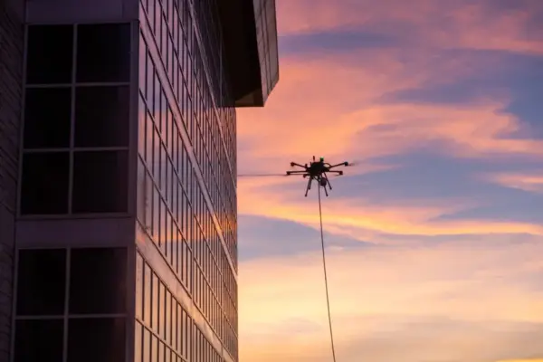
Cleaning, Painting, and Beyond: Lucid Bots Expands Its Drone Platform

October 9, 2026
By DRONELIFE Features Editor Jim Magill The inspiration needed to start a successful, high-impact enterprise can often strike in the…

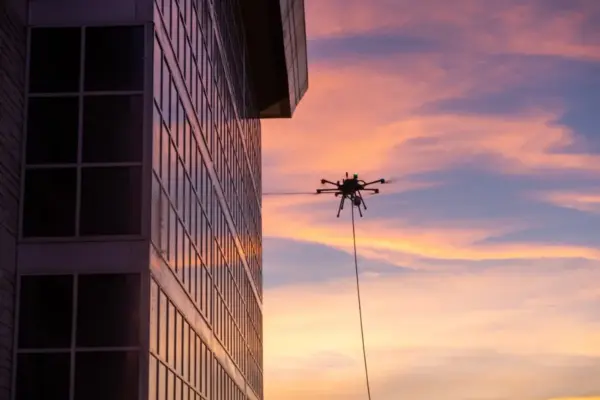
Cleaning, Painting, and Beyond: Lucid Bots Expands Its Drone Platform

October 8, 2026
By Jim Magill, Features Editor The inspiration needed to start a successful, high-impact enterprise can often come from unexpected places.…

Court Challenge Could Shape FCC Authority Over Previously Approved Drones

October 8, 2026
A high-stakes legal battle playing out before the U.S. Court of Appeals for the D.C. Circuit this week has far-reaching…

Court Challenge Could Shape FCC Authority Over Previously Approved Drones and Foreign Technology

October 8, 2026
A high-stakes legal battle argued before the U.S. Court of Appeals for the D.C. Circuit this week has the potential…

Posts navigation

Older posts
Newer posts

Recent Posts

  • Understanding Thematic Mapping: How Spatial Data Visualization Reshapes Modern Geographic Analysis and Decision-Making
  • GeoHound Chrome Extension Launches with Automated Web Map Service Detection and Built-In Spatial Workbench
  • From ERP Systems to AI Strategy: Inside Aakansha Bhalotia’s 13-Year Journey Shaping the Future of Tech
  • Elistair Unveils Tethered Air Module for Parrot ANAFI UKR to Enable Hours of Uninterrupted ISR Missions
  • A Mysterious 180-Year-Old Train Delay Reveals a Major Chronological Error in Space Weather History

Recent Comments

No comments to show.

Archives

  • October 2026
  • September 2026
  • August 2026

Categories

  • Data Visualization and Infographics
  • Disaster Response and Humanitarian Mapping
  • Drone Mapping and Aerial Photography
  • Environmental and Climate Mapping
  • Geography and Earth Science
  • Geolocation and Cybersecurity
  • Geopolitics and Map News
  • GIS and Spatial Technology
  • Location Intelligence and Spatial Analytics
  • Open Data and Civic Tech
  • Open Source Geospatial Software
  • OpenStreetMap and Community Mapping
  • Remote Sensing and Satellite Imagery
  • Transportation and Mobility Tech
  • Travel Hacking and Digital Nomad
  • Urban Planning and Smart Cities
  • Web Mapping and Cartography

© 2026 Hack The Map. All rights reserved.

Theme: The Original by Rifan Muazin.