Skip to content
Breaking News
  • GeoHound Tool Launches as Chrome Extension to Instantly Detect, Analyze, and Process Web Map Data
  • From ERP Systems to AI Strategy: Inside Aakansha Bhalotia’s 13-Year Tech Journey at Precisely
  • Elistair Unveils Tethered Air Module for the Parrot ANAFI UKR to Enable Extended ISR Missions
Thursday, October 22, 2026
Edition: U.S. International Login

Hack The Map

Category: Drone Mapping and Aerial Photography

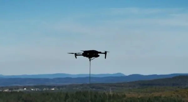
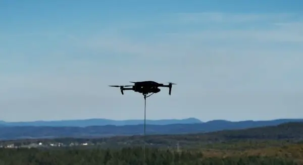
Elistair Unveils Tethered Air Module for the Parrot ANAFI UKR to Enable Extended ISR Missions

Lyon, France — In a significant development for tactical aerial operations, Elistair has officially unveiled a dedicated tethered air module designed specifically for the Parrot ANAFI UKR micro-UAV. Announced on October 21, 2026, the newly introduced system is engineered to…
Suro Senen • October 21, 2026

Elistair Unveils Advanced Tethered Solution for the Parrot ANAFI UKR Micro-UAV

October 21, 2026
Elistair has officially introduced a groundbreaking tethered air module designed specifically for the Parrot ANAFI UKR micro-UAV, a development poised…


Your Own Personal eVTOL? Skyfly Raises $10 Million to Bring the Axe to Market

October 21, 2026
UK aircraft developer targets private ownership under new FAA light-sport rules, while expanding into unmanned defense applications. UK-based aircraft developer…

Your Own Personal eVTOL? Skyfly Raises $10 Million to Bring the Axe to Market

October 20, 2026
UK aircraft developer targets private ownership under new FAA light-sport rules, while expanding into unmanned defense applications. UK-based aircraft developer…

Ukraine Uses Heavy-Lift Drone to Evacuate Wounded Soldier in First Documented Rescue

October 20, 2026
Ukrainian forces have successfully carried out what is being described as the world’s first front-line evacuation of a wounded soldier…

Ukraine Deploys Heavy-Lift Drone in World’s First Documented Evacuation of a Wounded Soldier from the Front Line

October 19, 2026
Ukrainian military forces have achieved a groundbreaking milestone in modern warfare by successfully evacuating a wounded soldier from the front…

China Revises Drone Export Controls: What It Means for Global Drone Markets

October 19, 2026
China has officially announced significant updates to its export control framework governing specific categories of unmanned aerial vehicles (UAVs), associated…

Senator Cites Classified Security Findings in Defense of DJI and Autel Restrictions

October 19, 2026
New federal filings have brought fresh attention to the ongoing regulatory battle surrounding foreign-manufactured drone technology, as lawmakers and federal…

Senator Cites Classified Security Findings in Defense of DJI and Autel Restrictions

October 18, 2026
New Federal Communications Commission (FCC) filings have brought fresh attention to the complex intersection of national security, supply chain resilience,…

Senator Cites Classified Security Findings in Defense of DJI and Autel Restrictions

October 18, 2026
New federal filings have brought fresh attention to the ongoing regulatory battle surrounding foreign-manufactured unmanned aerial systems, as U.S. lawmakers…

Posts navigation

Older posts

Recent Posts

  • GeoHound Tool Launches as Chrome Extension to Instantly Detect, Analyze, and Process Web Map Data
  • From ERP Systems to AI Strategy: Inside Aakansha Bhalotia’s 13-Year Tech Journey at Precisely
  • Elistair Unveils Tethered Air Module for the Parrot ANAFI UKR to Enable Extended ISR Missions
  • A 178-Year-Old Train Delay Solves a Major Mystery in the History of Space Weather and Solar Storms
  • Urban Parking Costs and Curb Management Drive Traffic and Transportation Planning Challenges, New Report Shows

Recent Comments

No comments to show.

Archives

  • October 2026
  • September 2026
  • August 2026

Categories

  • Data Visualization and Infographics
  • Disaster Response and Humanitarian Mapping
  • Drone Mapping and Aerial Photography
  • Environmental and Climate Mapping
  • Geography and Earth Science
  • Geolocation and Cybersecurity
  • Geopolitics and Map News
  • GIS and Spatial Technology
  • Location Intelligence and Spatial Analytics
  • Open Data and Civic Tech
  • Open Source Geospatial Software
  • OpenStreetMap and Community Mapping
  • Remote Sensing and Satellite Imagery
  • Transportation and Mobility Tech
  • Travel Hacking and Digital Nomad
  • Urban Planning and Smart Cities
  • Web Mapping and Cartography

© 2026 Hack The Map. All rights reserved.

Theme: The Original by Rifan Muazin.