The ongoing and exceptionally powerful "super El Niño" climate phenomenon is projected to reach its peak toward the end of 2026, a development that climate scientists warn will push average global temperatures to unprecedented heights next year.
The alarming projection comes from Carbon Brief’s latest "State of the Climate" update, a comprehensive analysis that evaluates El Niño forecasts from more than a dozen leading climate models alongside six major global temperature datasets. During a recent Carbon Brief Connect "Ask Me Anything" session for members, Dr. Zeke Hausfather, a climate science contributor for the organization, characterized the behavior of this year’s El Niño event as "simply staggering," highlighting just how far outside historical norms the current tropical Pacific conditions have strayed.

El Niño is a naturally occurring, cyclical climate pattern originating in the tropical Pacific Ocean. During an event, vast amounts of heat stored in the ocean are released into the atmosphere, temporarily driving up global surface temperatures. While long-term global warming is driven overwhelmingly by human greenhouse gas emissions, year-to-year fluctuations in global temperature are heavily influenced by the presence and intensity of El Niño phases.
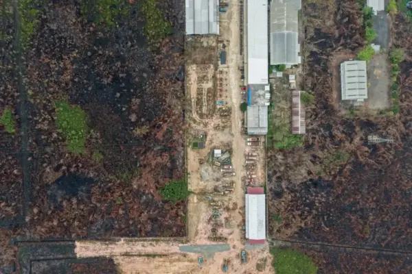
The current El Niño event has been underway since June, and it has already broken a series of meteorological records while significantly altering weather patterns around the world. The repercussions of this ongoing climate driver have been felt across multiple continents and ocean basins, directly fuelling devastating fires in Indonesia and spawning severe "super typhoons" across the western Pacific.
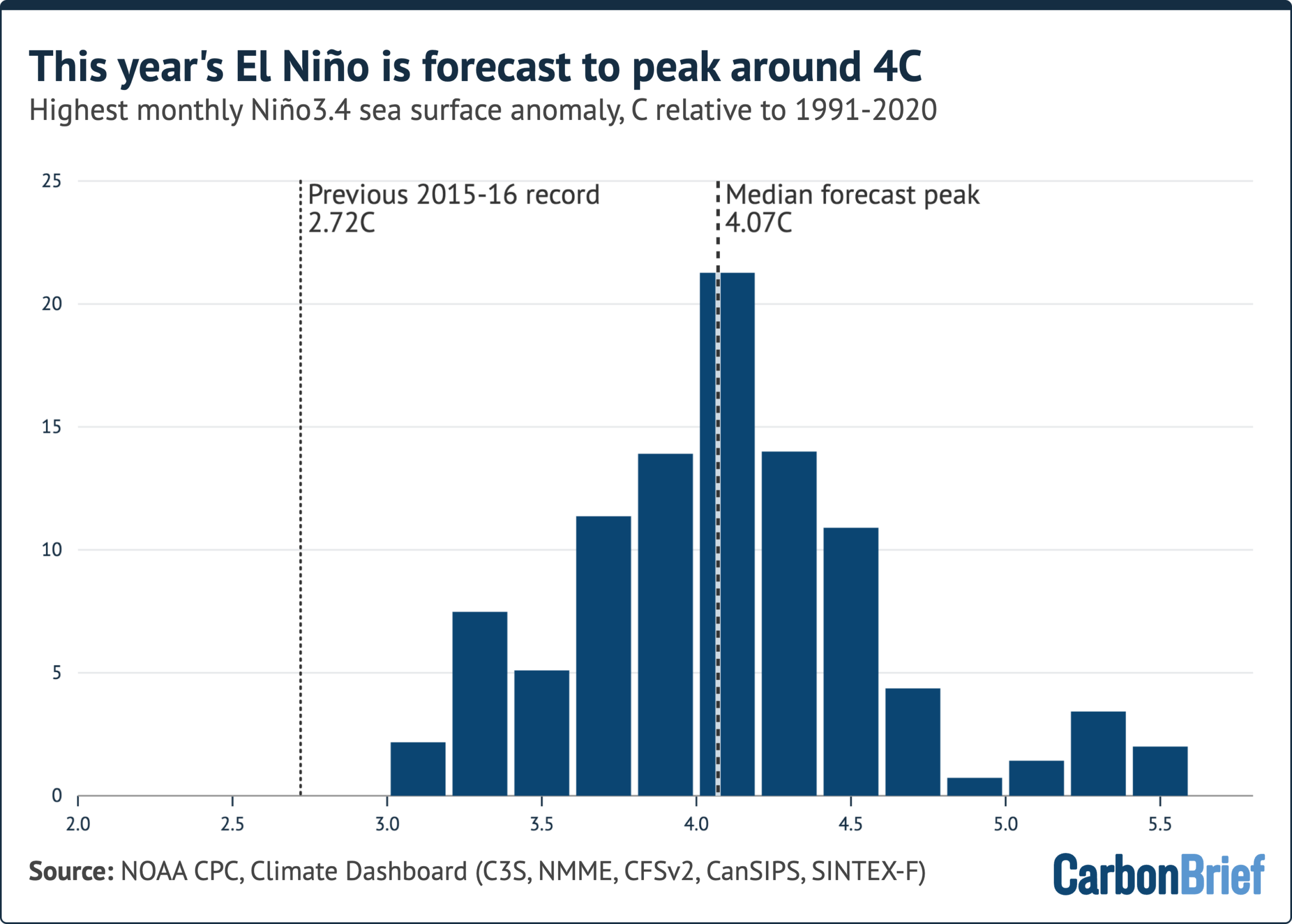
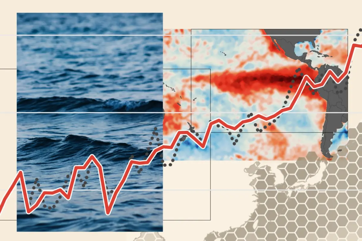
To measure the strength of any given El Niño event, scientists track what is known as the "Niño3.4 anomaly." This metric calculates the degree to which sea surface temperatures exceed the historical average within a specific section of the central Pacific Ocean.
A rigorous new analysis conducted by Hausfather—examining more than 600 individual forecasts generated by 14 different dynamical climate models for Carbon Brief’s climate update—reveals that the current event is projected to peak with an anomaly of approximately 4 degrees Celsius. If these model projections hold true, the peak anomaly will sit more than a full degree above the previous high-water mark recorded during the historic 2015-2016 El Niño event.

Writing on the Carbon Brief Connect platform, Hausfather detailed the unprecedented nature of the observations. "This El Niño event is developing so quickly and is reaching sea surface temperatures so warm that it’s simply staggering," he wrote. "We haven’t seen anything like this in the historical record and it may end up being the strongest El Niño event in the past millennium."
The event has already notched several major milestones on its path toward its winter peak. On September 18, the daily sea surface temperature anomaly in the Niño3.4 region shattered the previous satellite-era record established in 2015, climbing to 3.11 degrees Celsius. Shortly after, September as a whole recorded the highest monthly Niño3.4 region temperature anomaly since comprehensive sea surface temperature record-keeping began in the mid-19th century, hitting 2.84 degrees Celsius.
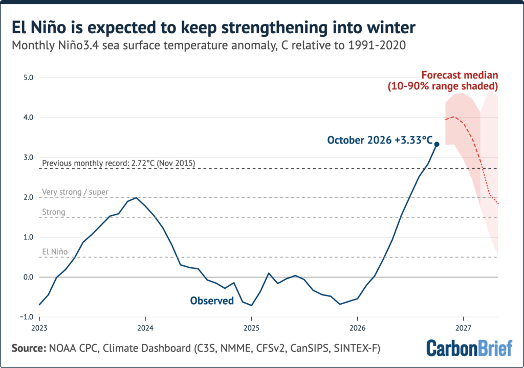
Hausfather noted that the event had been running well above any prior El Niño benchmark recorded since June, occasionally exceeding historical comparators by a full degree Celsius.
Carbon Brief’s updated analysis indicates that the climate phenomenon is far from finished intensifying. Projections show the event continuing to strengthen through December, with 10 out of the 14 evaluated climate models predicting that temperatures in the Niño3.4 region will reach their absolute peak in the final month of the year. The remaining models anticipate that the apex will be reached slightly earlier, in November.

While human emissions of greenhouse gases remain responsible for virtually all long-term global warming, individual years experience notable temperature swings dictated by natural variability, prominently featuring El Niño cycles.
Crucially, the "State of the Climate" analysis points out that the full thermal impact of this year’s intense El Niño will not be felt immediately by the planet’s surface atmosphere. Because global temperatures typically lag behind warming in the tropical Pacific by a period of approximately three months, the largest climate impacts and temperature spikes are projected to manifest throughout 2027.

Based on the historical relationship linking year-on-year temperature variations to El Niño conditions observed during the preceding autumn—while factoring in the remaining uncertainty regarding how global weather will unfold for the remainder of 2026—Carbon Brief projects that the average global temperature in 2027 will reach approximately 1.74 degrees Celsius above pre-industrial levels.
Furthermore, calculations derived from the data indicate a 96% probability that next year will surpass all previous benchmarks to become the warmest year on record.