
Skip to content
Breaking News
  • UNEP Emissions Gap Report: Temporary 1.5C Breach ‘Inevitable’ After Decades of Insufficient Action
  • Surging Wholesale Gas Costs Drive Vast Majority of UK Household Energy Bills, New Analysis Reveals
  • New Web Tool GeoHound Automates Spatial Data Discovery and Browser-Based GIS Analysis
Thursday, October 22, 2026
Edition: U.S. International Login

Hack The Map

Category: Drone Mapping and Aerial Photography

Blue Marble Moves Toward an End-to-End Geospatial Workflow with New Global Mapper Subscription

For professional drone operators, photogrammetrists, and geospatial analysts, collecting data is merely the opening chapter of a much larger operational story. Whether capturing high-resolution imagery or dense lidar scans from an unmanned aerial vehicle (UAV), the raw output from a…
Nana Wu • September 30, 2026

Skydio Unveils F10 Lightrunner Fixed-Wing Drone and MegaDock at Ascend 2026

September 29, 2026
The landscape of autonomous commercial aviation shifted significantly as drone manufacturer Skydio broke new ground during its annual Ascend conference…


Matternet Unveils M3 Autonomous Drone Delivery Platform for Rooftop Micro-Hubs

September 29, 2026
Mountain View, California-based drone delivery pioneer Matternet has officially introduced its next-generation aerial logistics ecosystem, the M3 platform. Unveiled on…

Colorado City Poneer New Ground Rules for Commercial Drone Delivery Hubs as National Networks Expand

September 29, 2026
The City of Northglenn, Colorado, is pioneering a proactive approach to the commercial drone delivery boom, currently weighing a comprehensive…

Lowe’s Launches Drone Delivery for Home Improvement Supplies in North Carolina Pilot

September 29, 2026
Lowe’s Companies, Inc. has officially entered the era of aerial logistics, launching its first-ever drone delivery service for home improvement…

U.S. Awards Amprius Up to $75 Million to Expand Domestic Drone Battery Production

September 28, 2026
Amprius Technologies has secured a landmark federal grant of up to $75 million to significantly scale up its domestic production…

House Committee Advances Bill Requiring Drone Operators to Acknowledge Safety Rules Before First Flight

September 27, 2026
The United States House Transportation and Infrastructure Committee has advanced a legislative proposal designed to tackle a persistent challenge in…

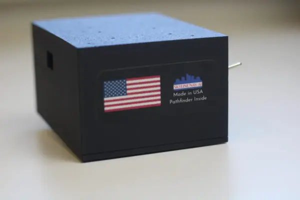
Bridging the Navigation Gap: How Skyline Nav AI is Guiding Drones Beyond the Reach of GPS

September 26, 2026
Since it first achieved widespread commercial adoption in the 1980s, Global Positioning System (GPS) technology has quietly woven itself into…

SkyeBrowse Expands Mapping Platform with Advanced Crash Analysis and Drone-Based Crowd Counting Tools

September 26, 2026
SkyeBrowse has significantly expanded its aerial mapping platform by introducing a suite of specialized tools designed to streamline vehicle crash…

UK Counter-Drone Optics Maker OpenWorks Opens US Headquarters and Plans Detroit Factory

September 26, 2026
UK-based counter-unmanned aerial systems (C-UAS) technology provider OpenWorks Engineering has officially established its United States footprint by opening a regional…

Posts navigation

Older posts
Newer posts

Recent Posts

  • UNEP Emissions Gap Report: Temporary 1.5C Breach ‘Inevitable’ After Decades of Insufficient Action
  • Surging Wholesale Gas Costs Drive Vast Majority of UK Household Energy Bills, New Analysis Reveals
  • New Web Tool GeoHound Automates Spatial Data Discovery and Browser-Based GIS Analysis
  • From ERP Systems to AI Strategy: Inside Aakansha Bhalotia’s 13-Year Tech Journey at Precisely
  • University of Cincinnati Engineers Use Sound to Detect Drone Damage for NASA

Recent Comments

No comments to show.

Archives

  • October 2026
  • September 2026
  • August 2026

Categories

  • Data Visualization and Infographics
  • Disaster Response and Humanitarian Mapping
  • Drone Mapping and Aerial Photography
  • Environmental and Climate Mapping
  • Geography and Earth Science
  • Geolocation and Cybersecurity
  • Geopolitics and Map News
  • GIS and Spatial Technology
  • Location Intelligence and Spatial Analytics
  • Open Data and Civic Tech
  • Open Source Geospatial Software
  • OpenStreetMap and Community Mapping
  • Remote Sensing and Satellite Imagery
  • Transportation and Mobility Tech
  • Travel Hacking and Digital Nomad
  • Urban Planning and Smart Cities
  • Web Mapping and Cartography

© 2026 Hack The Map. All rights reserved.

Theme: The Original by Rifan Muazin.