
For professional drone operators, photogrammetrists, and geospatial analysts, collecting data is merely the opening chapter of a much larger operational story. Whether capturing high-resolution imagery or dense lidar scans from an unmanned aerial vehicle (UAV), the raw output from a flight is just a starting point. That imagery and data must be meticulously processed, accurately positioned, thoroughly analyzed, and ultimately transformed into actionable intelligence that field teams, engineers, and decision-makers can rely upon. In many cases, that newly minted information must then be pushed right back out into the field to guide operations on the ground.
Recognizing the friction inherent in these fragmented multi-step processes, Blue Marble Geographics is taking decisive steps to connect those crucial stages into a unified ecosystem. The company has officially introduced a new Global Mapper subscription model that brings several previously distinct applications and services together under one administrative and licensing umbrella. Available across three distinct tiers—Essentials, Advanced, and Professional—the offering integrates Global Mapper with a suite of additional capabilities from Blue Marble and Avenza Systems, signaling a major evolution in how geospatial professionals manage their software toolkits.
This announcement represents much more than a routine update to software licensing terms. It marks a critical milestone in Blue Marble’s broader strategy to build a seamless, connected geospatial workflow following its strategic combination with Avenza Systems earlier in the year.
"It’s the realization of our vision around office-to-field and field-to-office capability," Eric Bogard, Vice President of Marketing at Blue Marble Geographics, explained in an interview with industry publication DRONELIFE. "With Avenza connectivity, it’s about that end-to-end workflow."
Building on the Avenza Combination
The groundwork for this integrated approach was laid when Blue Marble and Avenza announced their combination earlier this year, bringing together complementary technologies designed to address different phases of modern geospatial work. Historically, software tools for spatial data processing, coordinate transformation, and mobile field navigation lived in separate silos, requiring practitioners to jump between different vendor ecosystems and manage multiple licenses, disparate file formats, and disconnected user interfaces.
Under the hood, Global Mapper has long been recognized for its robust spatial data processing and analysis capabilities, handling everything from traditional vector and raster data to complex lidar and photogrammetry workflows. Meanwhile, Blue Marble’s Geographic Calculator has served as an industry standard for advanced coordinate transformation and geodetic management, ensuring spatial accuracy across diverse global reference systems. On the mobile front, Avenza Maps has carved out a powerful niche supporting mobile mapping, offline navigation, and field data collection for professionals working beyond the reach of reliable cellular networks.
The newly launched subscription structure consolidates a significant portion of the office-side workflow by packaging these powerful assets together. Specifically, the Advanced and Professional subscription tiers incorporate both Geographic Calculator and MAPublisher capabilities alongside the core Global Mapper application.
According to Patrick Stevenson, Chief Product Officer at Blue Marble Geographics, consolidating these tools directly addresses the administrative and operational headaches faced by modern geospatial teams.
"Consolidating the office workflow into one subscription and managing it through one administrative portal reduces the complexity of how practitioners access, manage, and use the tools they rely on," Stevenson noted. "Our focus is on making those workflows simpler without sacrificing the precision or capability professionals depend on, and then extending that experience more seamlessly between the office and field."
What the New Offering Includes
To accommodate the diverse needs of individual practitioners, small engineering firms, and large enterprise organizations, Blue Marble has structured the new subscription offering into three distinct tiers.
The Essentials tier is designed for users whose primary requirements center on core data viewing, file conversion, and standard coordinate transformation. Moving up to the Advanced tier introduces sophisticated analytical tools, including comprehensive terrain and vector analysis, advanced geodetic analysis, and professional-grade map production capabilities. At the top of the range, the Professional tier is tailored for power users, offering heavy-duty lidar and point-cloud processing, advanced drone photogrammetry, deep imagery analysis, and specialized artificial intelligence and machine learning tools.
For the commercial drone mapping sector, the Professional tier holds particular significance. Global Mapper’s built-in photogrammetry suite allows users to ingest raw aerial imagery captured by drones and transform it into dense 3D point clouds, highly accurate orthoimagery, and fully textured 3D models. These capabilities are further complemented by robust tools for lidar processing, terrain modeling, multispectral imagery analysis, and raster data manipulation.
Alongside these computational enhancements, Blue Marble has introduced more than eight new Global Mapper features that are available exclusively through the subscription model. These include advanced point-cloud handling functions, refined photogrammetry workflows, and cutting-edge AI tooling designed to automate repetitive extraction and analysis tasks.
To streamline software administration, the subscription model also introduces the Blue Marble Hub. This centralized portal acts as a single pane of glass for managing licenses, assigning seats across an organization, downloading software updates, accessing technical support, and viewing training materials. For larger enterprises and agencies managing multiple geospatial practitioners, the Hub eliminates the administrative overhead of tracking individual product keys, allowing IT and GIS managers to control software deployment efficiently from one central location.
Drones as Part of the Geospatial Workflow
This strategic shift in software packaging reflects a much broader, fundamental evolution within the commercial drone industry itself. For many years, drone mapping was often viewed as a specialized, isolated technology—a distinct operational island separate from traditional GIS operations. However, as commercial drone adoption has matured, the hardware has increasingly become just one component of a much larger, continuous data pipeline.
Speaking at the INTERGEO 2026 conference in Munich, Eric Bogard emphasized this changing perspective to DRONELIFE, noting that drones are no longer treated as standalone novelties. Instead, they are deeply embedded within broader geospatial processes.
"Drones are a way to accelerate data collection and provide additional inputs for downstream products," Bogard stated. "It’s about the job to be done. Drones are one of many tools in the toolbox."
This philosophy underscores the true utility of Blue Marble’s new offering. In a typical modern project, drone imagery does not exist in a vacuum. It is ingested into Global Mapper alongside terrestrial lidar scans, historical satellite imagery, ground survey measurements, and other auxiliary spatial datasets. Once combined, users can process, analyze, and synthesize these diverse inputs into cohesive maps, volumetric calculations, and analytical reports designed to drive critical decision-making and operational planning in the field.
Real-world applications across various industries clearly illustrate this progressive workflow. In public safety and law enforcement, agencies utilize drone-captured imagery to generate high-resolution orthomosaics, accurate point clouds, and precise 3D models for detailed traffic crash reconstruction and forensic investigations. Meanwhile, civil engineering and construction teams combine drone-derived photogrammetry with advanced terrain and watershed analysis models to plan complex infrastructure projects, monitor earthwork progress, and assess environmental compliance.
In each of these scenarios, the drone serves as an efficient data-collection vehicle. Yet the true economic and operational value is unlocked only when that raw data is successfully integrated into the broader geospatial workflow for rigorous analysis and distribution.
Connecting Office and Field
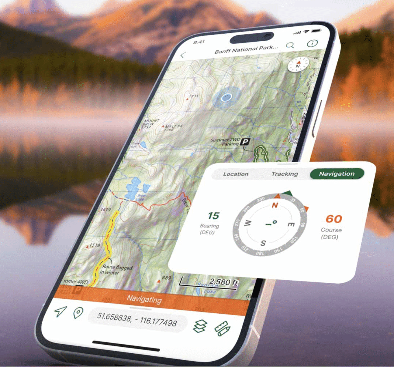
While the initial phase of Blue Marble’s new subscription rollout focuses heavily on streamlining the office-side experience, the overarching vision remains anchored in bridging the gap between desktop analysis and mobile field execution. Avenza Maps provides the critical mobile component of this strategy, empowering field crews with offline mapping capabilities, reliable GPS navigation, and intuitive location-based data collection tools.
The introduction of the unified subscription does not yet deliver complete technical integration between the desktop environment of Global Mapper and the mobile application environment of Avenza Maps. Rather, it successfully consolidates the foundational office workflow while deliberately laying the groundwork for much tighter, more responsive connections between office analysts and field operators. Company executives confirm that forthcoming software updates will continue to improve seamless data sharing, ensuring that spatial products generated in the office can be deployed directly to mobile devices in the field with minimal friction.
Jeremy Parker, CEO of Blue Marble Geographics, highlighted how this phased evolution directly addresses long-standing pain points within the geospatial community.
"Geospatial professionals increasingly work across environments, but the technology supporting them has often remained fragmented," Parker said. "Our strategy is to remove those boundaries by bringing together the capabilities, expertise, and products of Blue Marble and Avenza around a common vision. Global Mapper subscription is another step in that evolution, as we build a company and platform designed around the full scope of how our customers work."
For drone mapping professionals, this strategic trajectory mirrors the broader maturation of the spatial industry as a whole. While an unmanned aircraft may handle the initial task of collecting high-resolution aerial data, the professional workflow extends far beyond the landing pad, requiring sophisticated processing, rigorous analysis, precise delivery, and frequent return trips to the field.
By bringing these previously scattered tools under a single subscription umbrella and establishing a clear pathway toward integrated office-and-field operations, Blue Marble is actively working to eliminate the artificial barriers that have long separated desktop GIS analysis from operational execution on the ground.