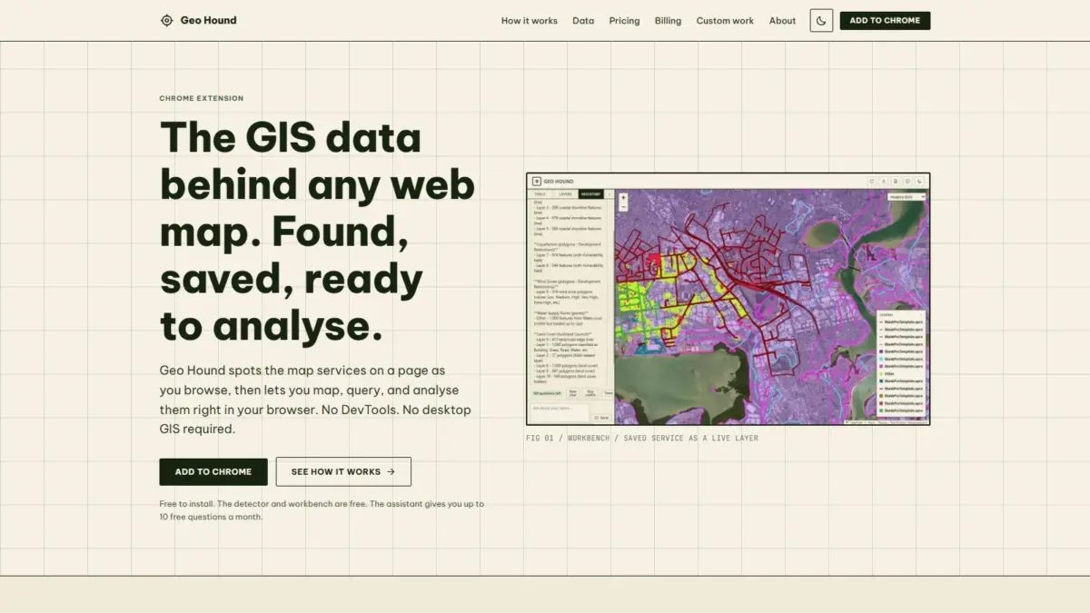
A new browser-based tool named GeoHound has officially launched, offering geospatial professionals, researchers, and mapping enthusiasts a streamlined solution for detecting, capturing, and analyzing spatial data across the web. Developed with core insights from geospatial specialist Daniel O’Donohue, creator and host of The MapScaping Podcast, GeoHound operates as a specialized Google Chrome extension that continuously identifies spatial web services operating behind interactive web maps, eliminating the need for manual network analysis or immediate desktop software dependencies.
Web mapping has become a foundational component of modern digital infrastructure, powering interactive dashboards, municipal planning portals, news publications, and corporate mapping applications. However, while web maps provide visual representations of location data, the underlying data layers and service endpoints are frequently hidden from immediate view. Historically, discovering the source data behind a web map required analysts to open browser developer tools, manually inspect network traffic logs, sift through payload calls, and isolate specific API endpoints. To perform even basic spatial analysis or data extraction on those discovered layers, users typically had to transfer those endpoints into dedicated desktop geographic information system software, such as QGIS or ArcGIS Pro.
GeoHound addresses these workflow bottlenecks by bringing automated detection and spatial tools directly into the web browser. As users navigate the internet, the extension actively monitors browser traffic in real time to identify underlying spatial services. Capable of detecting 29 distinct service types, GeoHound offers broad coverage across both open standard protocols and proprietary enterprise web mapping formats. The extension automatically recognizes Open Geospatial Consortium standards—including Web Map Services, Web Feature Services, and modern OGC APIs—alongside widely deployed commercial systems such as Esri ArcGIS REST services, raster and vector tile feeds, and standalone GeoJSON files.
When GeoHound detects a compatible spatial service on an active webpage, it automatically logs the layer along with its associated metadata. Capturing metadata alongside the raw service link preserves critical structural information, such as coordinate reference systems, layer attributes, spatial extents, and server capabilities. This automated logging mechanism prevents data loss and equips users with immediate technical visibility into the spatial services powering web-based visual displays.
In addition to its background detection engine, GeoHound includes a built-in spatial workbench that functions directly within the Google Chrome browser. The workbench allows users to interact with and process saved spatial layers without opening desktop GIS applications or writing external script automation. From within the browser environment, users can filter datasets based on attribute values, generate spatial proximity buffers around geometric features, execute spatial or attribute joins between datasets, and export the processed layers into downloadable formats for downstream use.
To further expand its functional capabilities, GeoHound integrates an artificial intelligence assistant designed to interpret natural language commands for geospatial tasks. While the core layer detector and browser workbench are available entirely for free, the platform includes an AI component that allows users to perform GIS operations on their saved spatial layers using plain English instructions. Rather than manually configuring spatial parameters or structuring database queries, users can prompt the assistant to execute specific transformations, analysis steps, or filtering tasks directly on the spatial data stored in their session workbench.
By uniting automated network detection, metadata preservation, basic spatial analysis, and AI assistance within a single browser extension, GeoHound addresses several longstanding friction points in modern geospatial workflows. In traditional web research environments, isolating map services through developer tools requires specialized knowledge of web protocols, HTTP request structures, and spatial web specifications. GeoHound automates this discovery phase entirely, transforming what was previously a manual inspection task into an automatic background process.
Furthermore, the extension’s browser-native workbench provides an intermediate workspace for lightweight spatial analysis. For routine tasks—such as checking spatial overlaps, isolating specific attribute subsets, or running buffer operations to evaluate proximity—geospatial professionals often face unnecessary friction when forced to export web endpoints into desktop GIS software suites. By offering filtering, buffering, joining, and exporting directly inside Chrome, GeoHound provides a self-contained spatial analysis environment that reduces software context-switching and speeds up exploratory data evaluation.
The release of GeoHound comes during a period of rapid growth in web-based geographic information systems, where public agencies, research institutions, and private enterprises routinely publish high-value spatial data through interactive web tools. However, access to the raw spatial web services powering these tools can vary significantly depending on how the host application is constructed. By providing real-time visibility into 29 spatial service types, GeoHound restores data transparency and facilitates open access to geospatial web services across diverse web architectures.
The tool’s creation reflects the professional background of Daniel O’Donohue, who has established a prominent presence in the spatial industry through The MapScaping Podcast. As a dedicated audio platform for the geospatial community, the podcast regularly explores emerging developments in spatial software, open-source technology, geographic data standards, and industry workflows. O’Donohue’s experience as a geospatial specialist and media host has provided continuous exposure to the challenges encountered by mapping professionals, particularly around data discovery, software interoperability, and workflow efficiency. GeoHound represents a practical extension of those community discussions, converting shared industry challenges into an accessible tool for web-first GIS tasks.
The technical coverage of GeoHound highlights the diversity of web mapping technology currently in active use across the internet. Standard Web Map Services deliver georeferenced map images rendered by remote servers, while Web Feature Services allow direct retrieval of vector geometries and associated attribute tables. Modern OGC APIs build upon these foundations using modern RESTful conventions, spatial JSON encodings, and web-friendly standards designed for seamless integration with contemporary web development stacks. Concurrently, ArcGIS REST services remain widespread throughout government and enterprise portals worldwide. By recognizing all of these formats alongside tiled map services and raw GeoJSON payloads, GeoHound maintains compatibility across legacy web GIS infrastructure and next-generation spatial APIs alike.
As web platforms increasingly serve as the primary medium for publishing and consuming geographic information, tools that connect web visualization back to raw spatial data services play an important role in modern data workflows. GeoHound provides a flexible bridge between passive web browsing and active spatial analysis, combining automated detection, metadata management, in-browser GIS operations, and plain-English AI processing within a free Chrome extension interface.