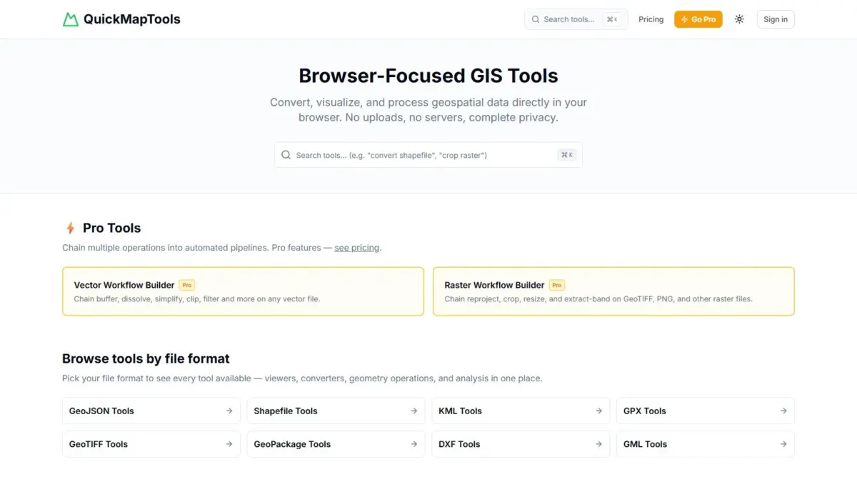
A new browser-focused geospatial platform called QuickMapTools has been launched to streamline everyday spatial data tasks while keeping user data strictly local. Built to operate entirely within the user’s web browser using WebAssembly technology, the suite allows geospatial analysts, developers, and field technicians to perform common operations—such as converting shapefiles, clipping raster imagery, buffering GeoJSON features, and transforming coordinate reference systems—without launching heavy desktop geographic information system (GIS) applications or uploading data to external servers.
Developed by Daniel O’Donohue, a geospatial specialist and the creator and host of The MapScaping Podcast, QuickMapTools addresses a long-standing operational bottleneck in the spatial industry: the friction of performing routine data adjustments quickly, securely, and without reliance on complex desktop environments or cloud-based file uploads.
By executing spatial processing logic on the client side via WebAssembly, the platform ensures that spatial datasets never leave the user’s local device. This architecture provides a solution for organizations handling confidential, proprietary, or privacy-sensitive geographic information, while simultaneously delivering near-native computational performance inside standard modern web browsers.
The platform provides viewing, conversion, reprojecting, and geometry manipulation capabilities across a comprehensive array of primary geospatial formats. Supported file types include GeoJSON, ESRI Shapefile, Keyhole Markup Language (KML), GPS Exchange Format (GPX), GeoTIFF, GeoPackage, Drawing Exchange Format (DXF), and Geography Markup Language (GML), alongside several other vector and raster data standards.
Historically, spatial analysts faced a persistent trade-off when attempting to complete basic data preparation tasks. Desktop GIS platforms, while computationally powerful and feature-rich, often require significant startup times, software installation, license management, and substantial system resources. Opening a full desktop GIS suite merely to verify a spatial file, convert a dataset from one format to another, or adjust a projection can introduce unnecessary delays into daily workflows.
Conversely, conventional web-based spatial converters and lightweight online utilities typically rely on server-side processing. Under that model, users must upload their spatial files to a third-party cloud server, where the processing is executed before the modified output is sent back to the user. This traditional cloud architecture introduces significant bandwidth costs, latency when handling large files, and severe data privacy and regulatory compliance challenges.
In many professional contexts—such as municipal planning, defense, environmental consulting, infrastructure management, and natural resource extraction—uploading unencrypted geographic data to third-party web servers is prohibited by strict data protection policies, non-disclosure agreements, or data sovereignty mandates. Spatial datasets often contain sensitive details, such as proprietary resource locations, critical infrastructure schematics, private land boundaries, or endangered species habitats.
QuickMapTools addresses these privacy constraints by leveraging WebAssembly, a web standard that enables low-level code compiled from languages such as C, C++, or Rust to run directly inside web browser engines at near-native speed. By running compiled geospatial algorithm libraries locally inside the browser memory sandbox, the platform completes all file parsing, geometric calculations, coordinate transformations, and format conversions on the user’s own computer hardware. No spatial data, telemetry, or file contents are transferred across the network to external servers during the processing lifecycle.
In addition to data security benefits, local browser execution eliminates network transmission bottlenecks. Processing performance scales directly with the hardware capabilities of the local machine rather than being limited by internet upload bandwidth or remote server capacity. Once the core web application scripts are loaded into the browser, users can perform data operations locally, allowing for rapid file processing even in bandwidth-constrained settings or disconnected field environments.
The array of supported formats addresses a persistent interoperability challenge within the geospatial sector. Spatial data is notoriously fragmented across different standards created for specific domain requirements. ESRI Shapefiles remain a widely used legacy standard despite their reliance on multi-file sidecar structures and attribute limitations. GeoJSON has become the de facto standard for modern web mapping applications due to its lightweight, text-based JSON structure. GeoPackage offers a modern, open, single-file SQLite database format designed to handle both vector layers and raster tiles efficiently. KML and GPX serve consumer mapping and field tracking tools, DXF connects spatial software with computer-aided design (CAD) platforms, and GML acts as an XML standard for enterprise spatial data infrastructures.
On the raster side, GeoTIFF remains the predominant format for continuous spatial datasets, including high-resolution aerial photography, multispectral satellite imagery, and digital elevation models (DEMs). By supporting direct conversion, viewing, and manipulation across these vector and raster standards, QuickMapTools acts as a browser-native bridge between disparate software ecosystems.
The functional range of the platform encompasses core geometric and spatial operations that form the building blocks of spatial analysis. Buffering enables users to generate polygon zone boundaries at specified distances around point, line, or polygon features, a routine requirement for proximity mapping, environmental buffer zone analysis, and setback calculations. Raster clipping allows users to trim large spatial imagery datasets to a specific boundary polygon, isolating exact study areas and reducing file storage requirements. Coordinate reference system transformations allow datasets to be reprojected between various local projected coordinate systems and global geographic coordinate frameworks, addressing projection mismatches that frequently prevent spatial datasets from aligning correctly.
QuickMapTools is structured with a tiered utility model. The platform’s core individual tools—including format converters, spatial viewers, coordinate transformers, and single-operation geometric utilities—are available free of charge. This allows casual users, researchers, and spatial professionals to access quick, on-demand conversion and editing tools without friction or subscription barriers.
For advanced users and enterprise professionals who manage multi-step processing tasks, QuickMapTools offers a Pro subscription tier. The Pro tier introduces automated, chained workflow pipelines for vector and raster data. In standard GIS operations, complex data preparation often requires running multiple tools sequentially: for instance, importing a raw vector dataset, reprojecting its coordinate system, applying a distance buffer, clipping an overlapping raster dataset to the buffered result, and finally exporting the output into a modern web format. Executing these operations manually in single-tool utilities requires saving and re-uploading intermediate datasets at each stage of the process.
The chained workflow pipelines in QuickMapTools Pro allow users to connect multiple vector and raster operations into a single, automated processing sequence. Data flows seamlessly from one processing step to the next within local memory, eliminating the need to save intermediate files and streamlining repeatable batch data workflows.
The project reflects the broader career and industry insights of its creator, Daniel O’Donohue. Through his work as a practicing geospatial specialist and as the host of The MapScaping Podcast, O’Donohue has spent years exploring the practical challenges faced by spatial professionals, software developers, and data end-users across the global geospatial industry. A recurring topic within the community has been the need for accessible, lightweight, and secure tools that bridge the gap between full-featured desktop suites and basic web utilities.
QuickMapTools reflects a growing movement toward edge computing and browser-native GIS solutions. As web browsers continue to evolve into powerful application runtime environments, complex spatial data processing tasks that once required dedicated software installations can increasingly be performed within web interfaces without compromising computational performance, user experience, or data privacy.