Louisiana’s natural environment is widely recognized for its extensive networks of low-lying bayous, sprawling coastal marshes, and major river basins. However, spatial data maintained by federal geographic agencies draws attention to a far less recognized element of the state’s landscape: its official collection of cascading surface water features. According to data cataloged by the United States Geological Survey (USGS), Louisiana is home to exactly three officially named waterfalls. This tally places Louisiana at 48th among all U.S. states in terms of formally recognized waterfall features, reflecting both the region’s low-relief terrain and the stringent standard required to secure an established entry in federal geographical registers.
The listing of Louisiana’s named waterfalls presents a complete geographic inventory based on records maintained in the federal government’s central place-name repository. While the total count is small compared to states situated along major mountain ranges, these three falls represent a distinct and valued component of Louisiana’s natural surface water infrastructure.
Federal Mapping and Geographic Recordation
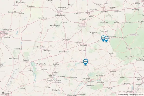
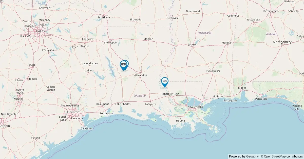
The spatial distribution of Louisiana’s named falls has been documented through public geographic datasets managed by the USGS Geographic Names Information System (GNIS). The federal mapping registry plots every named fall in the state, providing standard coordinates, administrative classifications, and direct access to federal records.
Using interactive spatial tools connected to the federal system, researchers, land managers, and members of the public can identify the precise geographic location of each cataloged feature. Clicking on mapped markers reveals critical archival details, including the waterfall’s official name, its county location, exact latitude and longitude coordinates, and driving directions designed to navigate users to the nearest public access roads. Furthermore, each feature record includes a direct deep link to its master record within the USGS GNIS framework, allowing for verification of historical documentation and geographic metadata.
Although Louisiana’s terrain lacks the extreme vertical drops found in high-altitude mountain states, the federal survey ensures that even modest natural drops are cataloged when they meet established naming criteria. The inclusion of these three features in federal datasets ensures that Louisiana’s unique hydrologic landmarks are recognized within national spatial planning and geographical documentation systems.
Waterfalls in Louisiana by the Numbers
Evaluating waterfall occurrences across the United States requires examining regional geological structures, stream gradients, and historical place-name usage. In Louisiana, natural features that produce persistent cascading water are rare due to the prevailing gentle slope of the land as it drains toward the Gulf Coast.
With only three officially designated named waterfalls, Louisiana ranks near the bottom of the national list at 48th overall. This numerical ranking places the state alongside other low-elevation coastal and plains states that feature minimal vertical relief.
However, federal analysts and geographic experts emphasize that there is a distinct difference between officially named waterfalls and physical flowing cascades:
- Official Tally: The federal registry managed by the USGS counts exactly three named waterfalls within Louisiana’s borders.
- National Rank: Louisiana holds the 48th spot nationally for total cataloged named waterfalls.
- Physical Realities: The total number of flowing cascades across the state exceeds the official count of three when counting seasonal, unnamed water features.
While three represents the definitive federal tally of waterfalls notable enough to carry an established proper name, the actual physical count of cascading water features across Louisiana fluctuates throughout the year. During periods of heavy precipitation, temporary streams and runoff channels generate short-lived cascades over bluffs, rock ledges, and drainage breaks. These unnamed seasonal features, while visible to local hikers and landowners during wet periods, do not possess formal geographic designations and are consequently omitted from the official USGS register. The federal standard requires a feature to have a recognized, established name in common local or historical use before it is permanently indexed in the GNIS database.
Regional Breakdown by County
The geographical distribution of Louisiana’s named waterfalls is restricted to a small footprint, with all three features concentrated within just two local jurisdictions. This clustering corresponds to specific geological formations within the state where localized elevation changes and exposed rock strata create the physical conditions necessary for waterfalls to form.
Natchitoches County serves as the state’s primary center for cataloged waterfall features, holding two of Louisiana’s three named falls. Situated in the north-central portion of the state, Natchitoches County features dissected hills, small stream valleys, and sandstone formations associated with regional upland terrain. These topographical characteristics allow running water to cut down into stream beds, producing the vertical drops required to create distinct falling water features.
West Feliciana County contains the state’s remaining named waterfall, accounting for the final feature in the federal registry. Located in southeastern Louisiana along the eastern bank of the Mississippi River, West Feliciana County is defined by the Tunica Hills region. This area features high bluffs, deeply carved ravines, and thick loess soil deposits cut by spring-fed streams. The resulting steep-sided creek beds provide rare vertical drops within the state’s coastal plain environment, creating the natural conditions for Louisiana’s third official waterfall.
Together, Natchitoches County (2 named falls) and West Feliciana County (1 named fall) represent 100 percent of the formally cataloged waterfall inventory in Louisiana.
Access, Land Ownership, and Visiting Guidelines
Navigating to Louisiana’s named waterfalls involves understanding land management structures, property boundaries, and physical access routes. A significant portion of the state’s cataloged falls sit on public lands set aside for conservation, forestry, and recreation.
The majority of named falls in Louisiana are situated on publicly accessible acreage. This includes tracts managed by federal, state, county, and municipal authorities, such as State Parks, National Forest lands, and properties under the jurisdiction of the Bureau of Land Management (BLM). These public holdings generally permit recreational visitation, subject to specific agency regulations, trail rules, and seasonal park operating hours.
However, not all named water features sit on open public property. Certain cataloged falls or the primary approach routes surrounding them are located on private land holdings or tribal lands. Access to these areas is governed by private landowners or tribal authorities, who maintain independent rules regarding entry, usage, and conservation. Geographic authorities strongly advise prospective visitors to verify the specific land management status of a feature before visiting, confirm open access routes, and strictly respect property boundaries to prevent trespassing.
For accessible features on public land, the driving directions provided through the USGS mapping entries guide visitors to the nearest designated public road or trailhead. From these roadway locations, reaching the physical waterfall site often requires additional foot travel. Depending on the specific terrain and site development, access may involve a brief walk along an established path or a moderate hike through unpaved forest trails, ravine bottoms, and uneven terrain.
Seasonal Flow Patterns and Environmental Conditions
The physical appearance, flow rate, and water volume of Louisiana’s named waterfalls vary significantly based on seasonal weather patterns, regional hydrology, and localized rainfall events.
Unlike waterfalls in mountainous regions that depend primarily on melting alpine snowpacks, Louisiana’s surface water cascades are predominantly rain-fed. Peak flow conditions generally coincide with spring weather systems, when heavy seasonal rains and saturated soil conditions lead to increased surface runoff and elevated stream volumes. During these wet periods, the state’s falls reach their maximum visual output and water velocity.
In contrast, late summer and early autumn typically bring drier conditions across the state, resulting in lower streamflows. While overall water volume decreases during these warmer months, the reduced flow frequently results in clearer water conditions. Visiting during the early autumn window also offers an opportunity to view the falls framed by changing foliage in forested areas like the Tunica Hills and the rolling woods of central Louisiana.
In high-elevation sections of the state, distinct winter conditions occasionally alter the landscape. During extended freeze events, lower temperatures can cause small falls to partially freeze. This creates localized ice formations and frozen cascades, presenting a striking visual dynamic that contrasts sharply with the state’s typical warm-temperate climate.
Data Provenance and Recording Methodology
The data underpinning this geographic summary is drawn directly from the federal standard for U.S. place names: the USGS Geographic Names Information System. Formally established in 1890, the GNIS operates as the central federal database for standardizing geographic feature names across maps, official publications, and digital spatial products.
The current dataset was compiled following a systematic query of The National Map’s ArcGIS REST service in May 2026. The search standard extracted every spatial record located within the state boundaries of Louisiana that carries the primary feature classification of Falls.
While the GNIS system serves as the definitive authority for geographic naming, spatial coordinates, county locations, and federal record links, it does not maintain physical dimensional metrics such as waterfall height, crest width, or volumetric discharge rates. For detailed physical dimensions and structural classifications of these features, researchers and outdoor enthusiasts refer to specialized private and open-source hydrologic indexes, such as the World Waterfall Database.