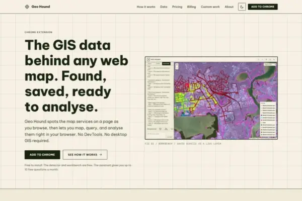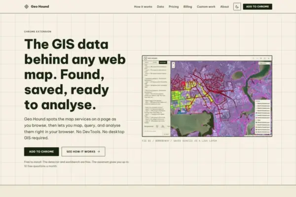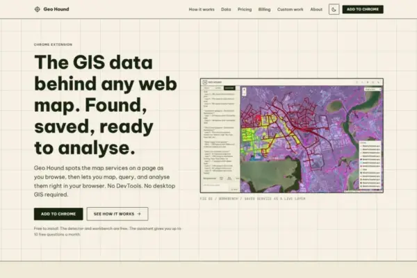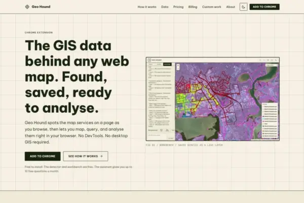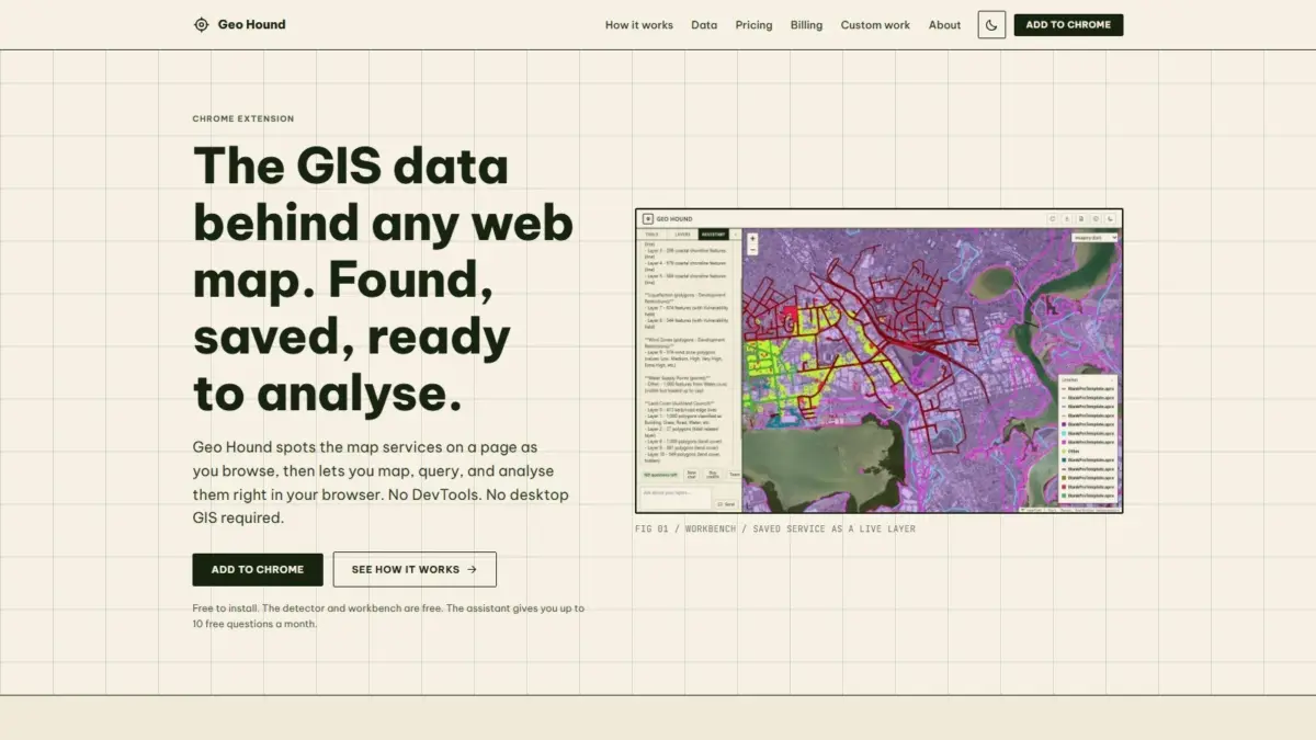
Geospatial data forms the invisible foundation of the modern web, underpinning interactive interfaces that track everything from real-time climate monitoring and transit routing to municipal zoning, property boundaries, and breaking news coverage. However, for geospatial professionals, researchers, open-source intelligence analysts, and web developers, uncovering the precise data sources streaming behind a polished web map interface has traditionally been a tedious technical chore. A newly released Google Chrome extension named GeoHound aims to streamline this workflow entirely by identifying, cataloging, and analyzing web map services directly within the browser environment as users navigate the web.
Created by Daniel O’Donohue, a professional geospatial specialist best known as the creator and voice behind The MapScaping Podcast, GeoHound addresses a long-standing friction point in spatial data discovery. When navigating web maps, users frequently encounter compelling layers of geographical information but lack an immediate, intuitive way to identify where the data originates or how to access the underlying service endpoints. GeoHound functions as an automated detection layer operating within the Chrome browser, continuously listening for incoming spatial endpoints and capturing the raw geospatial streams powering any active map.
The underlying mechanics of modern web mapping rely on a wide variety of protocols, standards, and data structures. Web mapping applications rarely serve spatial datasets as monolithic files; instead, they stream data dynamically using specialized geographic service standards. These include standards established by the Open Geospatial Consortium (OGC)—such as Web Map Service (WMS), Web Feature Service (WFS), and modern OGC APIs—alongside proprietary and widely adopted industry standards such as Esri ArcGIS REST services, raster and vector tile endpoints, and standalone GeoJSON objects.
In total, GeoHound is capable of detecting 29 distinct types of geospatial services and file formats as a user browses the web. Rather than requiring users to manually dig through raw network traffic, GeoHound automatically captures these services in real time and archives them alongside their comprehensive metadata. This provides instant visibility into layer definitions, spatial references, spatial extents, service capabilities, and attribute schemas without requiring any manual developer interventions.
Historically, extracting these raw geographic service feeds required a technical process often referred to by practitioners as DevTools spelunking. To locate an active spatial layer, an analyst had to open the browser’s developer tools, navigate to the network monitoring tab, refresh the page, filter through hundreds of individual HTTP requests, inspect raw XHR and Fetch calls, parse lengthy query strings, and isolate the base service URL. Once isolated, the user then had to verify the endpoint in a new browser tab, decipher the available parameters, and manually load the URL into a desktop Geographic Information System software package—such as QGIS or Esri ArcGIS Pro—simply to inspect the feature table, run a quick query, or check geographic overlaps.
GeoHound eliminates these multi-step technical barriers by combining spatial service detection with a built-in, interactive workbench native to the Google Chrome browser. When spatial layers are identified and saved during a browsing session, users can open the integrated workbench directly within the extension. This environment allows users to inspect and manipulate geographic datasets on the fly without having to launch heavy desktop GIS software or export raw service endpoints into third-party desktop environments.
The built-in workbench provides a suite of essential GIS processing capabilities designed for immediate spatial analysis. Within the browser interface, users can apply attribute filters to subset complex vector layers based on specific criteria, generate spatial buffers around vector geometries to evaluate proximity, perform spatial and attribute joins to combine disparate datasets, and export transformed geographic data into standard formats for downstream applications. By enabling core geographic manipulation tasks directly inside the browser, the tool bridges the gap between passive web map browsing and active spatial analysis.
In addition to its standard workbench toolkit, GeoHound incorporates an artificial intelligence assistant capable of executing GIS workflows through natural language prompts. Users can interact with their saved spatial layers by typing instructions in plain English, allowing the AI assistant to perform complex spatial filtering, transformations, and analytical operations automatically. This natural language interface lowers the technical barrier to spatial data manipulation, allowing non-specialist users to query and manipulate spatial layers without needing to master complex spatial database queries, write specialized Python scripts, or navigate multi-layered desktop GIS menus. At the same time, it offers experienced spatial professionals a rapid method for performing iterative data exploration and automated task execution.
The core service detector and the interactive browser workbench are offered completely free of charge, ensuring broad access for students, independent researchers, journalists, urban planners, and GIS specialists alike. By making both data discovery and fundamental spatial analysis tools freely accessible within the web browser, the extension democratizes access to geographic web services that were previously obscured behind user interfaces or buried within complex network requests.
The development of GeoHound stems directly from the practical experience of its author, Daniel O’Donohue. As a seasoned geospatial specialist, O’Donohue has spent years working with spatial technologies to analyze real-world complexity across diverse domains. Through his work hosting The MapScaping Podcast—a central media platform for the global geospatial community—O’Donohue regularly engages with emerging industry trends, open data standards, cloud-native geospatial architectures, and the evolving needs of spatial practitioners. GeoHound reflects a practical extension of that ongoing community dialogue, converting common spatial workflows into an accessible, browser-native tool.
The launch of GeoHound highlights a broader trend within the geospatial industry toward lightweight, browser-native, and AI-assisted spatial tools. As web mapping protocols become increasingly ubiquitous across modern web applications, the ability to inspect, extract, and analyze spatial data at the browser level represents a significant evolution in spatial data accessibility. By removing the friction associated with network inspection and software switching, tools like GeoHound transform static web maps into open, interactive data environments, allowing users to move seamlessly from discovering a map layer to analyzing its geographic contents in real time.