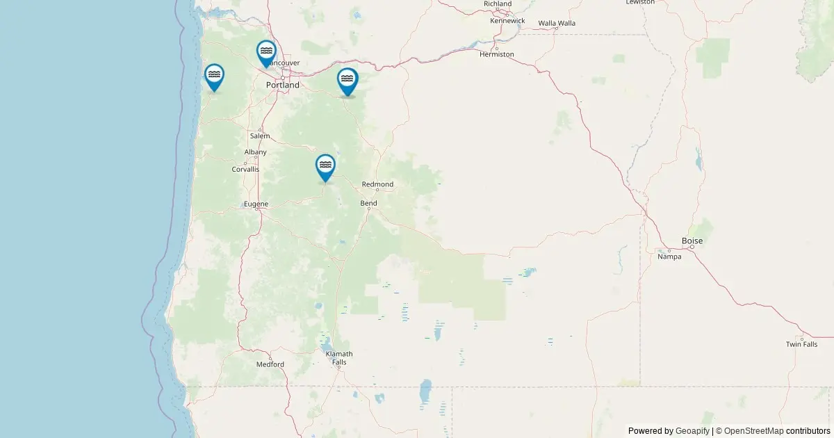
Comprehensive geographic data from the United States Geological Survey (USGS) confirms Oregon’s position as home to one of the densest concentrations of named waterfalls in the United States. According to federal records, the state contains 240 officially cataloged named waterfalls, placing Oregon at the top of national rankings for waterfall density.
A specialized interactive mapping project has plotted all 240 named falls across Oregon using data derived directly from the federal government’s primary geographic naming authority. By accessing records from the USGS Geographic Names Information System (GNIS), the mapping tool provides detailed geospatial information for every recognized waterfall in the state, offering researchers, outdoor enthusiasts, and the public an unprecedented view of Oregon’s unique hydrological landscape.
Federal Geographic Data Maps Oregon’s Waterfalls
The foundation of Oregon’s status as a national leader in waterfall density rests on official records maintained by the federal government. The Geographic Names Information System (GNIS), established in 1890, serves as the standard authority for domestic geographic names throughout the United States. In May 2026, a comprehensive query of The National Map’s ArcGIS REST service identified every feature classified specifically as "Falls" within the geographic boundaries of Oregon, establishing the current official count of 240 named waterfalls.
While Oregon contains countless unnamed cascades, seasonal trickles, and localized water features, the federal tally of 240 reflects only those features that possess sufficient geographic and historical significance to carry an officially registered name. This distinction is vital for geographical analysis, as it establishes a standardized benchmark based on historic designation and federal cataloging rather than informal local nomenclature.
The mapped features span the entire state, representing a diverse range of hydrologic environments ranging from coastal mountain ranges and dense river valleys to high-elevation volcanic slopes and eastern high desert drainages. By organizing these features into a unified digital interface, the project allows users to evaluate the spatial distribution of Oregon’s most prominent water drops.
Interactive Mapping Features and Navigation Tools
The newly compiled interactive map serves as a comprehensive visual database, placing individual geographic markers at the exact coordinates of each named waterfall recorded by the USGS. Users interacting with the map can select any marker to open a detailed data window containing critical geospatial and administrative details.
Each popup window provides the officially recognized name of the waterfall, the county in which it resides, its precise latitude and longitude coordinates, and direct links for practical navigation. A key feature of the interface is a driving-directions link that calculates routing to the nearest accessible public road relative to the feature’s location.
Because many of Oregon’s waterfalls are located in rugged, undeveloped terrain, reaching a fall often requires transitioning from vehicle transport to foot travel. The mapped coordinates provide an accurate baseline location, though visitors are advised that short or moderate hikes are frequently necessary once arriving at the designated road access points.
Furthermore, each map marker includes a deep link connecting directly to the corresponding record within the federal GNIS database. This connection allows users to inspect the official government archive entry for each individual feature, bridging the gap between high-level mapping tools and primary historical records.
County Breakdown of Oregon’s Waterfalls
The spatial distribution of named waterfalls across Oregon is heavily concentrated in specific counties, driven largely by local topography, precipitation patterns, and river basin structures. An analysis of the USGS data reveals that a handful of counties account for the vast majority of the state’s total recorded falls.
Lane County leads the state with 26 officially named waterfalls, the highest total of any single county in Oregon. Characterized by expansive river systems stretching from the Cascade Range downward toward the Pacific coast, Lane County’s steep terrain and high annual rainfall create ideal conditions for permanent water drops.
Close behind is Douglas County, which claims 25 named waterfalls. Positioned in the southwestern region of the state, Douglas County encompasses significant portions of the Umpqua River watershed and rugged mountainous terrain, contributing to its dense concentration of cataloged features.
Marion County ranks third overall, hosting 22 named waterfalls. Home to major hydrologic features within the North Santiam River basin and surrounding foothills, Marion County features a dense cluster of prominent falls that draw significant geographic interest.
Further north, Clackamas County and Multnomah County each account for 15 named waterfalls. Multnomah County, despite its relatively small geographic footprint, features a world-renowned concentration of high-relief falls situated along the steep basalt cliffs of the Columbia River Gorge. Clackamas County similarly benefits from the dramatic elevation changes along the western slopes of the Cascades.
In Central Oregon, Deschutes County records 14 named waterfalls. Situated on the eastern side of the Cascade crest, Deschutes County features notable falls fed by volcanic hydrology, snowpack runoff, and prominent river channels such as the Deschutes River.
Together, these six counties represent the primary heartland of Oregon’s waterfall density, though the remaining named falls are distributed across numerous other counties throughout the state.
Public Access, Land Management, and Stewardship
The vast majority of Oregon’s 240 named waterfalls are located on land that is accessible to the public. These features predominantly lie within boundaries managed by federal, state, and local public entities, including the United States Forest Service (USFS), the Bureau of Land Management (BLM), the Oregon State Parks and Recreation Department, and various municipal or county parks divisions.
However, public cataloging by the USGS does not automatically guarantee unrestricted physical access. A portion of the state’s named waterfalls sit on private property or within tribal lands, where access is subject to specific ownership regulations, legal restrictions, or tribal jurisdiction.
Land managers and geographic researchers emphasize the importance of verifying property boundaries and access rules before attempting to visit any cataloged feature. Visitors are urged to consult the appropriate managing agency—whether a national forest district office, state park authority, or local government body—to confirm current trail conditions, access permits, and land boundaries, while ensuring that private land rights are respected and trespassing is avoided.
Additionally, while the USGS GNIS framework provides accurate horizontal spatial coordinates and official naming histories, it does not record physical metrics such as waterfall height, width, or volumetric flow rate. For technical structural data and structural dimensions, researchers and visitors often cross-reference GNIS spatial data with specialized external records such as the World Waterfall Database.
Seasonal Flow Dynamics and Environmental Conditions
The visual characteristics and water volume of Oregon’s waterfalls vary significantly throughout the calendar year, driven by the state’s distinct seasonal climate patterns and regional geography.
Peak flow rates across most Oregon waterfalls occur during the spring months. This period coincides with the annual melting of high-elevation mountain snowpack combined with late-season rainfall, resulting in maximum water volumes and heavy hydraulic pressure along major stream channels. Secondary peak flows frequently occur during late autumn and winter following heavy, sustained rain events in western Oregon.
Conversely, late summer and early autumn typically bring lower water volumes as seasonal precipitation decreases and snowpack depletes. While flow volume is reduced during these months, river waters often run clearer, and surrounding deciduous vegetation undergoes seasonal foliage changes, offering distinct visual conditions for visitors.
During the winter months, high-elevation waterfalls located in mountain ranges experience extreme sub-freezing temperatures. In these areas, continuous freezing leads to the formation of massive ice structures and partially frozen cascades, dramatically altering the physical appearance of the falls until the spring thaw begins.
Frequently Asked Questions About Oregon’s Waterfalls
How many waterfalls are officially cataloged in Oregon?
The USGS Geographic Names Information System (GNIS) officially records 240 named waterfalls in Oregon. While the total number of physical cascades in the state is higher when including unnamed seasonal trickles and temporary runoff features, 240 represents the official federal count of falls notable enough to hold an established, registered geographic name.
Which Oregon counties host the highest concentration of named falls?
Lane County contains the highest number of named waterfalls in the state, with 26 cataloged features. It is followed closely by Douglas County with 25 named falls and Marion County with 22. Clackamas County and Multnomah County each contain 15 named falls, while Deschutes County records 14.
Are Oregon’s named waterfalls accessible to the public?
Most named waterfalls in Oregon are located on public lands managed by federal agencies such as the U.S. Forest Service and Bureau of Land Management, as well as state, county, and municipal park systems. However, some named falls are situated on private land or within tribal territories subject to specific access restrictions. Travelers should always confirm property ownership and land management guidelines prior to visiting.
What is the optimal time of year to view waterfalls across the state?
Peak flow volume typically occurs during the spring season as mountain snowpack melts, as well as following heavy winter rains. Late summer and early autumn provide lower, clearer water flows accompanied by fall foliage, while high-elevation falls frequently develop dramatic ice formations during the coldest winter months.
What is the primary source for Oregon’s waterfall geographic data?
The underlying location data originates from the USGS Geographic Names Information System (GNIS), which has served as the official federal standard for U.S. place names since 1890. The dataset was retrieved via The National Map’s ArcGIS REST service in May 2026, targeting all features officially classified as "Falls" within Oregon.