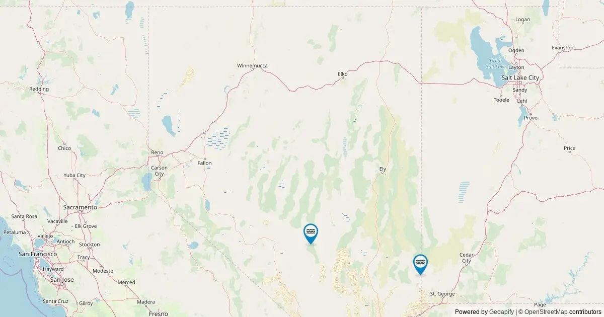
A federal geospatial survey of official U.S. land features reveals that Nevada is home to eight officially named waterfalls. According to records maintained by the U.S. Geological Survey through its Geographic Names Information System, this catalog places Nevada 38th nationally among U.S. states in the total number of designated falls.
While the state is dominated by the arid basins and rugged mountain ranges of the Great Basin and Mojave Deserts, these recorded hydrological features represent recognized permanent or recurring named water drops across six distinct counties. Interactive geospatial mapping utilizing data extracted from the federal repository provides precise location data, navigational routing, and administrative background for each cataloged feature.
The complete federal dataset provides an inventory of these distinct geographic points, detailing their spatial coordinates, administrative jurisdictions, and land management status. Though modest in comparison to wetter coastal or mountainous states, Nevada’s named falls offer a glimpse into the state’s complex topography, where high-elevation snowpack and seasonal drainage systems feed localized cascades.
Federal Geographic Records Detail Nevada’s Waterfalls
The federal cataloging of Nevada’s water features relies on spatial records compiled and maintained by the U.S. Geological Survey. Every named waterfall in the state has been mapped using precise geographical coordinates, linking spatial location data directly to official geographic designations.
Through digital mapping interfaces connected to the federal system, researchers, land managers, and members of the public can examine the location of each waterfall across Nevada’s expansive terrain. Interactive markers provide instant access to vital contextual data, including the exact geographic coordinates, the county in which the feature resides, and direct routing directions to the nearest access roads. Furthermore, each record links back to its permanent entry within the U.S. Geographic Names Information System repository, allowing users to verify official naming conventions and historical spatial records.
This spatial cataloging demonstrates that despite Nevada’s reputation as the driest state in the nation, localized precipitation, alpine runoff, and unique geological formations combine to sustain distinct falling water features across both public and restricted landscapes.
Waterfalls in Nevada by the Numbers
From a national perspective, Nevada’s total count of eight named waterfalls places it near the lower third of all U.S. states, ranking 38th overall. This figure reflects the strict criteria used by federal cartographers to establish official place names, distinguishing permanent or historically recognized landmarks from temporary, unnamed runoff.
The total inventory of eight named falls represents the baseline established by federal mapping standards. Hydrologists and environmental researchers note that the actual count of falling water across the state fluctuates significantly based on seasonal conditions. When factoring in temporary, unnamed seasonal cascades that flow exclusively during peak spring snowmelt or following intense summer thunderstorm events, the number of physical drops increases. However, the federal tally of eight remains the authoritative baseline for features carrying an official, recognized name.
County-by-County Distribution of Nevada Waterfalls
The geographical distribution of named waterfalls across Nevada is uneven, with eight features distributed across six of the state’s 17 counties.
Clark County, situated in the southern tip of the state and home to the Las Vegas metropolitan area as well as surrounding mountain ranges, holds the highest concentration of named waterfalls in Nevada, containing three distinct cataloged falls.
The remaining five named waterfalls are distributed individually across five separate counties spanning the southern, central, and northern regions of the state:
- Clark County: 3 named waterfalls
- Lincoln County: 1 named waterfall
- Washoe County: 1 named waterfall
- Lander County: 1 named waterfall
- Churchill County: 1 named waterfall
- Nye County: 1 named waterfall
This distribution highlights how named water features in Nevada are not confined to a single geographic area. Instead, they are scattered from the Sierra Nevada fringe in Washoe County to the central Great Basin ranges of Lander, Churchill, and Nye counties, down to the desert mountains of Lincoln and Clark counties.
Land Management and Accessibility Considerations
The majority of Nevada’s named waterfalls are situated on publicly owned lands, managed by a combination of federal, state, and local agencies. These public locations include tracts overseen by the Bureau of Land Management, the U.S. Forest Service within National Forest system lands, Nevada State Parks, and municipal or county park authorities.
However, select water features sit within private property boundaries or on tribal lands. In these locations, access is governed by specific land management policies, local regulations, or tribal sovereignty rules. Outdoor recreation authorities emphasize that visitors must research the governing land manager prior to planning trips and strictly respect private land boundaries to prevent trespassing.
Access parameters vary depending on the feature’s physical location. Digital mapping tools connected to the USGS database route vehicles to the nearest established roadway or public access point. From these vehicular drop-off locations, reaching the physical waterfall site often requires additional foot travel. Depending on the terrain and surrounding wilderness classification, visitors may encounter short paved paths, established dirt trails, or unmaintained wilderness routes requiring moderate hiking.
Seasonal Hydrology and Peak Viewing Conditions
The flow rates of Nevada’s named waterfalls are highly dynamic, dictated by the state’s semi-arid climate, precipitation patterns, and elevation variations.
For the majority of named falls across Nevada, peak volumetric flow occurs during the spring snowmelt period. As winter snowpack accumulation in high-elevation mountain ranges thaws under rising spring temperatures, runoff channels into alpine streams, producing maximum flow rates. Secondary peak flows can occur following intense rainfall events, such as summer monsoons or heavy cloudbursts.
By late summer and early autumn, water volumes generally diminish significantly due to reduced runoff and higher evaporation rates. However, this period often produces clearer water conditions paired with autumn foliage shifts in surrounding riparian vegetation.
During the winter months, high-elevation falls across Nevada experience significant temperature drops, causing water streams to partially or fully freeze. This seasonal freezing creates dramatic ice columns and frozen formations along mountain rock faces, transforming the hydrological characteristics of the sites until the spring thaw repeats the cycle.
Data Methodology and Federal Geographic Mapping
The dataset defining Nevada’s named waterfalls originates from the Geographic Names Information System, established in 1890 as the primary federal standard for geographic place names across the United States.
The underlying data for this state inventory was retrieved in May 2026 by querying The National Map’s ArcGIS REST service. The search targeted all geographic features explicitly classified under the spatial category of "Falls" within the state boundary of Nevada.
While the USGS GNIS registry serves as the authoritative source for official names, administrative locations, and geographic coordinates, it does not collect or store physical dimensions such as waterfall height, drop count, or crest width. For structural and physical measurements, land managers and hydrologists refer to secondary documentation repositories, such as the World Waterfall Database, to complement federal geographic records.
Frequently Asked Questions
How many waterfalls are there in Nevada?
The USGS Geographic Names Information System officially records eight named waterfalls within Nevada. While the total number of physical cascades in the state is higher when counting unnamed, temporary, or seasonal flows that appear during major weather events, eight is the official federal tally of falls significant enough to bear an established, officially recognized name.
Which county has the most waterfalls in Nevada?
Clark County contains the highest number of named waterfalls in the state, with three cataloged features. Lincoln, Washoe, Lander, Churchill, and Nye counties each contain one named waterfall, accounting for the remainder of the state’s total.
Are Nevada’s named waterfalls accessible to the public?
Most of Nevada’s named falls are located on public land, including state parks, National Forest terrain, BLM land, and local municipal tracts. However, some fall within private land or tribal reservations where access is restricted or subject to specific rules. Visitors are advised to verify land ownership, check local regulations, and follow driving directions to designated access roads, noting that reaching the actual waterfall location often requires a short to moderate hike.
When is the best time of year to view Nevada waterfalls?
Peak flow generally coincides with the spring snowmelt and periods following heavy rainfall. In late summer and early autumn, flows are typically lower but feature clear water and changing riparian foliage. In high-elevation areas during winter, low temperatures frequently freeze the falls, creating static ice formations.
What is the source of the Nevada waterfall data?
Data is sourced from the USGS Geographic Names Information System, the official federal standard for U.S. geographic names since 1890. The dataset was extracted in May 2026 via The National Map’s ArcGIS REST service for features categorized as "Falls" within Nevada. Physical metrics like waterfall height are not tracked by the GNIS and are recorded separately in databases such as the World Waterfall Database.