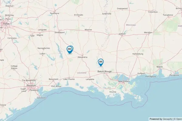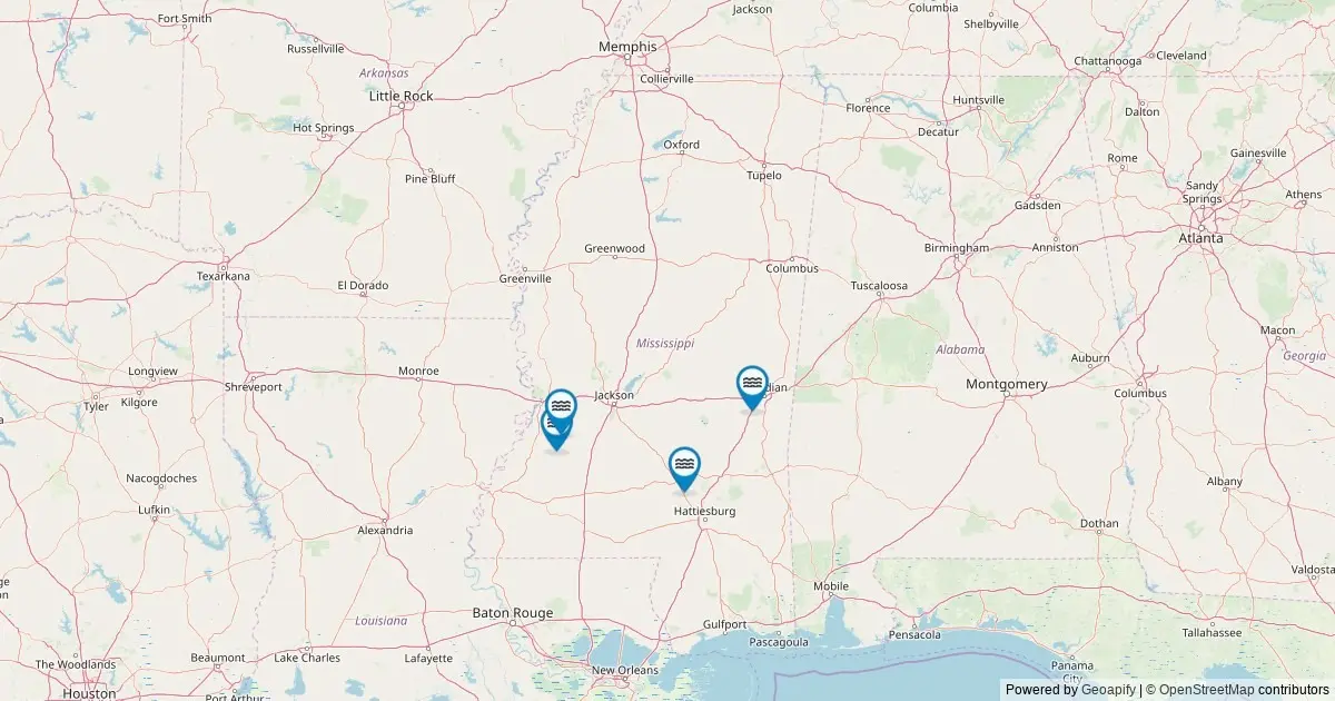
A comprehensive federal mapping initiative drawing from official geographic databases has catalogued the recognized named waterfalls across Mississippi, highlighting a small but unique collection of natural hydrologic features in the state. According to data maintained by the United States Geological Survey through its Geographic Names Information System, Mississippi contains four officially named waterfalls. This tally places the state at 47th nationally in total count of recognized named falls, reflecting its broader coastal plain topography while preserving a distinct set of localized geographic landmarks.
The newly compiled dataset plots every officially recognized waterfall within state boundaries using geographic coordinates and administrative tracking from federal records. By examining the federal registry, outdoor enthusiasts, researchers, and land managers can analyze the precise spatial distribution of these named falls, access exact geographic coordinates, review corresponding county locations, and consult direct
links to original federal records maintained by the United States Geological Survey.
Geographic Distribution Across Mississippi Counties
The federal dataset reveals an even geographic distribution of recognized named waterfalls across Mississippi, with no single county hosting more than one recorded feature. The four named waterfalls catalogued by federal surveyors are divided equally among four separate counties: Claiborne County, Copiah County, Lauderdale County, and Covington County.
In Claiborne County, located in the western portion of the state along the lower Mississippi River region, federal records identify a single named waterfall feature. Moving east into Copiah County, another distinct named fall is recorded within the county’s borders. Further east along the Alabama state line, Lauderdale County accounts for another named fall in the federal tally. Finally, Covington County, situated in the south-central portion of the state, contains the fourth recognized named waterfall catalogued by federal mappers.
This distribution underlines the dispersed nature of Mississippi’s named hydrologic drops. Rather than clustering within a single mountainous range or concentrated river gorge, the state’s named falls are scattered across distinct geographic regions, each serving as a localized point of interest within its respective county.
Federal Mapping Standards and the USGS Geographic Names Information System
The underlying records for Mississippi’s waterfall registry originate from the Geographic Names Information System, which has served as the official federal standard for place names across the United States since its establishment in 1890. Maintained by the United States Geological Survey, the system provides a centralized, authoritative database of cultural and physical geographic features recognized by the federal government.
To compile the current dataset for Mississippi, data analysts queried the ArcGIS REST service of The National Map in May 2026. The search specifically targeted geographic features categorized under the formal feature classification of "Falls" located within the state boundaries of Mississippi.
Federal records emphasize a key distinction between formally named geographic features and unnamed natural cascades. While the Geographic Names Information System officially records four named waterfalls within Mississippi, researchers note that the actual number of physical water drops in the state is higher. Throughout Mississippi’s river basins and forested terrain, numerous unnamed cascades and temporary wet-weather falls exist, particularly during periods of high precipitation. However, the federal count of four reflects only those features that have met historical and administrative criteria to receive an established, officially recognized name recorded in the national database.
Furthermore, federal cataloguing focuses strictly on geographic location, nomenclature, and administrative jurisdiction. The Geographic Names Information System does not record physical dimensions such as waterfall height or crest width. For physical dimensions and detailed structural profiles, researchers and naturalists consult specialized external cataloguing projects, such as the World Waterfall Database.
Land Access and Responsible Outdoor Exploration
Accessibility to Mississippi’s named waterfalls varies depending on underlying property ownership and local administration. A significant portion of the named falls catalogued in the federal database sits on publicly managed lands. These locations fall under the jurisdiction of various public entities, including state park systems, National Forest lands, Bureau of Land Management tracts, and local municipal or county authorities.
Publicly owned waterfall sites generally feature established access frameworks, though visiting conditions depend on local park infrastructure and land management policies. Map data associated with the federal inventory provides driving directions to the nearest public road access points for each named fall. From these road access points, reaching the actual waterfall location often requires walking or hiking a short to moderate distance along local trails or designated footpaths.
Not all catalogued waterfalls, however, reside on public property. Certain named falls recorded in federal historic databases are situated on privately owned land or within tribal lands. Private and tribal properties operate under distinct access rules and legal protections. Outdoor visitors are advised to verify property boundaries and consult the appropriate land management agency or landowner before attempting to visit any site. Maintaining access privileges requires strict adherence to property boundaries, adherence to posted rules, and a commitment to avoiding unauthorized entry on private lands.
Hydrologic Patterns and Seasonal Viewing Conditions
The physical appearance and water volume of Mississippi’s named waterfalls fluctuate significantly throughout the year, driven by regional precipitation patterns, seasonal temperature shifts, and local drainage conditions. Understanding these hydrologic cycles provides context for when flow rates are highest and how seasonal changes alter the surrounding landscape.
For the majority of Mississippi’s waterways, peak flow conditions occur during the spring months. High spring water levels are typically driven by seasonal rainfall patterns across regional watersheds, alongside runoff from upriver drainages. Heavy rain events during late winter and early spring can transform modest creeks into high-volume torrents, yielding maximum visual flow at waterfall drop points.
As the year transitions into late summer and early autumn, overall stream flow across the state generally decreases. During these drier months, water levels tend to drop, resulting in lower volume flows over named falls. Despite the lower water volume, late summer and early autumn offer clear water conditions and drier surrounding terrain. As autumn progresses, changing foliage across Mississippi’s mixed pine and hardwood forests creates a distinct visual setting around stream corridors and waterfall basins.
In localized areas of higher elevation or during severe winter weather patterns, temperature drops can dramatically alter the physical structure of these falls. During sustained freezing conditions, water movement over certain drops slows, allowing ice formations to build along rock faces and drop edges, creating notable seasonal features unique to cold-weather periods.
Mapping Methodology and Supplemental Geographic Resources
The interactive mapping project integrates federal geospatial records directly into a accessible visual tool. By drawing raw geographic data from the United States Geological Survey’s REST services, the map plots spatial markers for each of the four named falls across Mississippi’s county map.
When selecting an individual location marker on the digital map interface, users receive specific dataset attributes extracted directly from federal records. These attributes include the official feature name, the designated county, precise geographic coordinates in latitude and longitude, calculated driving directions to the nearest roadway, and a direct deep link to the corresponding entry in the federal Geographic Names Information System database.
This systematic documentation ensures that Mississippi’s small collection of officially recognized waterfalls remains accurately recorded and accessible for geographical study, resource management, and outdoor navigation. By maintaining standard federal criteria and making geographic data accessible, the project provides a comprehensive record of Mississippi’s rank and representation in national waterfall inventories.