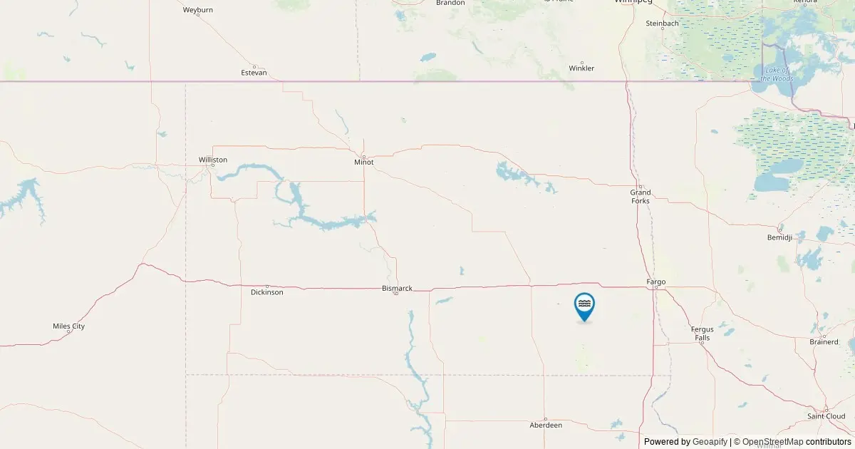
Comprehensive federal land records have illuminated the unique geographic standing of North Dakota’s hydrological features, confirming that the state is home to exactly one officially recognized named waterfall. According to data maintained by the United States Geological Survey through its Geographic Names Information System, this solitary feature places North Dakota 53rd nationally in total cataloged waterfalls, representing a small but distinct element of the state’s natural landscape.
The data, extracted directly from the federal database to construct a state-level mapping overview, provides detailed location parameters, coordinates, and land management context for the feature. While North Dakota’s landscape is defined largely by rolling plains, river valleys, and agricultural expanse, the inclusion of its single named waterfall in federal mapping repositories offers researchers, cartographers, and outdoor enthusiasts an accurate look at how official geographic classifications apply across the state.
Navigating the Interactive North Dakota Waterfalls Map
Digital cartography tools leveraging federal geographic data now allow users to explore North Dakota’s solitary named waterfall through precise spatial plotting. By querying the United States Geological Survey’s underlying Geographic Names Information System, digital maps can pinpoint the exact coordinates of the feature within the state’s borders.
The mapping system integrates detailed data popups for the state’s cataloged fall. When users interact with the map marker, the system displays key navigational and administrative attributes. These details include the official feature name as cataloged in federal records, the specific county in which the fall is situated, precise latitude and longitude coordinates, and automated driving directions to the nearest accessible roadway.
Furthermore, each interactive marker includes a direct deep link to the corresponding federal record within the Geographic Names Information System repository. This connection enables users to view official historical entries, administrative identifiers, and related spatial data directly from the federal agency responsible for maintaining the nation’s official geographic nomenclature.
Waterfalls in North Dakota by the Numbers
From a statistical perspective, North Dakota occupies a unique position in national hydrological inventories. With a total count of one officially named waterfall, the state ranks 53rd among U.S. states and territories evaluated within the federal framework.
The official tally relies strictly on spatial datasets retrieved from The National Map’s ArcGIS REST service. A targeted query conducted in May 2026 filtered all geographic features within North Dakota categorized specifically under the feature class of "Falls." This precise categorization ensures that only features meeting official federal standards for named physical geography are included in the primary count.
While the federal registry maintains a count of one, spatial researchers and outdoor observers note that the physical reality of water movement across the state includes additional features not captured in official registries. During periods of significant precipitation or seasonal thaw, temporary and seasonal cascades form across various terrains. However, these ephemeral features lack official naming status within the federal system, leaving the official count at one.
The standard for cataloging these features dates back to 1890, when the federal government established a centralized authority to standardize place names across the United States. Under this system, the Geographic Names Information System acts as the definitive authority for feature classification, though it specifically omits physical measurement metrics such as waterfall height or volume. Information regarding specific physical dimensions is typically tracked by specialized independent repositories, such as the World Waterfall Database, rather than federal naming records.
Ransom County Claims Sole Position in State Breakdown
A geographical analysis of North Dakota’s county-level distribution reveals that waterfall features are concentrated entirely within a single administrative jurisdiction. Out of North Dakota’s 53 counties, Ransom County stands alone as the sole location hosting an officially named waterfall recognized by the federal government.
The administrative breakdown confirms that Ransom County holds a total of one named fall, while all remaining 52 counties in North Dakota record a tally of zero within the official federal database. This distribution highlights the localized nature of named hydrological drop-offs within the state’s broader topography.
The presence of the state’s lone cataloged waterfall in Ransom County emphasizes the county’s distinct geographical position within North Dakota. Local terrain variations, river drainage paths, and geological formations in Ransom County have created the specific physical conditions necessary for a named falling water feature to be formally recognized and recorded by geographic survey teams over the past century.
Distinctive Features and Official Federal Designations
The process of cataloging named waterfalls involves rigorous historical and spatial criteria established by federal cartographers. For a waterfall to appear in the Geographic Names Information System, it must possess an established, documented name recognized through historical usage, local community adoption, or official state and federal documentation.
North Dakota’s single named waterfall represents a distinct geographic anomaly within the state. While unnamed cascades and temporary drops occur along various streams and drainage channels following heavy storms, they do not hold established names in historical records or official maps. Consequently, federal survey records distinguish clearly between ephemeral physical phenomena and formally named natural features.
The federal classification system prioritizes historical continuity and official nomenclature over temporary physical characteristics. As a result, the cataloged fall in Ransom County remains the sole feature in North Dakota to satisfy all criteria necessary for inclusion in the official national database of named geographic features.
Environmental Dynamics, Accessibility, and Visiting Guidelines
Visiting natural features in North Dakota requires an understanding of both seasonal hydrological cycles and regional land ownership structures. The physical appearance and water flow of named and unnamed falls throughout the state vary significantly depending on the time of year and localized weather conditions.
Seasonal Flow Patterns
Hydrological activity in North Dakota follows clear seasonal trends. Peak water flow typically occurs during the spring months, driven by melting winter snowpacks and spring rainfall. During this period, water bodies across the state reach their maximum volume, providing the most robust water flow for regional streams and cascades.
As spring transitions into late summer and early autumn, overall water flow generally diminishes. While late-summer conditions yield lower water volumes, the clearer water quality and surrounding autumn foliage create distinct viewing conditions for visitors exploring the region.
In the winter months, severe low temperatures alter the landscape entirely. Water movement slows or freezes, transforming flowing water features into frozen ice formations. In higher-elevation or shadowed terrain, these seasonal freezes create dramatic ice structures that persist until the spring thaw.
Land Access and Visitor Protocols
Navigating to waterfall locations requires adherence to property boundaries and public access regulations. A significant portion of cataloged natural features across the United States reside on publicly managed lands, including state park systems, National Forest lands, Bureau of Land Management tracts, and municipal or county park properties.
However, natural features may also sit entirely on private property or within sovereign tribal lands, both of which operate under specific access rules and entry restrictions. Visitors exploring natural sites are advised to determine land ownership status prior to travel and to strictly respect private property boundaries to prevent trespassing.
Public access to North Dakota’s mapped waterfall feature typically involves driving to a designated roadway point indicated by spatial coordinates, followed by a short or moderate hike along established trails or terrain pathways. Local land management agencies serve as the primary authority for updated information regarding trail conditions, park hours, and specific land-use rules.