
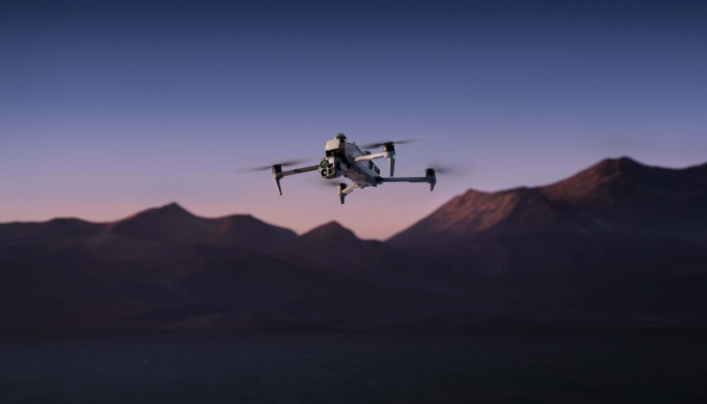
Global drone leader DJI has officially announced the launch of the Matrice 5T, a sophisticated and compact enterprise aircraft engineered specifically for demanding public safety missions, large-scale infrastructure inspections, and precise surveying applications. Unveiled to the commercial drone community, the newly developed flagship system merges several next-generation capabilities into a single ruggedized platform, featuring high-resolution thermal imaging, comprehensive onboard artificial intelligence, multi-sensor obstacle detection, and an impressive maximum flight duration of up to 59 minutes.
The launch represents a significant technological leap for DJI’s enterprise division, providing professional operators with advanced tools designed to perform efficiently in high-stakes environments. Built to endure harsh weather conditions, the Matrice 5T carries an IP55 rating, certifying its resistance to dust and water ingress. Furthermore, the aircraft is engineered to function reliably across a wide operating temperature range, spanning from minus 20 degrees Celsius to 50 degrees Celsius. This environmental resilience ensures that first responders, utility workers, and mapping professionals can deploy the drone during extreme weather events, severe cold snaps, or intense summer heat. To showcase the capabilities of the new hardware, DJI has scheduled a dedicated global webinar to introduce the platform to enterprise stakeholders and authorized dealers.
Higher-Resolution Thermal Imaging and Advanced Night Vision
One of the most notable engineering advancements of the Matrice 5T lies in its upgraded thermal imaging payload. The enterprise drone is equipped with a native thermal camera boasting a resolution of 1280 by 1024 pixels, delivering four times the pixel count of standard 640 by 512 thermal sensors commonly found on previous-generation inspection drones. For operators requiring even greater thermal fidelity, an ultra-high-resolution mode pushes the thermal image output to an impressive 2560 by 2048 pixels, allowing for the precise detection of minute temperature variances and thermal anomalies during critical missions.
In addition to its powerful thermal capabilities, the Matrice 5T integrates a suite of visible-light cameras tailored explicitly for low-light operations and intricate visual inspections. Among these is a wide-angle camera featuring a large 1/0.98-inch sensor and a bright f/1.8 aperture. This optical design allows the sensor to gather substantial light in near-dark conditions, while DJI’s proprietary AI enhancement algorithms enable full-color imaging in environments as dark as 0.01 lux.
For close-up inspection tasks that require maintaining a safe standoff distance, the aircraft incorporates a 50-megapixel medium telephoto camera equipped with 3x optical zoom. Complementing this is a secondary telephoto camera that delivers 11x optical zoom, an astonishing 176x hybrid zoom capability, and specialized monochrome night vision. Together, these complementary optical systems provide comprehensive visual data collection tools essential for complex search and rescue operations, rapid firefighting assessment, and detailed structural analysis of critical utility infrastructure.
Integrated Obstacle Detection and Improved Communications
Navigating complex and hazardous environments requires robust situational awareness. To address this, the Matrice 5T combines LiDAR technology, millimeter-wave radar, and omnidirectional vision sensors into a cohesive, multi-layered obstacle detection system. According to DJI, the integrated LiDAR payload is capable of identifying extremely thin obstacles—such as suspended power lines—at night and from distances of up to 32 meters. Meanwhile, the millimeter-wave radar provides reliable obstacle detection capabilities in degraded visual environments frequently plagued by thick fog, heavy rain, or swirling dust.

The aircraft’s navigation system also intelligently fuses visual data and radar telemetry to maintain stable, controlled flight in environments where satellite navigation signals are severely compromised, obstructed, or entirely unavailable, such as deep urban canyons, dense industrial complexes, or remote mountainous terrain.
To ensure uninterrupted command and control over extended distances, the Matrice 5T utilizes DJI’s O4 Enterprise Enhanced Video Transmission System. Under optimal and specified conditions, the transmission system supports a maximum operational range of up to 40 kilometers. To counter signal degradation caused by severe terrain, large structures, or long-range deployments, the aircraft supports cellular connectivity and multiple relay modes, ensuring that operators maintain a stable data link and live video feed throughout the duration of the mission.
Onboard AI and Automated Inspection Workflows
The integration of advanced edge computing empowers the Matrice 5T with sophisticated onboard artificial intelligence capable of recognizing more than 20 distinct target types using simultaneous thermal and visible-light imagery, including moving vehicles and watercraft. Through the DJI FlightHub 2 platform, mission commanders can leverage intuitive text or image prompts to quickly locate specific targets of interest. Operators can also program fully automated patrol routes that incorporate complex flight behaviors, such as precise hovering, targeted image capture, or the broadcasting of pre-recorded audio messages.
Expanding its utility for software developers and enterprise fleets, the Matrice 5T supports third-party AI models via its robust onboard computing architecture. Developers are also able to design and implement custom plugins tailored to the DJI Pilot 2 application. For utility companies managing extensive electrical grids, the drone’s LiDAR sensor can autonomously identify and track high-voltage power lines, allowing the aircraft to fly safely alongside conductors while simultaneously scanning for mechanical damage, overheating components, or encroaching vegetation.
Furthermore, DJI has engineered the platform to support advanced maritime operations, including taking off smoothly from moving vessels and executing precise landings on designated and marked ship decks.
Surveying and Rapid 3D Modeling
When paired with DJI Terra software, the Matrice 5T transforms into a powerful aerial mapping and surveying tool capable of achieving centimeter-level surveying accuracy without the necessity of ground control points under specified operational conditions. Field crews can generate accurate thermal maps, measure localized temperatures in real time, and swiftly pinpoint electrical anomalies or thermal leaks during comprehensive solar farm and electrical grid inspections.
The system’s processing efficiency has also been significantly upgraded. DJI reports that the enterprise remote controller can process up to 200 high-resolution images in just eight minutes to generate detailed point clouds or 2.5D models directly in the field. Additionally, the system is capable of constructing preliminary 3D models during ongoing operations, allowing flight crews to use these immediate spatial models to plan and execute subsequent automated inspection routes without returning to the office.
U.S. Availability Remains Uncertain Amid Regulatory Scrutiny
Despite the advanced capabilities and extensive feature set introduced with the Matrice 5T, the commercial availability of the drone within the United States remains highly uncertain. DJI has officially launched the aircraft for global distribution through its network of authorized enterprise dealers, but a definitive timeline or confirmation for a U.S. release has not been provided.
This regulatory ambiguity follows a major decision by the Federal Communications Commission in December 2025, which added foreign-produced drones and associated critical components to its restrictive Covered List. These ongoing regulatory restrictions generally prevent affected foreign technology products from securing the new FCC equipment authorizations that are legally required for commercial marketing, importation, and sale within the United States, barring the rare approval of specific exemptions.
As of the product launch, the Matrice 5T does not appear on the published FCC exemption list, and its formal equipment authorization status remains unconfirmed by federal regulators. While the new aircraft successfully expands DJI’s technological leadership in thermal imaging, autonomous flight capabilities, and multi-sensor obstacle detection, domestic operators and public safety agencies in the United States may ultimately face continued barriers to accessing and deploying the new platform.