
Skip to content
Breaking News
  • Visualizing Spatial Intelligence: The Growing Role and Impact of Thematic Mapping in Modern Data Science
  • GeoHound Chrome Extension Automates Web Map Layer Detection and In-Browser GIS Processing
  • Navigating Strategy, AI, and High Agency: Inside Aakansha Bhalotia’s 13-Year Tech Journey
Saturday, October 24, 2026
Edition: U.S. International Login

Hack The Map

Category: Data Visualization and Infographics

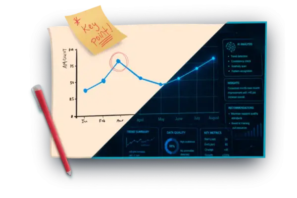
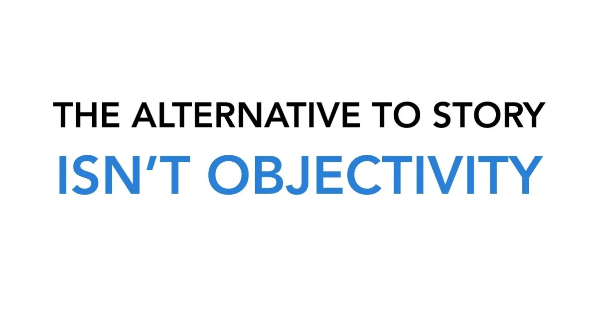
Why "Just Showing the Data" is a Myth: The Case for Perspective and Storytelling in Research

The ongoing debate surrounding data communication reached a fresh flashpoint yesterday when a participant in a professional data presentation workshop raised a fundamental question about the boundaries of objectivity. Working closely with academic researchers and rigorous statisticians, the workshop attendee…
Siti Muinah • October 4, 2026

Storytelling with Data Expands Its Team, Welcoming Alli Torban and Ryan Biesecker After Competitive Hiring Process

October 3, 2026
The art and science of communicating effectively with data continue to gain prominence across industries, and organizations dedicated to this…

Mastering Python Efficiency: Ten Essential One-Liners for Cleaner and Faster Code

October 3, 2026
In the fast-paced world of software development and data science, reducing verbosity without sacrificing readability is a constant pursuit. Programmers…

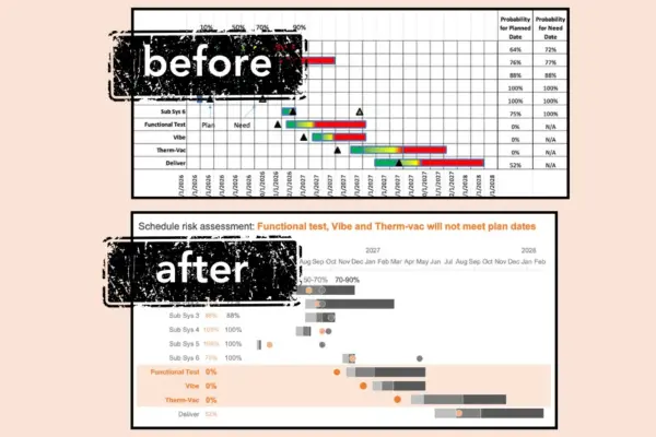
Transforming Project Management Data: How to Clear the Clutter from Complex Gantt Charts

October 3, 2026
Gantt charts have long remained a staple of project management, serving as the go-to visual tool for illustrating the start…

Transforming Messy Documents Into Structured Data: A Look at Docling’s Rise in AI and Data Processing

October 3, 2026
Somewhere on a shared drive right now, a professional is staring down a hundred-page PDF report, searching desperately for three…

Why Critical Thinking and "Productive Friction" Matter More Than Ever in the Age of AI

October 3, 2026
In an era where artificial intelligence can generate a polished chart, draft a legal brief, or assemble a presentation deck…

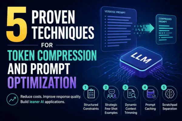
Mastering Large Language Model Efficiency: Five Proven Techniques for Token Compression and Prompt Optimization

October 3, 2026
In the rapidly evolving landscape of artificial intelligence development, efficiency has become a critical focal point for engineers and enterprise…

Storytelling with Data Launches New Monthly Challenge Exploring the Intersection of Human Insight and Artificial Intelligence

October 2, 2026
Artificial intelligence has rapidly permeated nearly every professional sector, and the realm of data communication is no exception. It is…

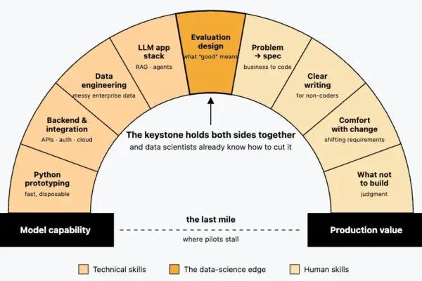
The Rise of the Forward Deployed Engineer: How AI’s "Last-Mile" Bottleneck Sparked a Hiring Boom

October 2, 2026
In January 2025, job listings on Indeed for a "forward deployed engineer" barely registered. By April 2026, however, postings for…

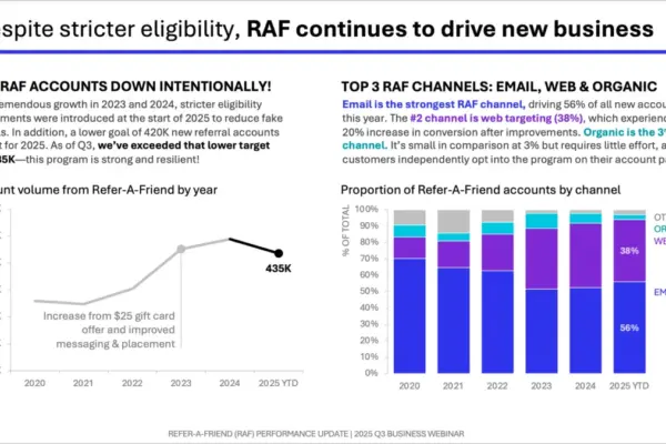
How to Structure a Data Slide: Layouts That Work for Any Scenario

October 2, 2026
The layout of a presentation slide, encompassing the precise placement of a graph, the proportional allocation of space for supporting…

Posts navigation

Older posts
Newer posts

Recent Posts

  • Visualizing Spatial Intelligence: The Growing Role and Impact of Thematic Mapping in Modern Data Science
  • GeoHound Chrome Extension Automates Web Map Layer Detection and In-Browser GIS Processing
  • Navigating Strategy, AI, and High Agency: Inside Aakansha Bhalotia’s 13-Year Tech Journey
  • FAA Releases Draft Design Standards for Vertiports and Vertical Flight Facilities
  • Japan’s Ancient Kikai Caldera is Quietly Refilling with Fresh Magma, Raising New Clues for Supervolcano Research

Recent Comments

No comments to show.

Archives

  • October 2026
  • September 2026
  • August 2026

Categories

  • Data Visualization and Infographics
  • Disaster Response and Humanitarian Mapping
  • Drone Mapping and Aerial Photography
  • Environmental and Climate Mapping
  • Geography and Earth Science
  • Geolocation and Cybersecurity
  • Geopolitics and Map News
  • GIS and Spatial Technology
  • Location Intelligence and Spatial Analytics
  • Open Data and Civic Tech
  • Open Source Geospatial Software
  • OpenStreetMap and Community Mapping
  • Remote Sensing and Satellite Imagery
  • Transportation and Mobility Tech
  • Travel Hacking and Digital Nomad
  • Urban Planning and Smart Cities
  • Web Mapping and Cartography

© 2026 Hack The Map. All rights reserved.

Theme: The Original by Rifan Muazin.