Most metropolitan areas maintain rigorous, highly detailed operational plans for managing severe weather events as they unfold. Cities routinely prepare for the immediate onslaught of hurricanes, torrential downpours, blizzards, and ice storms, deploying emergency personnel, prepositioning salt trucks, and issuing timely public safety warnings. Far fewer municipalities, however, possess a similarly comprehensive playbook for the critical days that follow—the arduous aftermath when the floodwaters finally recede, the accumulated ice melts away, and the massive, grinding work of community-wide cleanup officially begins.
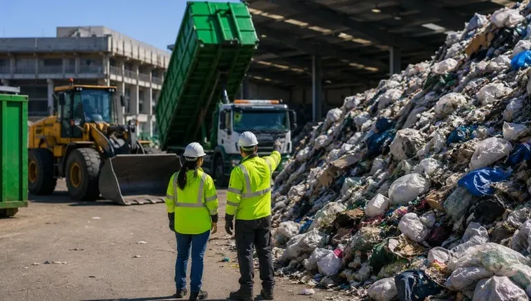
It is during this post-disaster window that municipal waste collection fundamentally shifts from a routine, behind-the-scenes public service into a high-stakes frontline emergency operation. In the wake of a major natural disaster, a municipality can suddenly face thousands of tons of ruined furniture, waterlogged drywall, hazardous debris, and ruined household goods, all while citizens flood city lines with urgent service requests that multiply by the hour. When examining why certain cities manage to clear towering piles of debris from their streets in a matter of weeks while others struggle for months, emergency management experts note that the disparity is rarely a matter of fleet size or the sheer volume of heavy machinery available. Instead, the determining factor is almost invariably whether a city’s geographic mapping, routing software, and data management systems were seamlessly integrated and connected long before the storm ever struck.
Two major American cities put this operational philosophy to the ultimate test over the past year, offering a clear window into the realities of modern disaster recovery. Milwaukee faced a catastrophic thousand-year flood that simultaneously crippled its primary waste transfer infrastructure, while Washington, D.C., was forced to dig out from beneath an immobilizing, multi-day ice storm so severe that sanitation crews required pickaxes merely to break apart the frozen debris. Their experiences underscore a growing consensus among public works professionals: disaster readiness is no longer just about emergency response vehicles; it is fundamentally about data infrastructure.
A Record Flood with Nowhere to Take the Waste
In August 2025, the city of Milwaukee experienced a weather event of historic proportions, receiving more than 14 inches of heavy rainfall in a span of under 24 hours. The deluge shattered previous Wisconsin meteorological records, overwhelming local drainage systems and catching neighborhoods off guard. For many residents, the impact was immediate and devastating, with floodwaters surging into basements and living spaces, leaving three to four feet of standing water inside residential homes and ruining personal property on a massive scale.
Compounding the crisis for city administrators, Milwaukee’s municipal waste infrastructure suffered critical failures almost simultaneously with the storm. Both of the city’s primary waste transfer stations went completely offline due to severe flood damage, catastrophic power outages, and failed internal compactors. This sudden loss of local processing capacity meant that sanitation crews could no longer drop off loads locally; instead, trucks were forced to haul debris directly to distant landfills. That logistical bottleneck added an exhausting hour to an hour and a half to every single trip, severely restricting the daily capacity of the collection fleet.
Faced with an unprecedented operational emergency, city leaders mobilized quickly, deploying a massive workforce of more than 50 heavy machines belonging to the municipal fleet, supplemented by an additional 45 heavy-duty contractors brought in from the private sector. Working around the clock through difficult and unsanitary conditions, this combined workforce ultimately cleared more than 11,000 tons of ruined household debris from the city’s waterlogged streets.
Turning 311 Calls into a Live Damage Map
While heavy machinery and contractor support were indispensable, municipal leaders quickly realized that the technology coordinating that equipment mattered just as much as the iron on the street. Milwaukee happened to be roughly one month into its rollout of Routeware SmartCity software, a platform designed to streamline municipal public works. Crucially, the city had already established Esri as its single source of truth for location data, successfully connecting its central 311 call center and legacy work order system directly to the new routing platform.
That foundational integration allowed the municipal team to execute one simple yet powerful operational change: instantly reclassifying bulky waste requests into a dedicated, highly visible flood debris category. The result of this digital shift was revolutionary for field operations. Instead of relying on traditional quarter-section paper maps that quickly became outdated, crews and supervisors utilized live, dynamic heat maps showing the hardest-hit neighborhoods at both a citywide level and a granular, street-by-street view.
This technological leap dramatically accelerated the recovery timeline. Milwaukee successfully completed the entire citywide cleanup operation in just two months—a stark contrast to the four to six months typically required to recover from a comparable flood in the city’s past. Furthermore, the precise, location-based data captured by the system along the way provided invaluable documentation that helped support a massive $195 million Federal Emergency Management Agency (FEMA) grant, delivering much-needed financial relief to affected households across three separate counties.
When the Backlog Comes Back All at Once
While Milwaukee battled historic water damage, Washington, D.C., faced a completely different kind of meteorological ordeal. A severe winter storm dropped seven inches of heavy snow on the nation’s capital, which was immediately followed by hours of relentless sleet and freezing rain. The combination bonded into a dense, rock-hard layer of ice that sanitation workers quickly dubbed "snowcrete." With temperatures remaining persistently below freezing for ten consecutive days, municipal authorities were forced to suspend standard bulk waste collection for two full weeks as crews pivoted entirely to treating impassable roadways.
When collection services were finally able to resume, the city confronted a daunting challenge: every single missed pickup from the previous two weeks came back at once, creating an overwhelming backlog of deferred service requests. Recognizing that standard operational protocols would leave neighborhoods waiting indefinitely, the office team abandoned the traditional first-in, first-out approach. Instead, they reorganized the backlog entirely by geography, strategically deploying eight heavy trucks instead of the usual six into the densest residential zones.
D.C. leadership then set ambitious new operational targets, tasking the logistics team with establishing eight new routes designed to clear 5,000 missed trash and recycling requests. To meet the tight turnaround, sanitation crews were trained and dispatched on the road by 6:00 a.m. the very next day, receiving quick-reference training guides pushed directly to their mobile phones. As residents continued to flag additional, unreported accumulations of trash, the city adapted dynamically, shifting its strategy to clearing entire alleys block by block and uploading custom collection routes in bulk to ensure no streets were accidentally bypassed.
Proof the Work Got Done
In Washington, D.C., as municipal operations ramped up under intense public scrutiny, the single most valuable tool for the sanitation department turned out to be something remarkably simple: the camera. Through a seamless integration with the city’s Open 311 system, field crews were required to photograph each completed collection stop immediately after finishing the work. Those images were then automatically logged into a centralized database where residents could view them directly, offering transparent proof of service.
As political pressure mounted from frustrated citizens and local leaders demanding answers about lingering delays, those time-stamped photographs served an essential dual purpose. They definitively answered constituent questions regarding collection timelines and effectively shut down a wave of fraudulent property damage claims filed against the city. The overarching operational takeaway for local government leaders was clear: in the modern era of public administration, simply doing the hard work of disaster recovery is no longer enough. Agencies must also possess the digital capability to prove transparently that the work was actually completed.
Built Before the Next Storm
Neither Milwaukee nor Washington, D.C., invented its core emergency response framework in the middle of a raging crisis. Both municipal governments had proactively connected their daily collection systems, geographic mapping databases, and 311 citizen request portals long before severe weather struck their communities. By doing so, they avoided the trap of trying to build brand-new, untested workflows under intense pressure, choosing instead to scale their everyday operational tools into an effective emergency response. Both cities detailed their full operational responses, including the implementation of live digital dashboards, during an on-demand industry webinar.
As meteorologists and municipal planners frequently note, the occurrence of the next severe weather event is no longer a matter of if, but precisely when. Cities that integrate their daily collection technology directly into broader emergency preparedness planning will consistently be the ones that achieve the fastest, most efficient recovery. Routeware provides specialized route optimization and operations software designed for municipal public works, solid waste and recycling programs, and snow and sweeper fleets.