Skip to content
Breaking News
  • Precisely Launches AI Studio to Bridge the Gap Between Enterprise Data and Practical Artificial Intelligence
  • FCC Seeks Public Input on Simplifying Satellite Communications Rules for Drones
  • Arctic Winter Sea Ice Could Shrink by an Additional One Million Square Kilometers, New Study Reveals
Tuesday, October 27, 2026
Edition: U.S. International Login

Hack The Map

Author: Basiran

Geopolitics and Map News

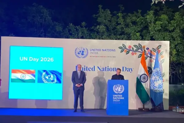
India Calls for Bold UN Reforms and Global South Representation at 81st Anniversary Reception

October 26, 2026 Basiran
NEW DELHI — India has forcefully reiterated its long-standing demand for a more representative, responsive, and effective United Nations, emphasizing…

Location Intelligence and Spatial Analytics

Bridging the Gap: Why Trusted Data is the Missing Link in Enterprise AI Success

October 26, 2026 Basiran
The corporate rush toward artificial intelligence has fundamentally transformed how organizations view their information architectures. According to recent data highlighted…
Environmental and Climate Mapping

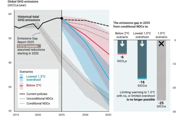
UN Emissions Gap Report: Temporary Breach of 1.5C Limit Now Inevitable Due to Decades of Inaction

October 26, 2026 Basiran
A temporary breach of the critical 1.5C global-warming limit is now completely inevitable following decades of insufficient climate action, according…
Open Source Geospatial Software

GeoServer Releases Version 2.28.5 with Critical Security Updates and Maintenance Fixes

October 26, 2026 Basiran
The GeoServer development community has officially announced the immediate availability of GeoServer 2.28.5, the latest maintenance release designed to bring…
Location Intelligence and Spatial Analytics

Precisely Unveils Unified Platform and AI Studio to Solve Enterprise Data Readiness Challenges

October 25, 2026 Basiran
Global data integrity leader Precisely has officially launched a comprehensive suite of solutions aimed at tackling what industry experts identify…
Transportation and Mobility Tech

Comprehensive Guide to Choosing the Best Walkers and Rollators for Seniors in 2024

October 25, 2026 Basiran
For senior citizens and elderly individuals dealing with mobility or balance challenges due to aging and its associated medical complications,…
Web Mapping and Cartography

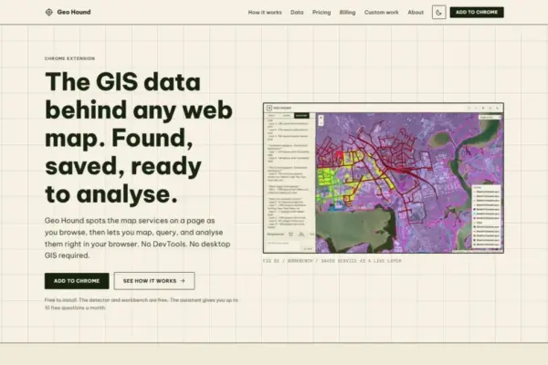
GeoHound Chrome Extension Introduced to Simplify Web Map Data Detection and In-Browser Spatial Workflows

October 24, 2026 Basiran
A new browser extension named GeoHound has been introduced to help geospatial professionals, researchers, and spatial data enthusiasts effortlessly identify,…
Drone Mapping and Aerial Photography

FAA Releases Draft Design Standards for Vertiports and Vertical Flight Facilities as Advanced Air Mobility Nears Commercial Operations

October 24, 2026 Basiran
The Federal Aviation Administration (FAA) has officially released updated draft design standards for the physical infrastructure that will support vertical…
Web Mapping and Cartography

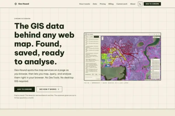
GeoHound Chrome Extension Automates Web Map Layer Detection and In-Browser GIS Processing

October 23, 2026 Basiran
A new browser tool designed to streamline spatial data discovery and lightweight geographic analysis has been released, providing geospatial professionals,…
Location Intelligence and Spatial Analytics

From ERP Systems to AI Strategy: Inside Aakansha Bhalotia’s 13-Year Journey Shaping the Future of Tech

October 22, 2026 Basiran
A career in technology can take many paths when it is shaped by curiosity, bold decisions, and a willingness to…

Posts navigation

Older posts

Recent Posts

  • Precisely Launches AI Studio to Bridge the Gap Between Enterprise Data and Practical Artificial Intelligence
  • FCC Seeks Public Input on Simplifying Satellite Communications Rules for Drones
  • Arctic Winter Sea Ice Could Shrink by an Additional One Million Square Kilometers, New Study Reveals
  • GeoServer 3.0.0 Released with Modernized Enterprise Architecture, New User Experience, and Enhanced Security
  • Enhancing Mobility: How Everyday Wheelchair Accessories Are Transforming Independence and Comfort

Recent Comments

No comments to show.

Archives

  • October 2026
  • September 2026
  • August 2026

Categories

  • Data Visualization and Infographics
  • Disaster Response and Humanitarian Mapping
  • Drone Mapping and Aerial Photography
  • Environmental and Climate Mapping
  • Geography and Earth Science
  • Geolocation and Cybersecurity
  • Geopolitics and Map News
  • GIS and Spatial Technology
  • Location Intelligence and Spatial Analytics
  • Open Data and Civic Tech
  • Open Source Geospatial Software
  • OpenStreetMap and Community Mapping
  • Remote Sensing and Satellite Imagery
  • Transportation and Mobility Tech
  • Travel Hacking and Digital Nomad
  • Urban Planning and Smart Cities
  • Web Mapping and Cartography

© 2026 Hack The Map. All rights reserved.

Theme: The Original by Rifan Muazin.