Skip to content
Breaking News
  • Understanding Thematic Mapping: How Spatial Data Visualization Reshapes Modern Geographic Analysis and Decision-Making
  • GeoHound Chrome Extension Launches with Automated Web Map Service Detection and Built-In Spatial Workbench
  • From ERP Systems to AI Strategy: Inside Aakansha Bhalotia’s 13-Year Journey Shaping the Future of Tech
Thursday, October 22, 2026
Edition: U.S. International Login

Hack The Map

Author: Nana Muazin

Web Mapping and Cartography

The Silent Data Hazard in Geospatial Workflows: Navigating Mismatched Direction Conventions

September 27, 2026 Nana Muazin
In spatial data engineering, few issues cause quieter yet more damaging data bugs than conflicting direction conventions. A field surveyor’s…

Drone Mapping and Aerial Photography

SkyeBrowse Expands Mapping Platform with Advanced Crash Analysis and Drone-Based Crowd Counting Tools

September 26, 2026 Nana Muazin
SkyeBrowse has significantly expanded its aerial mapping platform by introducing a suite of specialized tools designed to streamline vehicle crash…
Web Mapping and Cartography

Interactive Mapping Platform Synthesizes New Zealand Spatial Data to Clarify Legal Hunting Lands and Species Distributions

September 25, 2026 Nana Muazin
Navigating the vast and rugged backcountry of New Zealand presents a dual challenge for outdoor enthusiasts and hunters: determining precise…
Urban Planning and Smart Cities

America’s Aging Crisis: Older Adults Driving Record Upticks in Homelessness Amid a Looming Social Safety Net Crunch

September 24, 2026 Nana Muazin
As cities and counties across the United States continue to grapple with persistent upticks in homelessness, local leaders and housing…
Drone Mapping and Aerial Photography

Army Drone Magnet Deal Raises a Bigger Question: When Can the Supply Chain Be Fully Domestic?

September 24, 2026 Nana Muazin
The United States military’s ongoing push to secure a fully domestic defense manufacturing ecosystem has reached a critical milestone, though…
Data Visualization and Infographics

Empowering the Next Generation: Daphne Draws Data Reaches 15,000 Students Worldwide in Under Two Years

September 24, 2026 Nana Muazin
In a rapidly changing world driven by information, the ability to make sense of numbers is no longer a skill…
Web Mapping and Cartography

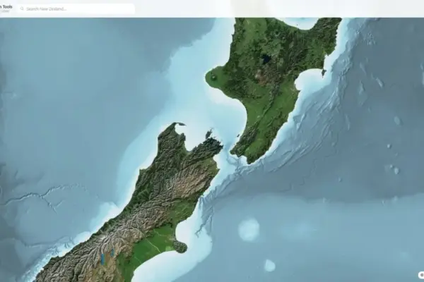
New NZ Elevation Tools Web Viewer Offers Instant Browser-Based Access to Detailed LINZ LiDAR Terrain Data

September 23, 2026 Nana Muazin
A new web-based spatial application named NZ Elevation Tools has been launched, offering streamlined interactive access to New Zealand’s national…
Drone Mapping and Aerial Photography

EagleNXT Fulfills Major U.S. Army Contract with Delivery of Domestic-Built Drones to Fort Irwin

September 23, 2026 Nana Muazin
The company’s advanced facility in Allen, Texas, successfully delivers nine eBee VISION drone kits to the National Training Center while…
Data Visualization and Infographics

Reframing Feedback: How a Data Storytelling Team is Changing the Narrative Around Workplace Critique

September 23, 2026 Nana Muazin
For many professionals, hearing the phrase, “This is a great start, but…” can instantly trigger a sense of dread. Whether…
Geopolitics and Map News

Beyond the Battery: Why Electric Mobility Needs a Complete Ecosystem Shift, Says Trev Mobility CEO

September 22, 2026 Nana Muazin
For years, the conversation surrounding the adoption of electric vehicles (EVs) was dominated by a single, persistent metric: range anxiety.…

Posts navigation

Older posts
Newer posts

Recent Posts

  • Understanding Thematic Mapping: How Spatial Data Visualization Reshapes Modern Geographic Analysis and Decision-Making
  • GeoHound Chrome Extension Launches with Automated Web Map Service Detection and Built-In Spatial Workbench
  • From ERP Systems to AI Strategy: Inside Aakansha Bhalotia’s 13-Year Journey Shaping the Future of Tech
  • Elistair Unveils Tethered Air Module for Parrot ANAFI UKR to Enable Hours of Uninterrupted ISR Missions
  • A Mysterious 180-Year-Old Train Delay Reveals a Major Chronological Error in Space Weather History

Recent Comments

No comments to show.

Archives

  • October 2026
  • September 2026
  • August 2026

Categories

  • Data Visualization and Infographics
  • Disaster Response and Humanitarian Mapping
  • Drone Mapping and Aerial Photography
  • Environmental and Climate Mapping
  • Geography and Earth Science
  • Geolocation and Cybersecurity
  • Geopolitics and Map News
  • GIS and Spatial Technology
  • Location Intelligence and Spatial Analytics
  • Open Data and Civic Tech
  • Open Source Geospatial Software
  • OpenStreetMap and Community Mapping
  • Remote Sensing and Satellite Imagery
  • Transportation and Mobility Tech
  • Travel Hacking and Digital Nomad
  • Urban Planning and Smart Cities
  • Web Mapping and Cartography

© 2026 Hack The Map. All rights reserved.

Theme: The Original by Rifan Muazin.