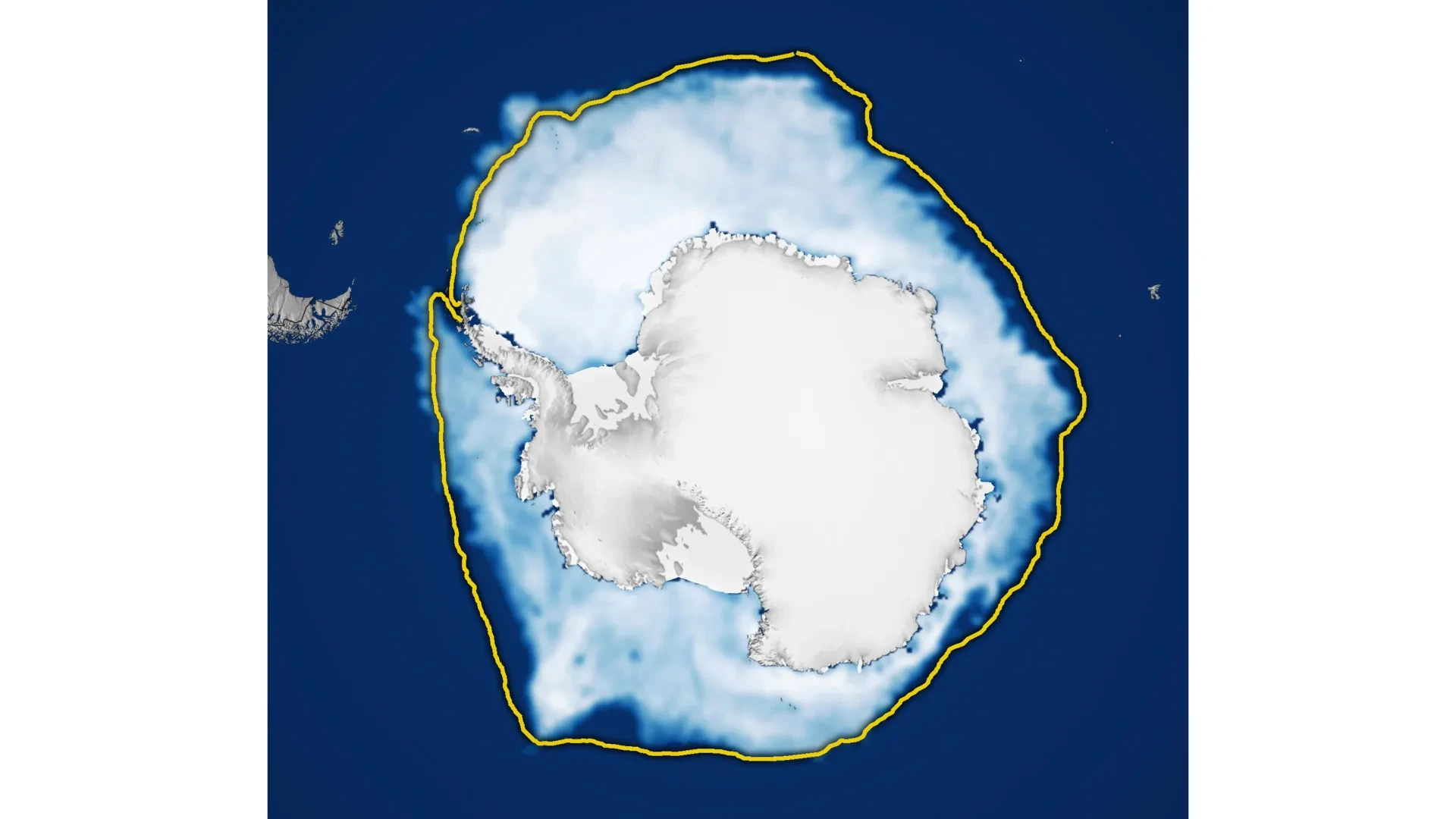
Antarctic sea ice reached its annual winter peak in September 2026, but the resulting frozen expanse covered far less ocean than in nearly any other year since satellite measurements began nearly five decades ago. According to data from NASA and the National Snow and Ice Data Center, the maximum extent of the sea ice was the third lowest on record, adding to a growing body of scientific evidence pointing toward a dramatic and persistent shift in the frozen waters surrounding the southernmost continent.
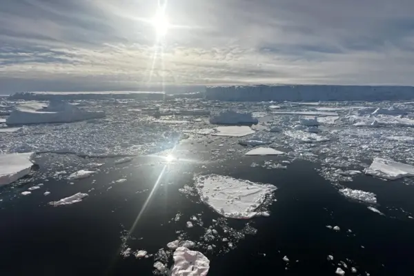
Unlike the Arctic, which consists of an ocean basin entirely enclosed by surrounding landmasses, Antarctica is completely surrounded by a vast, open ocean. This unique geography gives the region’s sea ice plenty of room to spread outward during the dark, freezing months of the Southern Hemisphere’s winter. However, this same geographic reality pushes the expanding sea ice far northward into warmer latitudes, where it becomes increasingly vulnerable to melting as the summer sun returns. As a result of this cycle, Antarctic sea ice generally reaches its largest annual extent every September before steadily shrinking to its annual minimum in February.
According to the official tracking provided by NASA and the National Snow and Ice Data Center (NSIDC), Antarctic sea ice likely reached its annual maximum extent on September 14. At its seasonal peak, the frozen cover stretched across approximately 17.59 million square kilometers, which translates to roughly 6.79 million square miles. That peak measurement cemented 2026 as the year featuring the third-lowest winter maximum ever documented in the comprehensive satellite record.
Antarctic Sea Ice Shifts From Record Growth to Historic Lows
For decades, the behavior of Antarctic sea ice seemed to defy global warming expectations, appearing to move in the exact opposite direction from the rapidly shrinking ice pack observed in the Arctic. Between 1979 and 2014, the overall sea ice extent surrounding Antarctica actually increased by approximately 1 percent per decade. Yet, because Antarctic ice coverage naturally fluctuates quite considerably from one year to the next due to complex atmospheric and oceanic forces, polar researchers remained cautious, uncertain whether this gradual upward trajectory reflected a meaningful long-term change in the global climate system or merely a temporary climatic oscillation.
This apparent expansion became especially noticeable and heavily documented between 2012 and 2014. During those years, Antarctic winter sea ice set new record highs for three consecutive years running. These surprising milestones stood in stark contrast to conditions unfolding at the opposite pole, where Arctic sea ice was undergoing a steep and unrelenting decline that captured international scientific concern.
However, Antarctica’s upward trend came to an abrupt halt in 2015. Beginning in 2016, the region experienced substantial, unprecedented losses in sea ice coverage, marking a striking and abrupt reversal from the preceding decades of modest growth. Although a few intervening years have brought modest, temporary recoveries, Antarctic sea ice has generally remained stubbornly below its historical long-term average.
The most extreme conditions observed thus far occurred in 2023, a benchmark year when Antarctica recorded both its lowest summer minimum and its lowest winter maximum since satellite observations began in the late 1970s. The unusually low maximum recorded in 2026 adds yet another significant and concerning measurement to this evolving and turbulent picture. Climate scientists and polar researchers are continuing to track the ice pack closely each year to determine whether these persistent declines represent a lasting, structural transformation in Antarctic sea ice conditions or if they ultimately fall within an expanded range of natural statistical variability.
How Satellites Track Antarctic Sea Ice Through Clouds
Accurately measuring the vast expanses of Antarctic sea ice is a monumental logistical challenge that relies entirely on advanced spaceborne technology. Scientists routinely monitor and measure Antarctic sea ice using specialized satellites equipped with instruments known as passive microwave sensors. Rather than relying on standard visible light—which is entirely useless during the prolonged darkness of the Antarctic winter or when heavy cloud cover obscures the region—these sophisticated instruments are designed to detect microwave energy that is naturally emitted by Earth’s surface.
Frozen sea ice produces a distinctively stronger microwave signal than open ocean water, allowing researchers to easily distinguish frozen areas from ice-free seas regardless of the ambient lighting conditions. An immensely important advantage of this microwave remote sensing approach is that the energy wavelengths can easily pass through dense clouds and severe weather systems. This unique capability means that scientists can repeatedly and reliably observe Antarctic sea ice even when thick, persistent cloud cover prevents conventional satellite cameras from seeing the surface of the planet below.
The long-running satellite data record that makes these historical comparisons possible began in late 1978 with continuous observations gathered by NASA’s Nimbus-7 spacecraft. Starting in 1987, a series of satellites operated under the United States Defense Meteorological Satellite Program contributed crucial additional measurements to the continuous timeline. Furthermore, NASA’s Aqua satellite provided vital overlapping data between 2002 and 2011, ensuring the continuity and calibration of the measurements.
This critical monitoring effort continues to evolve as satellite technology advances and older instruments are eventually retired. In 2025, researchers took another step forward by officially beginning to incorporate high-quality observations from the Japan Aerospace Exploration Agency’s GCOM-W satellite. Integrating this new data source helps maintain the unbroken, decades-long observational record that is indispensable for understanding Antarctica’s rapidly changing ice environment and its broader implications for the global climate system.