Skip to content
Breaking News
  • UNEP Emissions Gap Report: Temporary 1.5C Breach ‘Inevitable’ After Decades of Insufficient Action
  • Surging Wholesale Gas Costs Drive Vast Majority of UK Household Energy Bills, New Analysis Reveals
  • New Web Tool GeoHound Automates Spatial Data Discovery and Browser-Based GIS Analysis
Thursday, October 22, 2026
Edition: U.S. International Login

Hack The Map

Month: October 2026

Geolocation and Cybersecurity

UK Sanctions Chameleonic Crypto Platform Cryptomus Over Cybercrime and Russian Sanctions Evasion

October 14, 2026 Nana Muazin
The United Kingdom has officially issued sweeping economic sanctions against Cryptomus, a volatile and shifting cryptocurrency platform that cybersecurity experts…

Open Source Geospatial Software

GeoServer Issues Urgent Security Update After August Zero-Day Disclosure and Outlines New AI Vulnerability Policies

October 14, 2026 Evan Lee Salim
The GeoServer project has issued a comprehensive security recap detailing a tumultuous summer of vulnerability disclosures, zero-day exploits, supply chain…
Transportation and Mobility Tech

Comprehensive Industry Review Highlights Top-Rated Wheelchairs for Enhanced Mobility and Independence

October 14, 2026 Siti Muinah
Wheelchairs remain one of the most widely utilized forms of medical equipment globally, serving as an indispensable resource for individuals…
Data Visualization and Infographics

Overcoming Data Clutter: How a Team Workshop Transformed Complex Workforce Metrics Into Actionable Leadership Insights

October 14, 2026 Neng Nana
When organizations face unexpected staffing shortfalls, bringing the issue to executive leadership is a critical first step. Yet, a raw…
Location Intelligence and Spatial Analytics

The AI Readiness Gap: Why Trusted Data Remains the Bottleneck for Enterprise Production

October 14, 2026 Siti Muinah
In the contemporary corporate landscape, artificial intelligence has firmly transitioned from an experimental novelty to a top-tier operational priority. Recent…
Drone Mapping and Aerial Photography

Proposed “Ban Flock Act” Targets License Plate Readers, Including Drone-Based Systems

October 14, 2026 Pevita Pearce
A newly proposed piece of federal legislation introduced in the United States House of Representatives aims to place strict limitations…
Geography and Earth Science

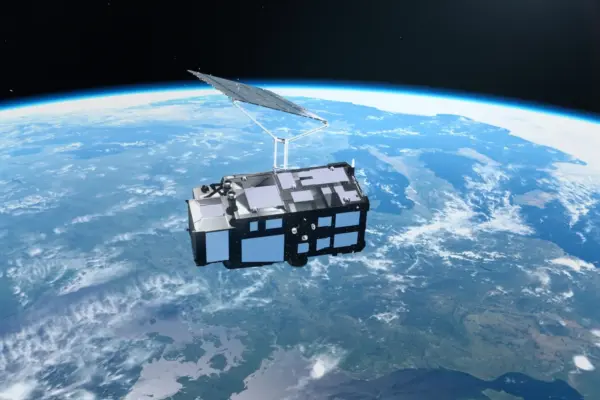
Europe’s New Sentinel-3C Satellite Delivers Stunning First Earth Images and Critical Climate Data

October 14, 2026 Sagoh
Just two weeks after successfully reaching orbit, Europe’s newest Earth-observing spacecraft, the Copernicus Sentinel-3C satellite, has delivered its first breathtaking…
Urban Planning and Smart Cities

Transit Leaders Share Strategies to Overcome Fiscal Cliffs and Expand Regional Networks at National Conference

October 14, 2026 Nana Muazin
As public transportation agencies across the United States continue to navigate the profound structural shifts brought on by the post-pandemic…
Geopolitics and Map News

The Limits of Airpower: Why the U.S. Campaign Against Iran Exposes the Flaws of Punitive Bombing

October 14, 2026 Layla Zulfa
For months, Iran’s surprising resilience in its ongoing conflict with two of the world’s most formidable militaries has left politicians…
Geopolitics and Map News

Symbiosis International Annual Dinner: Dr Ramakrishnan Raman Emphasizes AI, Adaptability, and Global Diplomacy in Higher Education

October 14, 2026 Suro Senen
NEW DELHI — Amid a rapidly shifting global landscape defined by unprecedented technological disruption and economic transformation, educational institutions must…

Posts navigation

Older posts
Newer posts

Recent Posts

  • UNEP Emissions Gap Report: Temporary 1.5C Breach ‘Inevitable’ After Decades of Insufficient Action
  • Surging Wholesale Gas Costs Drive Vast Majority of UK Household Energy Bills, New Analysis Reveals
  • New Web Tool GeoHound Automates Spatial Data Discovery and Browser-Based GIS Analysis
  • From ERP Systems to AI Strategy: Inside Aakansha Bhalotia’s 13-Year Tech Journey at Precisely
  • University of Cincinnati Engineers Use Sound to Detect Drone Damage for NASA

Recent Comments

No comments to show.

Archives

  • October 2026
  • September 2026
  • August 2026

Categories

  • Data Visualization and Infographics
  • Disaster Response and Humanitarian Mapping
  • Drone Mapping and Aerial Photography
  • Environmental and Climate Mapping
  • Geography and Earth Science
  • Geolocation and Cybersecurity
  • Geopolitics and Map News
  • GIS and Spatial Technology
  • Location Intelligence and Spatial Analytics
  • Open Data and Civic Tech
  • Open Source Geospatial Software
  • OpenStreetMap and Community Mapping
  • Remote Sensing and Satellite Imagery
  • Transportation and Mobility Tech
  • Travel Hacking and Digital Nomad
  • Urban Planning and Smart Cities
  • Web Mapping and Cartography

© 2026 Hack The Map. All rights reserved.

Theme: The Original by Rifan Muazin.