Skip to content
Breaking News
  • GeoHound Tool Launches as Chrome Extension to Instantly Detect, Analyze, and Process Web Map Data
  • From ERP Systems to AI Strategy: Inside Aakansha Bhalotia’s 13-Year Tech Journey at Precisely
  • Elistair Unveils Tethered Air Module for the Parrot ANAFI UKR to Enable Extended ISR Missions
Thursday, October 22, 2026
Edition: U.S. International Login

Hack The Map

Month: October 2026

Transportation and Mobility Tech

Comprehensive Mobility Review Highlights Top-Performing Wheelchairs for Enhanced Independence

October 16, 2026 Pevita Pearce
Mobility equipment plays a vital role in modern healthcare and daily living, serving as one of the most widely utilized…
Data Visualization and Infographics

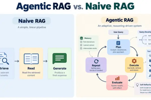
From Linear Pipelines to Autonomous Loops: How Agentic RAG is Redefining Enterprise AI

October 16, 2026 rifanmuazin
Large language models have established themselves as remarkable text generators, yet they continue to grapple with a well-documented and persistent…
Environmental and Climate Mapping

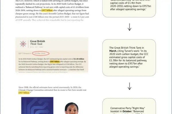
Conservative Party Booklet Repeats Doubled Net-Zero Cost Estimate Stemming from Spreadsheet Error

October 16, 2026 Ali Ikhwan
A policy document recently published by the UK’s opposition Conservative Party has sparked scrutiny after it was discovered that a…
Environmental and Climate Mapping

Global Diplomats Gather in Yerevan for High-Stakes UN Biodiversity Negotiations at the Halfway Mark to 2030 Goals

October 16, 2026 Siti Muinah
Next week, diplomats, environmental officials, and delegates from around the world will descend on Yerevan, Armenia, for a pivotal summit…
Environmental and Climate Mapping

Global Financing for Nature Falls Dangerously Short of UN 2030 Targets, Stocktake Report Warns

October 16, 2026 Muslim
The financial resources directed toward protecting global biodiversity fall drastically short of what is required to meet the United Nations’…
Environmental and Climate Mapping

More Than Half of World’s Nations Meet UN Deadline for Nature Pledges Ahead of COP17

October 16, 2026 Muslim
Nearly three years after the international community struck a landmark pact to halt and reverse the destruction of the natural…
GIS and Spatial Technology

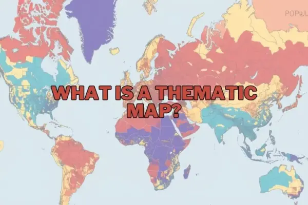
Thematic Maps: How Visualizing Spatial Data Transforms Complex Information into Actionable Insights

October 16, 2026 Reynand Wu
In the contemporary landscape of data visualization and spatial analysis, maps have evolved far beyond basic navigation aids designed to…
Web Mapping and Cartography

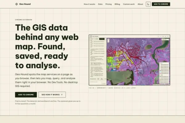
GeoHound Browser Extension Launches to Streamline Web Map Service Discovery and In-Browser Spatial Analysis

October 16, 2026 Asep Darmawan
A new browser extension named GeoHound has been released for Google Chrome, introducing an automated method for geospatial professionals, web…
Location Intelligence and Spatial Analytics

Enterprise AI’s Biggest Bottleneck Isn’t the Technology—It’s the State of Enterprise Data

October 16, 2026 Neng Nana
Every major technology shift over the past three decades has shared a common defining characteristic: the primary hurdle was getting…
Drone Mapping and Aerial Photography

Automated BVLOS Drone Surveys Take on Major Infrastructure Project in Australia

October 16, 2026 Nana Wu
Drone-in-the-box technology is rapidly changing the landscape of modern construction monitoring and site safety, a transformation currently on full display…

Posts navigation

Older posts
Newer posts

Recent Posts

  • GeoHound Tool Launches as Chrome Extension to Instantly Detect, Analyze, and Process Web Map Data
  • From ERP Systems to AI Strategy: Inside Aakansha Bhalotia’s 13-Year Tech Journey at Precisely
  • Elistair Unveils Tethered Air Module for the Parrot ANAFI UKR to Enable Extended ISR Missions
  • A 178-Year-Old Train Delay Solves a Major Mystery in the History of Space Weather and Solar Storms
  • Urban Parking Costs and Curb Management Drive Traffic and Transportation Planning Challenges, New Report Shows

Recent Comments

No comments to show.

Archives

  • October 2026
  • September 2026
  • August 2026

Categories

  • Data Visualization and Infographics
  • Disaster Response and Humanitarian Mapping
  • Drone Mapping and Aerial Photography
  • Environmental and Climate Mapping
  • Geography and Earth Science
  • Geolocation and Cybersecurity
  • Geopolitics and Map News
  • GIS and Spatial Technology
  • Location Intelligence and Spatial Analytics
  • Open Data and Civic Tech
  • Open Source Geospatial Software
  • OpenStreetMap and Community Mapping
  • Remote Sensing and Satellite Imagery
  • Transportation and Mobility Tech
  • Travel Hacking and Digital Nomad
  • Urban Planning and Smart Cities
  • Web Mapping and Cartography

© 2026 Hack The Map. All rights reserved.

Theme: The Original by Rifan Muazin.