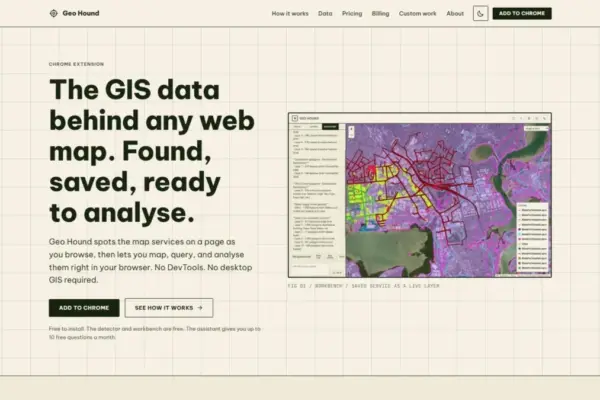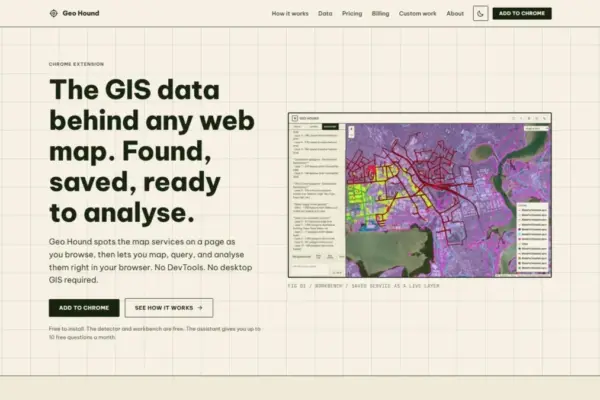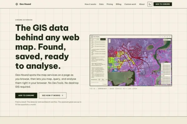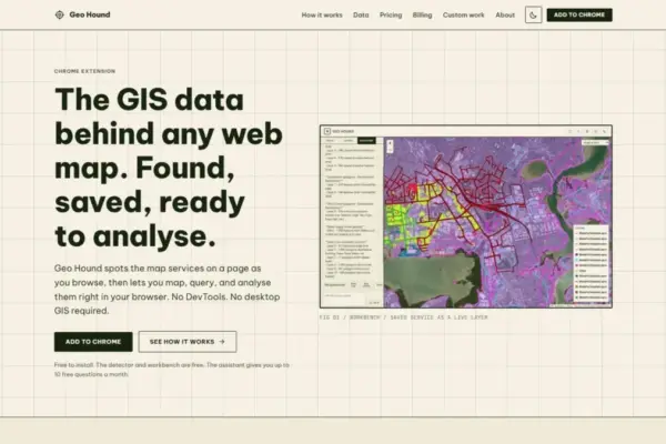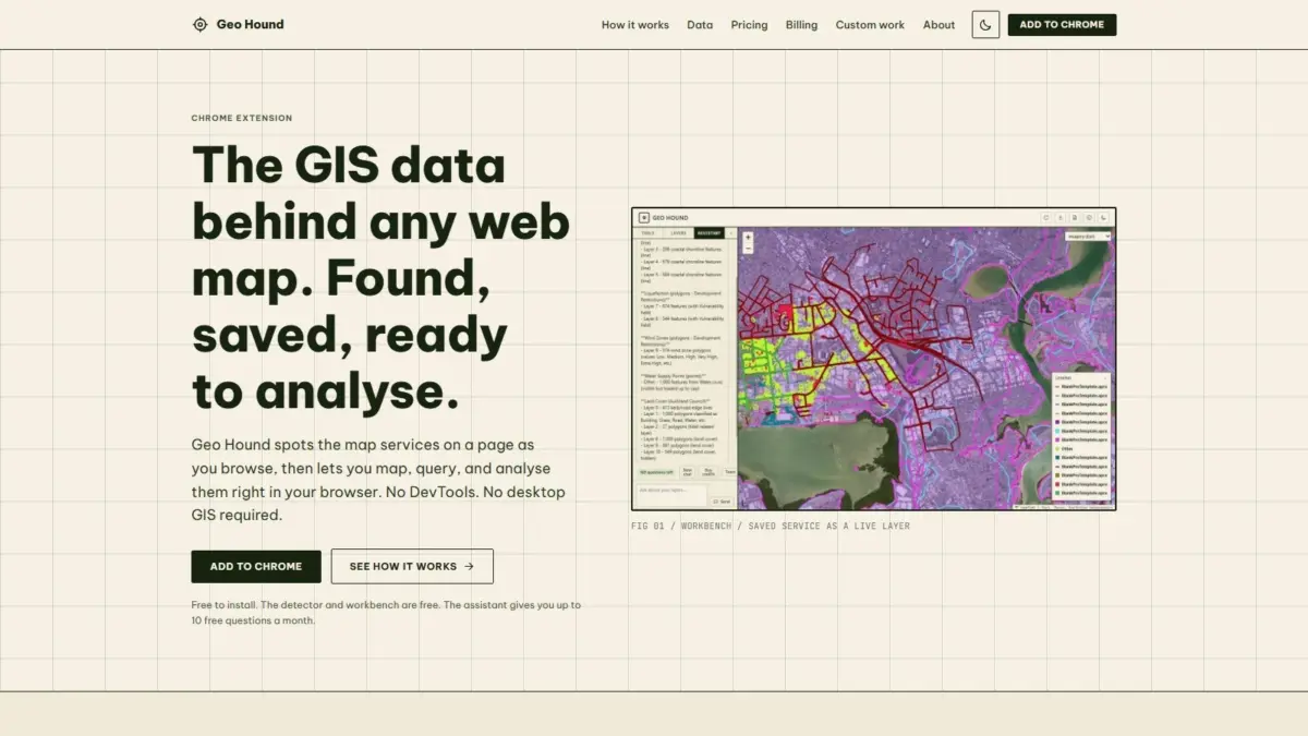
A new browser extension named GeoHound has been released for Google Chrome, introducing an automated method for geospatial professionals, web developers, and spatial data enthusiasts to identify, capture, and interact with the underlying data services that power interactive web maps across the internet. Created by geospatial specialist Daniel O’Donohue, who is widely known as the voice and creator behind The MapScaping Podcast, the tool aims to address a persistent friction point in digital mapping by removing the need for manual browser inspect operations and desktop Geographic Information System software during initial data discovery.
For years, spatial practitioners seeking to uncover the raw source data driving a web map have had to rely on cumbersome manual procedures. When encountering a dynamic web map online, identifying the specific geospatial endpoints serving those visual layers typically required opening browser developer tools, filtering through extensive lists of network requests, inspecting individual payload headers, and deciphering web service calls. This manual searching through browser network logs—often referred to in the mapping community as DevTools spelunking—presented a recurring workflow bottleneck for analysts attempting to locate, verify, or extract web-hosted geospatial layers.
GeoHound redefines this interaction by operating continuously in the background as users navigate the web. As a browser extension, GeoHound automatically monitors web pages for active spatial services, identifying and cataloging the geospatial endpoints feeding the map displays in real time. Rather than requiring users to manually trace dynamic server queries or inspect network traffic, the tool quietly captures the detected map services and aggregates them directly within the user’s browser session.
The scope of service detection provided by GeoHound covers a comprehensive array of modern and legacy geospatial web standards. In total, the extension is equipped
to detect 29 distinct types of spatial services and data formats. These supported services encompass foundational Open Geospatial Consortium standards, such as Web Map Services for rendered image layers, Web Feature Services for vector feature data, and the modern suite of OGC APIs designed for web-native spatial data access. Additionally, the extension identifies widely deployed commercial standards, including ArcGIS REST services, which are heavily utilized across public sector portals and enterprise spatial infrastructures.
Beyond traditional server-rendered and vector service protocols, GeoHound identifies various tile services—including raster basemap tiles and vector tile endpoints—along with standalone spatial data streams such as GeoJSON layers. By identifying 29 distinct service categories, the extension provides broad coverage across diverse web mapping frameworks, regardless of whether a website is built on proprietary enterprise platforms, open-source mapping libraries, or custom client-side web application code.
Along with detecting active endpoints, GeoHound captures and preserves the essential metadata associated with each identified service. Spatial metadata serves a critical role in geographic analysis, providing necessary context regarding layer extents, coordinate reference systems, attribute schema definitions, feature capabilities, and layer naming conventions. By storing this metadata directly alongside the detected service connections, the extension ensures that users maintain full visibility into the underlying structure and parameters of the spatial data before attempting downstream operations.
Once spatial layers are detected and captured, GeoHound moves beyond simple service discovery through its built-in browser workbench. This integrated environment allows users to interact with and process saved geospatial layers directly within the web browser, eliminating the immediate necessity to launch resource-intensive desktop GIS software, such as QGIS or ArcGIS Pro, simply to inspect, transform, or export data.
The in-browser workbench equips users with a suite of core spatial processing tools that operate directly on the saved data layers. Within the workbench, users can perform attribute and spatial filtering to isolate specific subsets of features based on spatial criteria or tabular conditions. The environment also supports vector processing capabilities, including the ability to generate buffers around spatial features to evaluate proximity and spatial relationships. Furthermore, users can execute join operations to combine attribute data across datasets based on shared attributes or spatial locations, streamlining preliminary data integration tasks directly inside the Chrome interface.
After processing or filtering data within the workbench, users can export the resulting spatial layers into standard file formats for external use, archival storage, or integration into broader spatial pipelines. By conducting discovery, filtering, buffering, joining, and exporting within a single unified web interface, the extension significantly condenses the analytical feedback loop, allowing spatial professionals to evaluate web-based spatial layers in seconds rather than spending considerable time executing manual extraction routines.
Accessibility remains a key focus of the platform’s release model. The core detector functionality—responsible for identifying the 29 supported service types and preserving metadata—and the built-in spatial workbench are provided to users entirely for free. This model ensures that individual analysts, researchers, students, and open-data advocates can access robust discovery and browser-based processing capabilities without cost barriers.
To complement the core workbench features, GeoHound incorporates an artificial intelligence assistant designed to execute complex GIS tasks on saved layers using plain English commands. Rather than requiring users to manually configure spatial parameters, write complex SQL queries, or navigate multi-tiered software menus within the workbench, the AI assistant translates natural language prompts into executable spatial processing workflows. Users can instruct the assistant to perform specific filtering, buffering, or data manipulation tasks on their captured layers simply by typing conversational instructions.
The introduction of natural language interaction for spatial processing mirrors broader technology trends across the geospatial industry, where artificial intelligence is increasingly being leveraged to lower technical barriers and improve spatial workflow efficiency. By enabling plain English command execution directly on intercepted web layers, the AI assistant facilitates rapid data exploration and allows users to perform spatial operations without needing to write specialized code or construct intricate command chains manually.
The development of GeoHound reflects the ongoing efforts of its creator, Daniel O’Donohue, to address real-world challenges faced by spatial professionals. Through his work as a geospatial specialist and his long-running role as the host of The MapScaping Podcast, O’Donohue has spent years exploring the practical complexities of spatial technology, cartography, data distribution, and geographic analysis. The podcast has served as a central hub for discussions on spatial data interoperability, web mapping evolution, and the practical friction points encountered by analysts working across modern web and desktop environments.
GeoHound directly responds to community-wide discussions regarding data accessibility and web service discoverability. While public agencies, organizations, and open-data initiatives publish vast volumes of spatial data via web mapping applications, the underlying data feeds often remain opaque or buried beneath application user interfaces. By providing a lightweight, browser-native tool that automatically reveals these endpoints and provides instant spatial manipulation tools, the extension bridges the gap between web map consumption and active GIS analysis.
Ultimately, GeoHound represents a functional shift in how spatial practitioners discover and evaluate web-hosted geographic data. By combining automated detection across 29 service types, integrated metadata preservation, an in-browser analytical workbench, and plain-English AI processing, the tool converts the web browser from a passive viewing engine into an active spatial discovery and analytical platform.