Skip to content
Breaking News
  • GeoHound Tool Launches as Chrome Extension to Instantly Detect, Analyze, and Process Web Map Data
  • From ERP Systems to AI Strategy: Inside Aakansha Bhalotia’s 13-Year Tech Journey at Precisely
  • Elistair Unveils Tethered Air Module for the Parrot ANAFI UKR to Enable Extended ISR Missions
Thursday, October 22, 2026
Edition: U.S. International Login

Hack The Map

Author: Iffa Jayyana

Geopolitics and Map News

Bridging Divisions in a Turbulent Global Order: Inside the 18th BRICS Summit in New Delhi

October 3, 2026 Iffa Jayyana
By Shailja Khetan In an era defined by intensifying geopolitical friction and a fast-shifting international landscape, the states of the…

Urban Planning and Smart Cities

New York City’s Affordable Housing Push Seeks to Spread Development Across All Boroughs

October 2, 2026 Iffa Jayyana
New York City is confronting one of the most severe housing crises in its modern history, defined by a historically…
Geography and Earth Science

Two Newly Identified Snail Species Expand European Biodiversity, Highlight Conservation Needs in Montenegro

October 2, 2026 Iffa Jayyana
Two newly identified snail species have significantly expanded the known diversity of European land snails, offering a fresh glimpse into…
Drone Mapping and Aerial Photography

Public Safety Drone Review Welcomes Michigan Drone Association Founder Matt Rybar for October 6 Webcast

October 1, 2026 Iffa Jayyana
As uncrewed aerial systems (UAS) continue to revolutionize emergency response, law enforcement, and municipal safety, staying abreast of the latest…
Data Visualization and Infographics

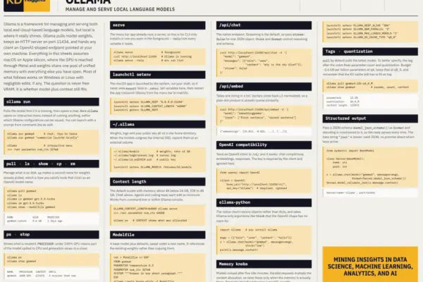
KDnuggets Releases New Cheat Sheet to Master Local Language Models with Ollama

September 30, 2026 Iffa Jayyana
Running a language model on your own hardware has become straightforward enough that the interesting problems have moved elsewhere. In…
Data Visualization and Infographics

Human Judgment Meets AI Execution: Redefining the Data Storytelling Workflow

September 29, 2026 Iffa Jayyana
As professionals across industries participate in the real-world experiment of integrating artificial intelligence into the modern workplace, many are navigating…
Drone Mapping and Aerial Photography

Matternet Unveils M3 Autonomous Drone Delivery Platform for Rooftop Micro-Hubs

September 29, 2026 Iffa Jayyana
Mountain View, California-based drone delivery pioneer Matternet has officially introduced its next-generation aerial logistics ecosystem, the M3 platform. Unveiled on…
Travel Hacking and Digital Nomad

Understanding the Financial Partnership Disclosures Behind Credit Card Reviews

September 24, 2026 Iffa Jayyana
In the modern digital financial landscape, consumers navigating the vast array of available credit cards often rely on specialized financial…
Travel Hacking and Digital Nomad

Maximizing Your Rewards: A Comprehensive Guide to Timing and Choosing Marriott Bonvoy Credit Cards

September 23, 2026 Iffa Jayyana
Marriott stands as the undisputed titan of the global hospitality industry, managing an expansive portfolio that encompasses over 9,000 properties…
Geopolitics and Map News

A Shrunken UN for a Fractured World: The Search for a New Direction as Guterres Nears the End of His Ten-Year Tenure

September 22, 2026 Iffa Jayyana
As world leaders converge on New York for the annual high-level week of the United Nations General Assembly, international officials…

Posts navigation

Older posts
Newer posts

Recent Posts

  • GeoHound Tool Launches as Chrome Extension to Instantly Detect, Analyze, and Process Web Map Data
  • From ERP Systems to AI Strategy: Inside Aakansha Bhalotia’s 13-Year Tech Journey at Precisely
  • Elistair Unveils Tethered Air Module for the Parrot ANAFI UKR to Enable Extended ISR Missions
  • A 178-Year-Old Train Delay Solves a Major Mystery in the History of Space Weather and Solar Storms
  • Urban Parking Costs and Curb Management Drive Traffic and Transportation Planning Challenges, New Report Shows

Recent Comments

No comments to show.

Archives

  • October 2026
  • September 2026
  • August 2026

Categories

  • Data Visualization and Infographics
  • Disaster Response and Humanitarian Mapping
  • Drone Mapping and Aerial Photography
  • Environmental and Climate Mapping
  • Geography and Earth Science
  • Geolocation and Cybersecurity
  • Geopolitics and Map News
  • GIS and Spatial Technology
  • Location Intelligence and Spatial Analytics
  • Open Data and Civic Tech
  • Open Source Geospatial Software
  • OpenStreetMap and Community Mapping
  • Remote Sensing and Satellite Imagery
  • Transportation and Mobility Tech
  • Travel Hacking and Digital Nomad
  • Urban Planning and Smart Cities
  • Web Mapping and Cartography

© 2026 Hack The Map. All rights reserved.

Theme: The Original by Rifan Muazin.