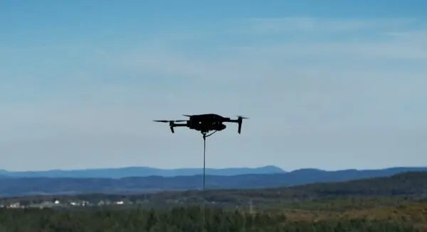
For an autonomous drone searching for a missing person across a sprawling wilderness, new information can change the mission in an instant. A single high-resolution image captured by an onboard camera or a faint sensor reading picked up by infrared equipment may suggest that the aircraft should immediately abandon its current trajectory and search somewhere else.
Yet, as the commercial and emergency deployment of unmanned aerial vehicles continues to accelerate worldwide, a fundamental operational question persists among engineers and mission planners: Exactly how often does an autonomous drone need to reconsider its route while actively processing incoming environmental data?
New research from The University of Texas at Austin suggests the surprising answer may be very few times. Researchers have found that an autonomous vehicle can capture the vast majority of the operational benefits associated with fully adaptive route planning by recalculating its path only two or three times over the course of an entire mission.
This innovative approach could make autonomous searches significantly faster, more energy-efficient, and drastically less computationally demanding. Potential applications span a wide spectrum of critical industries, including search and rescue operations, large-scale infrastructure monitoring, environmental and scientific research, and precision agriculture.
Finding a Middle Ground for Drone Autonomy
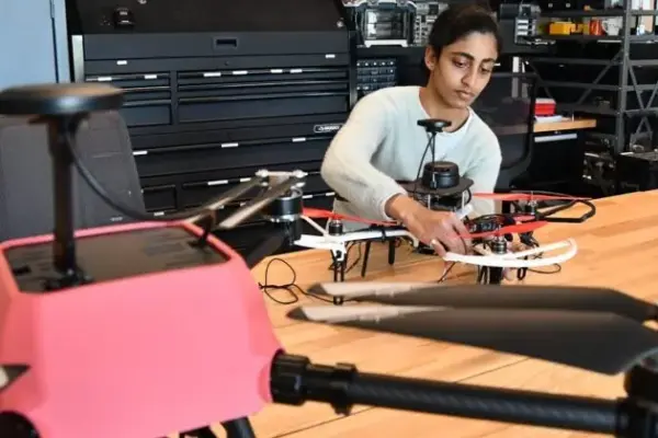
Rohan Ghuge, an assistant professor of information, risk, and operations management at the McCombs School of Business at The University of Texas at Austin, led the research team. For this project, Ghuge collaborated closely with fellow researchers Rayen Tan and Viswanath Nagarajan of the University of Michigan, tackling a common and persistent challenge in the field of autonomous operations.
In typical search and reconnaissance scenarios, a drone or other autonomous vehicle may start a mission with limited information about the terrain, obstacles, or the exact location of its target. As it navigates the airspace and continuously collects data through its suite of sensors, the optimal route to achieve the mission objectives naturally shifts.
Ghuge highlighted the core dilemma facing system designers: determining precisely how much incoming data is required before a system should trigger a disruption. As Ghuge described it, the central question is knowing how much data an operator or algorithm needs to accumulate to finally say that it is time to stop, change course, and completely alter the path that the vehicle has been traveling on.
Historically, system designers have gravitated toward two distinct approaches, each with its own significant drawbacks. One option is a fully adaptive system. In this model, the autonomous vehicle continually and dynamically changes its planned route in real time as every piece of new information arrives. While this continuous adjustment can theoretically produce the most geometrically efficient routes, the constant recalculations require immense computing resources, heavy onboard processing power, and valuable time.
At the other structural extreme lies a nonadaptive system. This traditional setup forces the autonomous vehicle to strictly follow its original, pre-programmed route from takeoff to landing, regardless of what it discovers, encounters, or misses along the way. While computationally effortless, this rigid approach lacks the flexibility required for dynamic real-world environments where conditions change rapidly.
To bridge this gap, the researchers developed an innovative hybrid approach positioned directly between those two rigid models. In this newly proposed framework, the autonomous vehicle follows a planned route for a set, predetermined period of time—referred to by the researchers as a "round." Once that specific round is completed, the vehicle uses the accumulated information collected during that timeframe to calculate its next trajectory for the subsequent round.
Two or Three Adjustments May Be Enough
To test the viability and efficiency of this hybrid model, the research team conducted rigorous computer simulations comparing fully adaptive systems, nonadaptive systems, and their new multi-round framework. The results revealed a dramatic and quantifiable difference in processing speed and computational overhead.
The computer simulations demonstrated that a hybrid solution utilizing just two adaptive rounds operated 15 times faster than the traditional fully adaptive model. Crucially, this massive leap in computational efficiency came with a negligible penalty: the operational cost of the two-round approach was only 12 percent higher than that of a comparable fully adaptive search.
Furthermore, the researchers uncovered a classic economic principle of diminishing returns when introducing additional adjustments. Once the autonomous vehicle executed three rounds of path recalculation, the overall accuracy and effectiveness of the search did not improve in any significant or meaningful way.
Ghuge emphasized that the data points toward a streamlined philosophy for autonomous navigation. Operators do not truly need to process every single incoming data point in real time to make sound navigational decisions. According to Ghuge, when searches are conducted sequentially, executing just two or three distinct rounds is more than sufficient to achieve optimal results.
This finding could carry profound implications for real-world drone operations, where aircraft face severe physical limitations regarding battery power, onboard computing resources, and wireless communication bandwidth. Because battery life is often the primary constraint in aerial search and rescue missions, maximizing efficiency is paramount.
As Ghuge pointed out, constantly replanning a route can itself be exceptionally expensive in terms of energy consumption and processor strain. When an autonomous robot or drone changes its navigation solution just a few times rather than continuously, it still retains the vast majority of the benefits associated with being fully adaptive. This makes the technology vastly more practical for field deployment, incurring only a small and manageable added cost.
Implications for Real-World Drone Operations
The underlying mathematical and operational principles established by the research team apply directly to any mission profile where drones are tasked with searching large, unstructured areas while simultaneously gathering new intelligence. Beyond emergency search and rescue operations, utility companies could deploy these autonomous systems to rapidly locate the exact source of an electrical grid outage following a severe storm. Similarly, agricultural enterprises could utilize the technology to monitor vast crop fields, adjusting flight paths only when anomalies are detected by multispectral sensors.
It is important to clarify what the research does and does not claim. The findings do not mean that physical drones can fly through an air corridor or search a geographic area 15 times faster in the physical world. Rather, the researchers discovered that their innovative two-round computational model solved the complex mathematical path-planning problem 15 times faster than the fully adaptive model within simulated testing environments.
This broader discovery points to a highly practical issue that engineers must grapple with as drone autonomy advances across commercial and public safety sectors. More frequent decision-making does not automatically or proportionally produce better real-world results. For many complex missions, a carefully calculated sequence of a few well-timed course corrections may provide the vast majority of the operational value found in continuous adaptation, streamlining both software architecture and hardware requirements for future unmanned aerial systems.