Skip to content
Breaking News
  • QuickMapTools Launches WebAssembly-Driven Browser Platform for Secure and Local Geospatial Data Processing
  • Precisely Unveils Unified Platform and AI Studio to Solve Enterprise Data Readiness Challenges
  • University of Cincinnati Engineers Use Sound to Detect Drone Damage for NASA
Sunday, October 25, 2026
Edition: U.S. International Login

Hack The Map

Author: Pevita Pearce

Open Source Geospatial Software

GeoServer Releases Version 2.27.7 to Address Critical Security Vulnerabilities

October 25, 2026 Pevita Pearce
The GeoServer development team has officially announced the immediate availability of GeoServer 2.27.7, a specialized release designed to address urgent…
OpenStreetMap and Community Mapping

OpenStreetMap Foundation Launches ‘Maptober’ 31-Day Community Challenge to Expand Global Geographic Data

October 24, 2026 Pevita Pearce
The OpenStreetMap Foundation has officially inaugurated a month-long community mapping initiative dubbed "Maptober," inviting geospatial enthusiasts, volunteer cartographers, and local…
Open Source Geospatial Software

GeoServer 2.28.6 Released with Important Maintenance Updates, Security Fixes, and Component Upgrades

October 24, 2026 Pevita Pearce
The GeoServer development community has officially announced the immediate availability of GeoServer 2.28.6, the latest maintenance release in the 2.28…
Geopolitics and Map News

The Melting Frontier: How Climate Change and Geopolitics Are Transforming the Arctic into a Global Theatre

October 24, 2026 Pevita Pearce
Leaders from twelve countries gathered in Rovaniemi, Finland, for the European Arctic Summit earlier in September 2026, where the emerging…
Data Visualization and Infographics

Crafting Meaningful Data: Why Effective Data Storytelling Requires More Than Just Fewer Words

October 23, 2026 Pevita Pearce
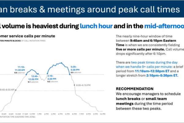
When professionals look at a graph depicting customer service call volume throughout a typical business day, the immediate visual pattern…
Geography and Earth Science

Remarkable Rock from Papua New Guinea Upends Scientific Understanding of Deep Earth Temperatures

October 22, 2026 Pevita Pearce
A remarkable rock discovered in the remote jungles of Papua New Guinea has revealed an unexpected and puzzling temperature pattern…
GIS and Spatial Technology

Understanding Thematic Mapping: How Spatial Data Visualization Reshapes Modern Geographic Analysis and Decision-Making

October 22, 2026 Pevita Pearce
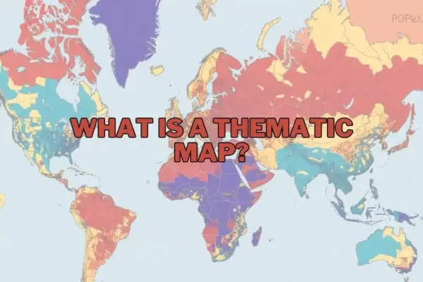
In an era increasingly defined by vast quantities of spatial information, maps have evolved far beyond basic tools designed merely…
Urban Planning and Smart Cities

Urban Parking and Curb Management Critical to Reducing Traffic Congestion and Modernizing City Planning, Report Finds

October 22, 2026 Pevita Pearce
The management, pricing, and availability of urban parking are proving to be decisive factors in shaping modern city landscapes, directly…
Web Mapping and Cartography

GeoHound Tool Launches as Chrome Extension to Instantly Detect, Analyze, and Process Web Map Data

October 21, 2026 Pevita Pearce
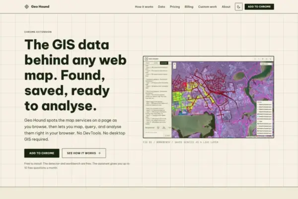
A new browser-based tool named GeoHound has been released to help geospatial professionals, developers, and cartographic enthusiasts discover and manipulate…
Transportation and Mobility Tech

Comprehensive Industry Review Highlights Top-Rated Wheelchairs for Enhanced Mobility, Comfort, and Independence

October 21, 2026 Pevita Pearce
As one of the most widely utilized forms of medical equipment across the globe, wheelchairs remain a cornerstone for individuals…

Posts navigation

Older posts

Recent Posts

  • QuickMapTools Launches WebAssembly-Driven Browser Platform for Secure and Local Geospatial Data Processing
  • Precisely Unveils Unified Platform and AI Studio to Solve Enterprise Data Readiness Challenges
  • University of Cincinnati Engineers Use Sound to Detect Drone Damage for NASA
  • A Mysterious 180-Year-Old Train Delay Leads Scientists to Correct a Historic Space Weather Mistake
  • Seattle Social Housing Developer Expands Portfolio with New Central District Project

Recent Comments

No comments to show.

Archives

  • October 2026
  • September 2026
  • August 2026

Categories

  • Data Visualization and Infographics
  • Disaster Response and Humanitarian Mapping
  • Drone Mapping and Aerial Photography
  • Environmental and Climate Mapping
  • Geography and Earth Science
  • Geolocation and Cybersecurity
  • Geopolitics and Map News
  • GIS and Spatial Technology
  • Location Intelligence and Spatial Analytics
  • Open Data and Civic Tech
  • Open Source Geospatial Software
  • OpenStreetMap and Community Mapping
  • Remote Sensing and Satellite Imagery
  • Transportation and Mobility Tech
  • Travel Hacking and Digital Nomad
  • Urban Planning and Smart Cities
  • Web Mapping and Cartography

© 2026 Hack The Map. All rights reserved.

Theme: The Original by Rifan Muazin.