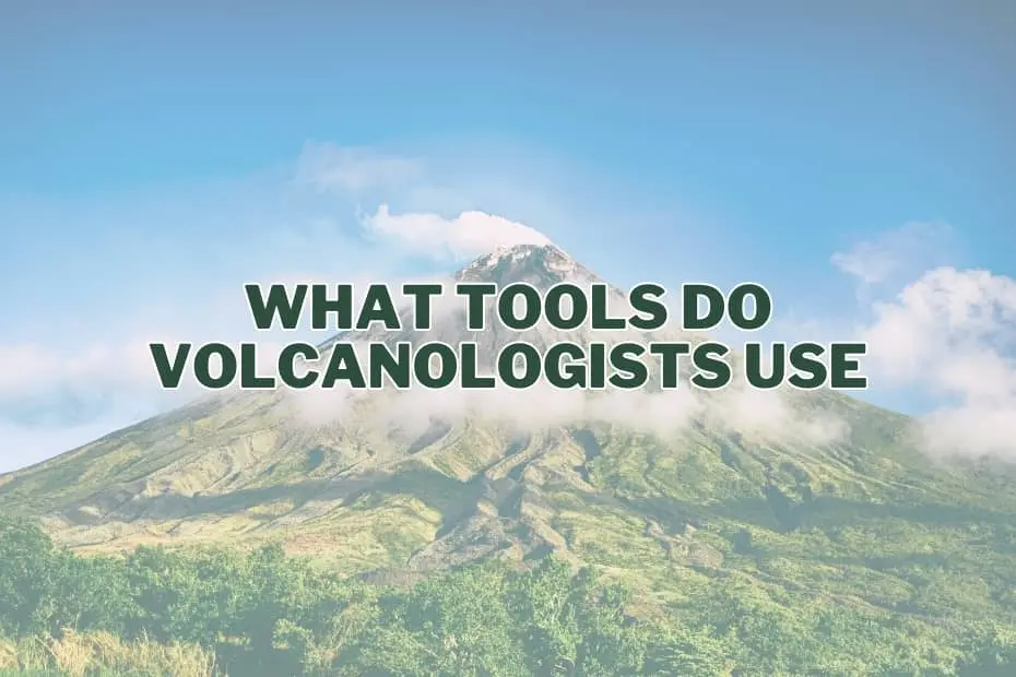
Volcanoes remain among the most imposing and destructive forces on Earth. Capable of reshaping entire landscapes, altering global weather patterns, and placing surrounding communities in immediate peril, volcanic eruptions present a persistent natural hazard. To anticipate these powerful geological events, volcanologists rely on a sophisticated array of monitoring instruments and field techniques. By continuously tracking physical, chemical, and thermal changes deep beneath the surface, scientists are able to evaluate volcanic behavior, issue timely public safety warnings, and advance our fundamental understanding of Earth’s internal dynamics.
Understanding a volcano requires interpreting subtle signals transmitted through the crust. Magma moving through subterranean conduits generates seismic tremors, deforms the ground surface, alters local gravity, and releases characteristic gas mixtures. To capture this complex multi-hazard dataset, modern volcano observatories deploy an integrated suite of specialized tools.
1. Seismographs: Detecting Earth’s Tremors
Seismographs serve as the primary monitoring baseline for virtually every active volcano observatory in the world. These sensitive instruments measure seismic waves generated by micro-earthquakes and fluid movement within the Earth’s crust. When magma, volcanic gases, or hydrothermal fluids force their way upward through subsurface rock, they fracture surrounding formations and produce distinct vibrations.
Volcanologists analyze seismic data to map the depth, magnitude, and spatial progression of magma ascent. Distinct seismic patterns—such as high-frequency volcano-tectonic earthquakes indicating rock fracture, or low-frequency continuous harmonic tremors signaling fluid flow—provide critical early indicators that a volcano may be transitioning from a quiescent state to an eruptive phase.
2. Gas Analyzers: Measuring Volcanic Gas Emissions
Volcanic eruptions are fundamentally driven by gas expansion. As magma rises toward the surface, decreasing pressure allows dissolved volatiles to bubble out of solution and escape through cracks and vents. Gas analyzers allow volcanologists to detect and measure the concentration and flux of key gases, most notably sulfur dioxide ($textSO_2$), carbon dioxide ($textCO_2$), and water vapor ($textH_2textO$).
Changes in total gas output or shifts in gas ratios provide direct clues regarding the location and volume of ascending magma. A sudden increase in $textSO_2$ emissions often indicates that fresh magma has reached shallow depths where lower pressures allow sulfur species to degas rapidly. Monitoring gas compositions helps scientists assess the likelihood of explosive eruptions versus effusive lava output.
3. GPS Receivers: Measuring Ground Deformation
As magma accumulates in subterranean reservoirs, the intense hydraulic pressure pushes against the overlying rock layers, causing the volcano’s flanks to swell, stretch, or tilt. High-precision Global Positioning System (GPS) receivers anchored to the ground continuously measure three-dimensional surface movements with millimeter-level accuracy.
Networks of geodetic GPS stations reveal how the volcanic edifice inflates prior to an eruption and deflates as magma is evacuated during an event. By analyzing continuous GPS data, volcanologists can model the depth, geometry, and volume changes of underground magma chambers, offering essential context for eruption forecasting and hazard mapping.
4. Thermal Cameras: Detecting Heat Changes
Thermal imaging cameras capture infrared radiation, allowing scientists to monitor surface temperature distributions that are invisible to the human eye. Volcanic activity is accompanied by significant heat transfer as magma approaches the surface, heating surrounding rock, groundwater, and surface vents.
Thermal cameras are used to monitor heat anomalies around summit craters, measure the temperature of active lava flows, track the movement of thermal fronts, and map active fumaroles. Thermal monitoring allows scientists to identify potential breakthrough points for lava or pyroclastic materials, providing critical real-time information during active eruptive crises.
5. Spectrometers: Analyzing Light and Composition
Spectrometers measure the interaction between electromagnetic radiation and atmospheric molecules, allowing volcanologists to analyze the chemical composition of volcanic gas plumes and ash columns from safe distances. By measuring specific wavelengths of absorbed or scattered light, these instruments identify the fingerprint of individual chemical compounds.
Differential Optical Absorption Spectroscopy (DOAS) and ultraviolet spectrometers are routinely deployed downwind of active vents to calculate total gas emission rates without requiring physical sampling within hazardous zones. Spectrometric data contributes to continuous emission inventories, helping scientists track subsurface magma ascent and evaluate atmospheric dispersion hazards.
6. Drones (UAVs): Remote Volcanic Observation
Unmanned Aerial Vehicles (UAVs), commonly known as drones, have transformed field volcanology by enabling safe aerial inspection of highly dangerous environment. Active volcanic vents, steep crater walls, and unstable lava domes present extreme physical hazards to field scientists.
Drones equipped with high-resolution optical cameras, thermal sensors, and miniaturized gas analyzers can fly directly into volcanic plumes and over active craters. They gather real-time video, capture photogrammetric image sets to generate precise 3D digital elevation models, and extract gas samples from previously unreachable vents, significantly expanding data collection while keeping personnel out of harm’s way.
7. Gravimeters: Measuring Gravity Changes
Gravimeters measure minute variations in the Earth’s local gravitational acceleration. Underground movements of magma, water, or gas alter the local density distribution within a volcanic edifice, leading to measurable changes in local gravity fields.
When dense magma moves into shallow crustal reservoirs, replacing lighter, gas-filled or porous rock, local gravitational pull subtly increases. Conversely, the drainage of magma or subsurface fluid vaporization causes gravity to decrease. By conducting repeating micro-gravity surveys or deploying continuous gravimeters, volcanologists can estimate the bulk mass of magma entering or leaving a volcanic system beneath the surface.
8. Tiltmeters: Measuring Surface Tilting
Tiltmeters operate much like hyper-sensitive electronic spirit levels, measuring minute changes in the slope or inclination of the ground surface. Installed in shallow boreholes or protective enclosures on the flanks of a volcano, these instruments can detect slope variations as small as a fraction of a microradian.
Ground tilting is an immediate response to subsurface inflation or deflation. As magma pressurizes a shallow reservoir, the ground surface tilts outward, away from the summit center. Rapid changes in tilt rates frequently precede flank eruptions or structural slope failures, making tiltmeters indispensable for short-term warning systems.
9. Infrasound Sensors: Capturing Low-Frequency Sounds
Infrasound sensors record acoustic pressure waves propagating through the atmosphere at frequencies below the range of human hearing (typically below 20 Hertz). Volcanic eruptions, ash explosions, gas bursts, and pyroclastic flows generate strong infrasonic signatures that can travel hundreds or even thousands of kilometers.
Infrasound arrays allow scientists to detect and characterize explosive eruptive activity rapidly, even during nighttime hours or severe weather when visual observation is obscured. Infrasound monitoring is particularly crucial for detecting early eruption columns, providing rapid warnings to aviation authorities to prevent aircraft from encountering hazardous volcanic ash clouds.
10. Satellite Imagery: Monitoring from Space
Spaceborne remote sensing platforms offer broad spatial coverage and continuous global observation of active and remote volcanoes. Earth-observing satellites utilize a spectrum of sensors, including synthetic aperture radar (SAR), multispectral thermal imagers, and optical cameras.
Interferometric Synthetic Aperture Radar (InSAR) allows scientists to measure regional ground deformation across vast geographic areas by comparing radar signals acquired at different times. Thermal infrared satellite sensors detect hotspot anomalies and lava flows, while multispectral imaging tracks atmospheric ash plumes and sulfur dioxide clouds across international borders.
11. Rock Hammers: Collecting Samples
Despite the prevalence of high-tech digital instrumentation, direct physical sampling remains a fundamental component of geological field research. The classic geologist’s rock hammer allows volcanologists to collect fresh samples of lavas, tephra, pumice, and xenoliths directly from field deposits.
Laboratory analysis of physical rock samples reveals essential information regarding bulk geochemistry, mineralogy, texture, and dissolved water contents. Petrological examination allows scientists to determine the temperature, pressure, and chemical evolution of the magma prior to eruption, reconstructing the historical behavior of the volcanic plumbing system.
12. Core Samplers: Extracting Deep Rock Samples
Core samplers and rotary drills extract intact, cylindrical columns of rock, sediment, and ash layers from deep subterranean environments, lake beds, or marine basins surrounding a volcano.
Analyzing stratigraphic drill cores allows volcanologists to build detailed chronologies of past volcanic events spanning thousands to millions of years. By dating individual ash beds (tephrochronology) and examining variations in deposit thickness, researchers can establish long-term eruptive recurrence intervals, determine prehistoric eruption magnitudes, and evaluate future risk scenarios for regional land-use planning.
13. Fourier Transform Infrared (FTIR) Spectrometer: Advanced Gas Analysis
Fourier Transform Infrared (FTIR) spectrometers represent an advanced class of analytical instruments capable of measuring multiple gas species simultaneously in real time. FTIR systems measure how atmospheric gases absorb broad-spectrum infrared radiation emitted from volcanic vents, incandescent lava, or artificial light sources.
FTIR spectroscopy allows volcanologists to obtain high-resolution measurements of volatile species such as water vapor ($textH_2textO$), carbon dioxide ($textCO_2$), sulfur dioxide ($textSO_2$), carbon monoxide ($textCO$), hydrochloric acid ($textHCl$), and hydrofluoric acid ($textHF$). By tracking rapid shifts in volatile ratios—such as $textCO_2/textSO_2$ balances—scientists gain precise insights into deep magma degassing processes and volatile saturation thresholds preceding explosive activity.
14. X-ray Fluorescence (XRF) Analyzer: Chemical Element Detection
Portable and laboratory-based X-ray Fluorescence (XRF) analyzers measure the elemental composition of volcanic rocks, minerals, and ash samples. By bombarding a sample with high-energy X-rays, the instrument measures the characteristic secondary X-rays emitted by specific chemical elements present in the material.
Rapid XRF analysis allows field researchers to determine concentrations of major elements (such as silicon, iron, magnesium, and aluminum) and trace elements within hours of sample collection. Chemical classification helps volcanologists determine whether fresh, chemically primitive magma is injecting into an existing reservoir, a process that frequently triggers violent eruptive episodes.
15. Geochemical Probes: Measuring Volcanic Fluids
Geochemical probes are specialized sensor packages deployed directly into volcanic hydrothermal environments, including crater lakes, hot springs, and high-temperature fumaroles. These probes continuously measure parameters such as fluid temperature, electrical conductivity, acidity ($textpH$), oxidation-reduction potential, and dissolved ion concentrations.
Hydrothermal systems act as natural buffer zones that filter and absorb rising volcanic fluids. Changes in fluid chemistry, water temperature, or spring discharge rates often signal changes in deep thermal output or the input of magmatic volatiles into the shallow groundwater table, providing early baseline indicators of volcanic unrest.
Synthesizing Data for Eruption Forecasting
No single instrument can provide a complete picture of volcanic behavior. Modern volcano monitoring relies on an integrated approach where seismic, geodetic, chemical, and remote sensing streams are transmitted in real time to centralized observatories.
By cross-referencing surface ground swelling measured via GPS with seismic depth profiles, infrared thermal anomalies, and changing gas ratios, volcanologists synthesize complex datasets into unified hazard assessments. This multidisciplinary monitoring framework enables scientists to track magma transport, assess eruptive risks accurately, and issue timely early warnings that protect public safety and infrastructure.
Frequently Asked Questions
How do seismographs help predict volcanic eruptions?
Seismographs record ground vibrations caused by magma and volcanic fluids fracturing subsurface rock. By tracking changes in earthquake frequency, depth, location, and vibration patterns (such as continuous harmonic tremors), scientists can monitor magma movement toward the surface and forecast potential eruptive events.
Why are gas analyzers important in volcano monitoring?
Gas analyzers measure emissions of key volatile compounds like sulfur dioxide and carbon dioxide. Shifts in gas flux and relative gas ratios provide direct evidence of magma degassing, indicating whether new magma is rising toward shallow depths and helping evaluate the explosive potential of an eruption.
What role do drones play in volcano research?
Drones allow volcanologists to collect high-resolution aerial photographs, thermal images, and gas samples from dangerous or physically inaccessible regions, such as active craters and toxic plumes, without exposing field researchers to direct physical risks.
How does satellite imagery assist volcanologists?
Satellite imagery provides broad regional monitoring capabilities from space. Spaceborne sensors track ground deformation across entire volcanic belts, detect thermal hotspots, monitor lava effusion rates, and track the dispersion of hazardous ash plumes and gas clouds in real time for international aviation safety.
What is the purpose of geochemical probes?
Geochemical probes monitor the physical and chemical characteristics of volcanic fluids in fumaroles, hot springs, and crater lakes. Tracking changes in temperature, $textpH$, and dissolved chemical compounds helps scientists detect subterranean thermal changes and magmatic volatile inputs into shallow groundwater systems.