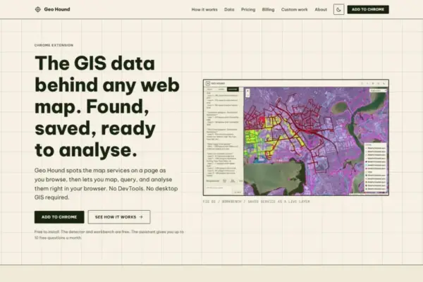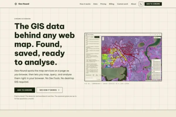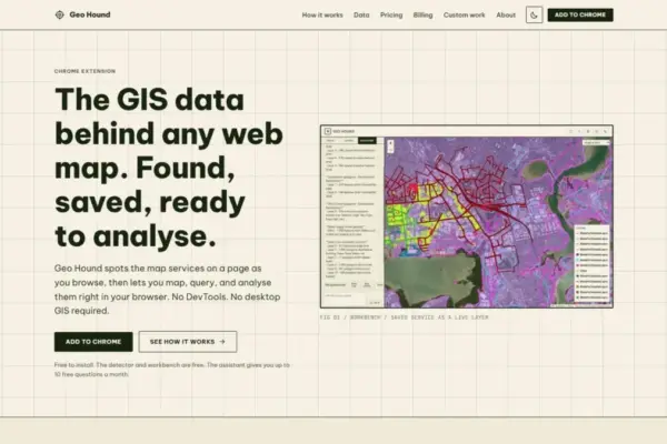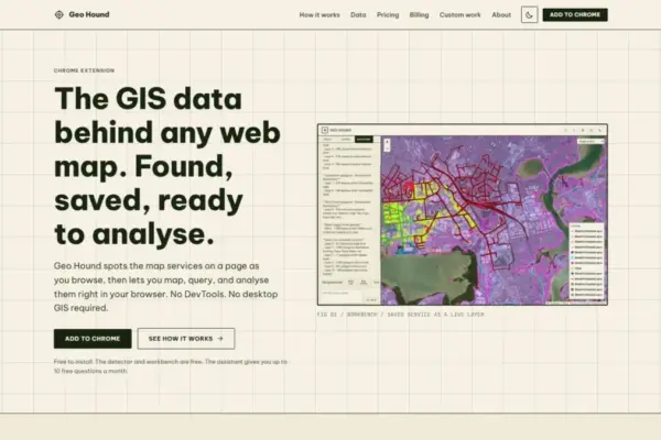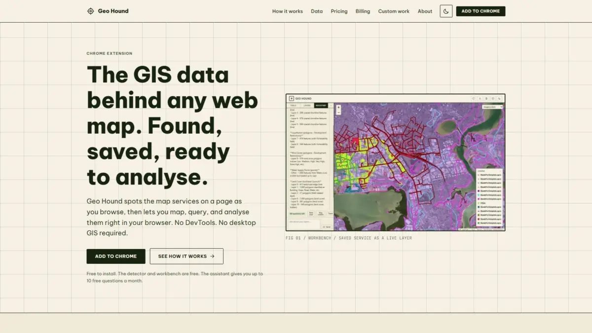
A new browser extension named GeoHound aims to fundamentally change how spatial professionals, researchers, and mapping enthusiasts interact with spatial data across the web by automating service detection and enabling directly integrated browser-based analysis. Created by geospatial specialist Daniel O’Donohue, who is widely known as the voice and creator behind The MapScaping Podcast, the Google Chrome extension automatically identifies, captures, and organizes the geographic web services powering interactive web maps as users navigate the web.
Interactive web maps have become ubiquitous across modern digital platforms, serving as primary interfaces for public infrastructure updates, municipal planning portals, environmental monitoring dashboards, open-source intelligence projects, and news coverage. However, despite the widespread presence of these cartographic web applications, the underlying raw datasets and vector geometries that feed them often remain obscured behind user interface layers. Historically, determining where a map’s source data resides or extracting backend endpoints required users to conduct manual network inspection using browser developer tools, reverse-engineer web queries, or hunt through complex application code to isolate service links.
GeoHound addresses this technical friction by running quietly in the background during standard web browsing sessions. As a user loads and navigates any web map within Google Chrome, the extension automatically inspects incoming network traffic to detect backend geospatial web services. Upon detecting spatial data streams, GeoHound captures the endpoint details and saves them along with their associated metadata, converting standard web browsing into an automated geographic data discovery routine without requiring users to open DevTools or execute manual network network traces.
The extension features broad compatibility across the modern spatial web ecosystem, detecting 29 distinct spatial service types in total. Among these supported standards are traditional Open Geospatial Consortium (OGC) formats such as Web Map Services (WMS) for georeferenced map imagery and Web Feature Services (WFS) for streaming raw vector geometries and associated attributes. Additionally, GeoHound identifies modern OGC APIs, ubiquitous Esri ArcGIS REST service endpoints widely deployed across municipal and enterprise spatial data infrastructures, raster and vector tile services, and standalone GeoJSON data files.
A key component of GeoHound’s functionality is its dynamic capture of metadata alongside raw web service URLs. Metadata provides essential context regarding spatial datasets, including coordinate reference systems, dataset bounding boxes, attribute fields, service layer capabilities, and publisher information. By automatically cataloging metadata in tandem with detected endpoints, the extension ensures that users maintain complete spatial context, enabling them to assess data validity, projection compatibility, and feature attributes without needing to send manual administrative queries to backend mapping servers.
Detecting backend spatial feeds represents only the initial phase of geospatial workflow management. Traditionally, once a web map service URL was identified, analysts were required to export the link into desktop geographic information system (GIS) software packages—such as QGIS or Esri ArcGIS Pro—to inspect table structures, perform spatial calculations, or re-export layers into usable spatial formats. GeoHound eliminates this structural step by incorporating a fully integrated, browser-native spatial workbench directly into the Chrome extension.
The built-in GeoHound workbench allows users to perform core GIS data manipulation tasks directly within their web browser, bypassing the need to launch external desktop GIS software. Within the workbench environment, users can inspect attribute tables, filter datasets using specific spatial or tabular criteria, construct geometric buffers around map features, execute tabular and spatial joins across saved datasets, and export processed spatial layers into preferred file formats. This browser-based processing capability enables rapid data exploration and spatial manipulation immediately after a service is detected on a web page.
By integrating spatial filtering, buffering, joining, and exporting into the browser, GeoHound reduces the operational overhead associated with preliminary spatial analysis. Urban planners investigating zoning boundaries, journalists verifying spatial footprints, and mapping specialists evaluating regional datasets can perform lightweight spatial workflows in real time without downloading raw datasets, setting up local spatial projects, or maintaining dedicated GIS installations on their local machines.
To further lower technical entry barriers, GeoHound incorporates an artificial intelligence assistant capable of executing GIS analytical tasks on saved layers using natural language prompts. Users can interact with their collected geographic datasets by asking questions or describing intended analytical tasks in plain English. The AI assistant interprets these conversational commands and performs corresponding spatial processes directly on the saved layers within the workbench.
The introduction of natural language interactions for geographic information systems mirrors a wider shift across software development, where conversational interfaces are applied to simplify complex technical workflows. By processing plain English commands into spatial actions, the AI assistant enables both seasoned GIS specialists looking to accelerate repetitive tasks and non-technical professionals who may not be familiar with spatial SQL syntax or software tool hierarchies to execute functional geographic operations on live web map data.
GeoHound is structured around an accessible distribution model. Both the primary spatial service detector and the integrated browser workbench are available to users at no cost. This free availability ensures that students, independent open-source intelligence researchers, professional cartographers, and enterprise GIS managers can incorporate automated spatial service discovery and lightweight browser-based processing into their everyday web workflows without financial barriers.
The development of GeoHound builds directly upon the professional experience of its creator, Daniel O’Donohue. As a geospatial specialist, O’Donohue has spent years leveraging spatial technology to analyze complex geographic phenomena layer by layer. Through his work as the host and producer of The MapScaping Podcast—a prominent media platform within the geospatial industry dedicated to spatial computing, earth observation, location intelligence, and geographic technology trends—O’Donohue continuously explores emerging trends and practical challenges facing the mapping community.
The launch of GeoHound reflects O’Donohue’s broader commitment to enhancing spatial data accessibility and providing practical tools that solve persistent technical challenges within the mapping community. As the volume of web-based spatial data expands across diverse API standards and web platforms, tools that streamline layer identification, capture metadata, and offer accessible analytical environments represent a key step forward for spatial data interoperability and digital cartography.
By combining background service detection across 29 spatial layer types with an in-browser workbench and plain-English AI analytical capabilities, GeoHound offers a unified solution for web-based spatial data discovery. The free extension effectively bridges the gap between passive web map navigation and functional GIS data extraction, offering the geospatial community a versatile method for identifying, analyzing, and exporting spatial datasets directly within the browser environment.