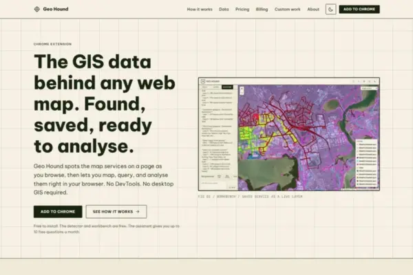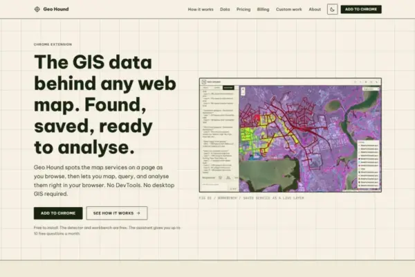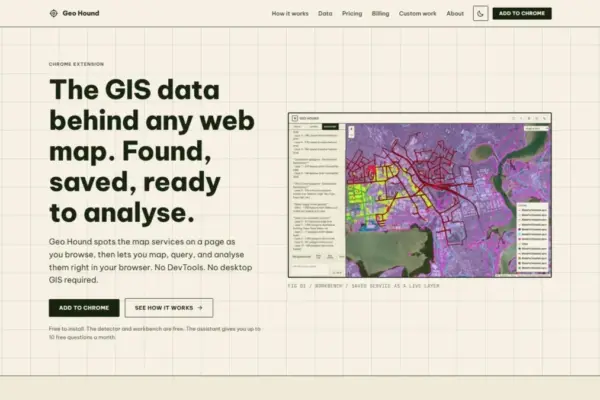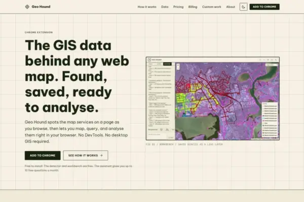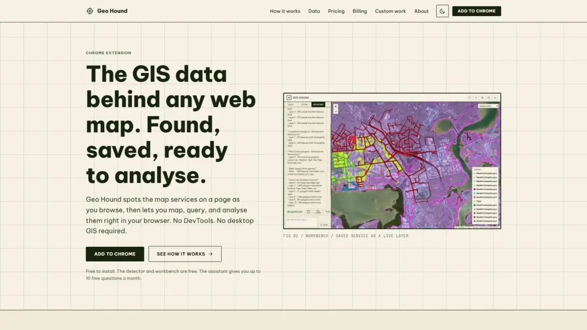
A new browser extension designed to simplify web map inspection and streamline everyday spatial data workflows has officially launched with the release of GeoHound. Built specifically as a Google Chrome extension, GeoHound automatically detects, captures, and logs the underlying spatial web services and data layers powering interactive maps across the internet. Created by geospatial specialist Daniel O’Donohue, the voice and developer behind The MapScaping Podcast, the tool directly addresses a persistent operational challenge in the geographic information systems (GIS) field: discovering, evaluating, and extracting spatial data sources directly from web maps without relying on complex browser inspection tools or launching heavy desktop software.
Web maps have become ubiquitous across digital platforms, serving as critical visual interfaces for municipal planning portals, environmental monitoring dashboards, utility management platforms, real estate applications, and scientific research portals. However, the actual geographic datasets rendering these visual overlays often remain obscured behind multi-layered client-server web architectures. When spatial analysts, cartographers, urban planners, or research journalists encounter a web map and want to identify where the data lives or extract the original source layers, they historically faced a tedious manual inspection process.
Without specialized software extensions, investigating web map layer endpoints required users to open browser Developer Tools, commonly known as inspect mode, and manually navigate through network traffic logs. Analysts had to monitor active HTTP requests while panning or zooming around a web map, filter through hundreds of individual web network requests, parse dynamic request headers, and construct valid service endpoints from raw web parameters. This process, often described as DevTools inspection, is time-consuming, highly technical, and prone to error, presenting a significant workflow bottleneck for professionals who need to rapidly assess spatial data sources or extract geographic layers for research and spatial projects.
GeoHound removes this friction by operating continuously in the background during normal web browsing sessions. As a user navigates across web pages containing embedded interactive maps, spatial portals, or custom mapping applications, the extension automatically scans active network requests in real time to identify underlying geospatial endpoints and service calls. Detected services are cataloged immediately, alongside their associated structural metadata, allowing users to discover data layers effortlessly as they browse.
The extension features broad protocol support across the geospatial technology landscape, capable of identifying 29 distinct web map service types and spatial data formats. Included within its detection capabilities are foundational Open Geospatial Consortium (OGC) standard services, such as Web Map Service (WMS) endpoints, which serve server-side rendered map images, and Web Feature Service (WFS) endpoints, which deliver raw, queryable vector feature geometries and attribute tables over the web. GeoHound also detects modern OGC APIs, representing the latest evolution of open geospatial standards engineered to integrate seamlessly with modern web development practices and RESTful web architectures.
In addition to open standard protocols, GeoHound automatically detects Esri ArcGIS REST services, which constitute a significant majority of the public enterprise spatial infrastructure used by state, regional, and municipal government agencies around the world. The tool also identifies both raster and vector tile services—which drive high-performance, client-side web map rendering—as well as standalone, lightweight geographic data files such as GeoJSON payloads.
Beyond simply discovering and capturing URL endpoints, GeoHound automatically captures and stores the underlying metadata associated with each detected layer. Metadata is a crucial component of geospatial data integrity, providing essential details regarding spatial reference systems, coordinate projections, geometric bounding boxes, layer capabilities, attribute field definitions, feature counts, and service constraints. By saving detected layers together with their full metadata, GeoHound ensures that analysts maintain total visibility into the technical parameters of the geographic datasets they encounter online. This capabilities metadata enables users to evaluate spatial accuracy, confirm projection compatibility, and verify attribution rights before integrating discovered services into broader analytical workflows.
To complement its data detection capabilities, GeoHound incorporates a built-in workbench that operates entirely inside the browser window. This integrated workbench transforms the browser into a functional spatial analysis environment, allowing users to work with captured geospatial layers directly without having to download source files, launch desktop GIS platforms like QGIS or ArcGIS Pro, or establish manual database connections.
The in-browser workbench provides a suite of essential vector processing and table management tools. Users can apply attribute and spatial filters directly to saved layers, allowing them to isolate specific geographic features or refine datasets based on defined attribute values. The workbench also supports proximity buffering operations, enabling users to generate vector buffer zones around point, line, or polygon features to examine geographic reach, spatial extent, or boundary intersections.
Furthermore, the workbench enables spatial and attribute joins, allowing users to combine disjointed tabular and geographic datasets based on common key attributes or spatial overlapping conditions right inside the browser interface. Once processing is complete, users can export their manipulated or extracted datasets directly into standard geospatial file formats for downstream application, reporting, or sharing across teams.
By unifying spatial layer detection, metadata logging, and vector processing into a single browser tool, GeoHound significantly compresses the traditional spatial data pipeline. Standard geographic workflows typically require locating raw endpoint URLs through network inspect panels, opening external desktop software, configuring server connections, loading layers, executing processing scripts, and saving local project files. GeoHound eliminates these tedious intermediate steps, allowing professionals to locate, analyze, transform, and export geospatial data in real time as an organic part of their daily browser routine.
The foundational capabilities of GeoHound—including both the real-time layer detector and the browser-based workbench environment—are provided completely free of charge. To further optimize operational efficiency and accessibility, the extension also features an integrated artificial intelligence assistant designed to carry out complex spatial tasks on saved layers using plain English natural language commands.
Rather than requiring users to manually set spatial buffer parameters, build complex structured query expressions, or select multi-nested tool menus, the AI assistant interprets natural language instructions typed by the user. The assistant converts these plain English requests into functional spatial operations, executing filters, buffers, joins, and data transformations directly on the layers residing within the workbench. This conversational interface drastically lowers the technical entry threshold, enabling both seasoned spatial analysts and non-GIS specialists to run spatial queries and perform layer manipulation without needing deep familiarity with traditional GIS software syntax or tool configurations.
The release of GeoHound highlights broader industry trends toward browser-native spatial computing, interoperable web services, and natural language interfaces in geographic data science. Creator Daniel O’Donohue developed the tool drawing from his extensive background as a professional geospatial specialist and as the host of The MapScaping Podcast, a widely recognized media platform within the spatial technology community. Through his podcasting and professional work, O’Donohue has consistently focused on exploring how spatial technologies, open data architectures, and modern software design can be harnessed to unravel complex global challenges layer by layer. GeoHound serves as a practical extension of that effort, offering a lightweight tool that turns standard web browsers into active spatial discovery engines.