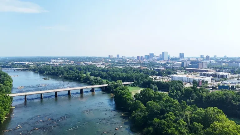
Nearly a decade after a catastrophic, 1,000-year rainfall event brought historic devastation to South Carolina, the city of Columbia is turning a painful chapter of environmental crisis into an unprecedented opportunity for urban renewal, ecological protection, and economic growth.
In early October 2015, Hurricane Joaquin tracked far off the eastern coast of the United States, yet its expansive reach sent a massive plume of tropical moisture straight toward Richland County. What followed was described by the Weather Channel as one of the most prolific rainfall events in modern United States history. The resulting deluge unleashed a 1,000-year flood that struck Columbia with relentless force, severely damaging local infrastructure and breaching earthen dams along the Columbia Canal—the single largest source of drinking water for the capital city.
For Clint Shealy, the timing could not have been more dramatic. Just six weeks into his new job as the water works superintendent at the Columbia Canal, the skies opened up. "It started raining and just kept raining," Shealy recalled. As massive chunks of the canal’s earthen embankment rapidly washed away, Shealy and his engineering team were forced into a desperate, high-stakes race against time. They had to act immediately to safeguard the drinking water supply for a population of roughly 150,000 residents.
To prevent total failure, the emergency response team constructed a robust rock dam designed to isolate the breach. They also engineered a makeshift finger lake to capture, hold, and pump raw water—an interim operational measure that, remarkably, remains in place today. "We’ve been operating in kind of a diminished capacity ever since," Shealy noted, highlighting the lingering vulnerability of the city’s vital utilities.
Now serving as the assistant city manager for Columbia water, Shealy still carries the weight of those harrowing days. "We don’t sleep well when we think about this thing happening again," he said. "We need to be protected."
River City Resiliency
In the years following the disaster, city officials have moved past temporary fixes, responding to the historic emergency with an ambitious, forward-looking initiative designed to comprehensively restore, upgrade, and modernize the entire Columbia Canal system. The scope of these investments reflects a deep-seated commitment to safeguarding public health while simultaneously reimagining how the city interacts with its surrounding waterways.
Among the immediate infrastructure priorities, the city is currently collecting bids for a $12 million project aimed at fully repairing the 12 critical headgates that were severely damaged during the 2015 storm. Simultaneously, progress is well underway on an even larger undertaking: a $63.8 million project to install a brand-new, highly resilient water supply intake. Once completed, this new intake will boast a robust capacity of 80 million gallons per day drawn directly from the nearby Congaree River, vastly improving the reliability and security of the municipal water supply.
"We’re a little better off than we were in 2015," Shealy acknowledged. "लेकिन that thing that happened in 2015 is still in the back of our minds. So, we started pursuing a resiliency project pretty early on."
Crucially, the scope of these engineering upgrades extends far beyond municipal utility maps. The resiliency initiative is intricately tied to the creation of a sprawling 100-acre riverfront district. This ambitious urban planning venture will encompass a major recreation area and a vibrant mixed-use development, effectively linking two prominent local parks and opening up unprecedented public access to the Congaree River that generations of residents and visitors have never experienced before.
According to city spokespersons, the future Congaree Riverfront District will eventually connect seamlessly with an expansive 27-mile riverfront trail and park system. This larger greenway follows the winding course of the Saluda River through downtown Columbia as it converges with the Broad River to form the mighty Congaree.
"You just don’t have opportunities like this very often in downtown communities," Shealy said. "The city is investing with its partners to strengthen quality of life, protect our critical infrastructure, and really embrace who we are as a river city."
Connectivity, Community, and Conservation
To bring this grand vision to life, the city has partnered with Field Operations, an internationally acclaimed landscape architecture firm renowned for designing high-profile urban transformations such as New York City’s iconic High Line and Chicago’s bustling Navy Pier. Field Operations is currently crafting a comprehensive master plan for Columbia in close collaboration with Richland County, the University of South Carolina, a coalition of local development foundations, and numerous community stakeholders. Shealy confirmed that the finalized master plan is expected to be released later this year.
The funding and land acquisition strategy for the riverfront system relies heavily on public-private cooperation. Notably, Guignard Associates—the real estate management arm for a prominent and historic local family—donated a crucial piece of land to anchor the riverfront park network. The development is being financed through a diversified financial model that combines available municipal funds, competitive grants, philanthropic contributions, and potential future naming rights or corporate sponsorship opportunities, though the total aggregate cost remains to be finalized.
Throughout the planning process, municipal leaders have emphasized public engagement, ensuring that the voices of everyday citizens help shape the final landscape. "We’ve really been intentional about doing online surveys, having stakeholder meetings, and trying to get public input so that we’re really satisfying our community’s needs," Shealy said. "And wow, has our community embraced this thing."
Community feedback has clearly pointed toward several core priorities. Residents have expressed overwhelming interest in enhanced connectivity between urban parks, local neighborhoods, and surrounding communities; continuous corridors designated for walking and bicycling; expanded physical access to the river for water-based recreation; and the rigorous preservation of natural resources and vital wildlife habitats.
To ensure the long-term viability of these public spaces, Field Operations is also assisting the city in identifying strategic private development opportunities. Proposed additions include boutique housing, local coffee shops, brewpubs, and hotels. These commercial elements are designed to stimulate economic growth and generate a reliable local tax base specifically earmarked for park maintenance. As Shealy aptly noted, "The last thing you want to do is build a beautiful park and not have a funding stream to be able to maintain it."
This deliberate cultural and structural shift is already reshaping the identity of South Carolina’s capital. In 2024, the city officially launched a major marketing and branding campaign, introducing a fresh corporate logo featuring three distinct shades of blue. Each shade serves as a visual tribute to the Congaree, Saluda, and Broad rivers that define the region’s geography.
"We’re embracing the rivers as part of our identity," Shealy concluded. "And now that we have these opportunities to do this—the riverfront development, the resiliency projects, the overall connectivity—it’s just a key core of who we are as a city and how we want to be represented."