Skip to content
Breaking News
  • From Hype to Reality: Big Data London Highlights Shift Toward AI Trust, Governance, and Data Readiness
  • SimActive and Phase One Streamline Large-Scale Defense Mapping
  • When Mountains Collapse into Melting Fjords: The Inside Story of Alaska’s Historic Megatsunami and the Urgent Need for Early Warnings
Tuesday, November 3, 2026
Edition: U.S. International Login

Hack The Map

Month: November 2026

Open Source Geospatial Software

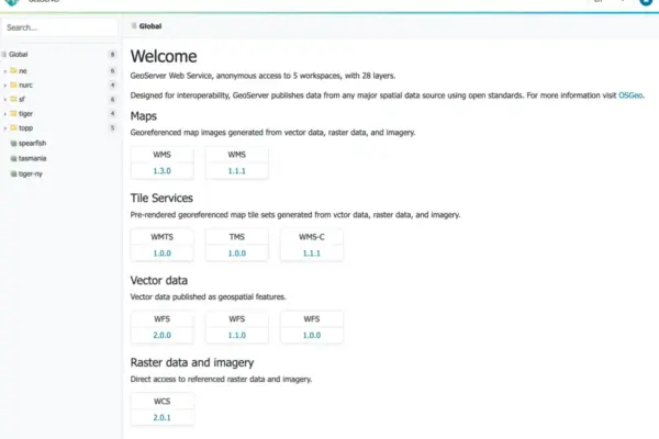
GeoServer 3.0.0 Released with Major Architecture Upgrades and New User Experience

November 3, 2026 Evan Lee Salim
The open-source geospatial community has reached a significant milestone with the official release of GeoServer 3.0.0. Available now for download…

Transportation and Mobility Tech

Enhancing Mobility and Independence: A Comprehensive Look at Top-Rated Wheelchair Accessories

November 3, 2026 Raul Delapena Setiawan
For individuals who rely on a wheelchair, as well as the caregivers who support them, daily life involves navigating a…
Data Visualization and Infographics

Navigating Unexpected Data: How to Deliver Difficult Insights When Audiences Expect Something Else

November 3, 2026 Jia Lissa
During a recent virtual public workshop hosted by Storytelling with Data, a thought-provoking question from a participant struck at the…
Data Visualization and Infographics

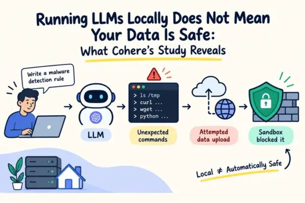
Running Local LLMs Does Not Automatically Guarantee Data Safety, Cohere Study Reveals

November 3, 2026 Raul Delapena Setiawan
Running a large language model locally has long been viewed as the gold standard for developers and organizations seeking absolute…
Web Mapping and Cartography

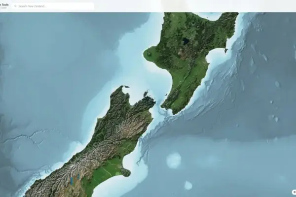
NZ Elevation Tools Launches Browser-Based Platform for High-Resolution New Zealand LiDAR Terrain Data

November 2, 2026 Jia Lissa
A web-based spatial application known as NZ Elevation Tools has launched, offering a lightweight and immediate gateway to New Zealand’s…
Location Intelligence and Spatial Analytics

Beyond the Platform: Why Enterprise Data Leaders Say Trust Is the Real Catalyst for AI Readiness

November 2, 2026 Reynand Wu
Most organizations have spent the better part of the last decade investing heavily in modern data infrastructure. Executive boards have…
Drone Mapping and Aerial Photography

Is Trump’s Plan to Build a U.S. Drone Industry Working?

November 2, 2026 Lina Irawan
Foreign manufacturers are pursuing U.S. production, domestic companies are attracting investment, and Pentagon orders are growing. But can the industry…
Geography and Earth Science

Ancient Chinese Eclipse Record Reveals Shifts in Earth’s Rotation and Ancient Solar Activity

November 2, 2026 Lina Hope
An international team of researchers has revisited one of the oldest precisely dated records of a total solar eclipse in…
Travel Hacking and Digital Nomad

Exploring the Evolution of Modern Cruise Ship Amenities: A Closer Look at the MSC Sportsplex Aboard the MSC World Europa

November 2, 2026 Asro
November 2, 2026 — As the cruise industry continues to evolve and push the boundaries of what is possible at…
Open Source Geospatial Software

GeoServer 2.27.6 Released with Urgent Security Fixes for End-of-Life Series

November 2, 2026 Raul Delapena Setiawan
The GeoServer development team has officially announced the immediate availability of GeoServer version 2.27.6, a specialized software release deployed specifically…

Posts navigation

Older posts
Newer posts

Recent Posts

  • From Hype to Reality: Big Data London Highlights Shift Toward AI Trust, Governance, and Data Readiness
  • SimActive and Phase One Streamline Large-Scale Defense Mapping
  • When Mountains Collapse into Melting Fjords: The Inside Story of Alaska’s Historic Megatsunami and the Urgent Need for Early Warnings
  • Los Angeles Modernizes City Operations with Launch of New Unified Legislative Management System
  • The Democratic Party’s 2028 Foreign Policy Battleground: Navigating a Fractured Global Order

Recent Comments

No comments to show.

Archives

  • November 2026
  • October 2026
  • September 2026
  • August 2026

Categories

  • Data Visualization and Infographics
  • Disaster Response and Humanitarian Mapping
  • Drone Mapping and Aerial Photography
  • Environmental and Climate Mapping
  • Geography and Earth Science
  • Geolocation and Cybersecurity
  • Geopolitics and Map News
  • GIS and Spatial Technology
  • Location Intelligence and Spatial Analytics
  • Open Data and Civic Tech
  • Open Source Geospatial Software
  • OpenStreetMap and Community Mapping
  • Remote Sensing and Satellite Imagery
  • Transportation and Mobility Tech
  • Travel Hacking and Digital Nomad
  • Urban Planning and Smart Cities
  • Web Mapping and Cartography

© 2026 Hack The Map. All rights reserved.

Theme: The Original by Rifan Muazin.