
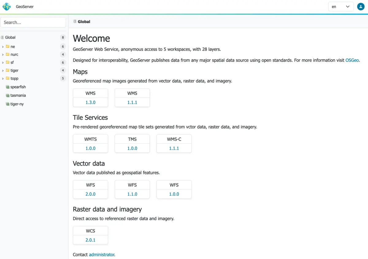
The open-source geospatial community has reached a significant milestone with the official release of GeoServer 3.0.0. Available now for download in binary, Windows installer, and WAR formats—alongside comprehensive documentation and a full suite of extensions—this major stable release represents the culmination of a full year of intensive development, strategic planning, and community-wide support. Released in conjunction with GeoTools 35.0 and GeoWebCache 2.0.0, GeoServer 3.0.0 brings critical architectural modernization, enhanced security considerations, and a completely refreshed user experience to production mapping environments worldwide.
The release was brought to fruition through the dedicated efforts of key contributors, including Andrea Aime of GeoSolutions, Jody Garnett of GeoCat, and Peter Smythe of AfriGIS. Their work anchors a broader collaborative effort driven by an extensive crowdfunding campaign and the continuous backing of numerous global organizations and individual donors.

Security Considerations
As a major stable release for the GeoServer 3.0.x series, version 3.0.0 includes vital updates addressing security vulnerabilities, making it an essential upgrade for production mapping systems. The project team leverages the CVE system to ensure security advisories reach a significantly wider audience than standard blog posts alone. Organizations managing geospatial data infrastructure are encouraged to review the official project security policy on GitHub for detailed guidance on how vulnerabilities are handled, reported, and mitigated across the software ecosystem.

Welcome to GeoServer 3
The launch of GeoServer 3 marks a new era for the platform. Following a grueling final stretch of development supported by a dedicated community, the release team has delivered a modernized foundation designed to meet the evolving demands of enterprise web mapping. Special care has been taken by the development team to ensure a seamless and straightforward upgrade path for administrators transitioning from the GeoServer 2.28.x series, minimizing disruption while introducing powerful under-the-hood enhancements.

The existence of GeoServer 3 is a testament to the success of the GeoServer 3 crowdfunding campaign. Financial sponsorship and technical backing from a diverse coalition of global organizations made the multi-milestone development roadmap possible. Key corporate and institutional sponsors supporting the initiative include AfriGIS, Camptocamp, DLR, Dorset Council, Deutsche Telekom, Frachtwerk GmbH, GeoCat BV, Geocrafter, Comune di Genova, g.on, GeoSolutions SRL, geosos, Geospatial Enabling Technologies, Incloud Limited, HL Consulting, IGN France, ITS Digital, JDev, Kreditanstalt für Wiederaufbau, Mammoth Geospatial, the National Ocean Service of NOAA, Plangis, the Office of Public Works, Open Geo Groep, OSGeo:Korea, OSGeo:UK, Quarticle Research Srl, Sea Island Software, Tailormap, terrestris, Ubigu, Value AG, Region Västra Götaland, and WaldExpert. In addition, individual contributions from Abhijit Gujar, Hennessy Becerra, Ivana Ivanova, John Bryant, Jason Horning, Jose Macchi, Peter Smythe, Sajjadul Islam, Sebastiano Meier, and Stefan Overkamp provided crucial grassroots support throughout the campaign.

New Context-Driven User Experience
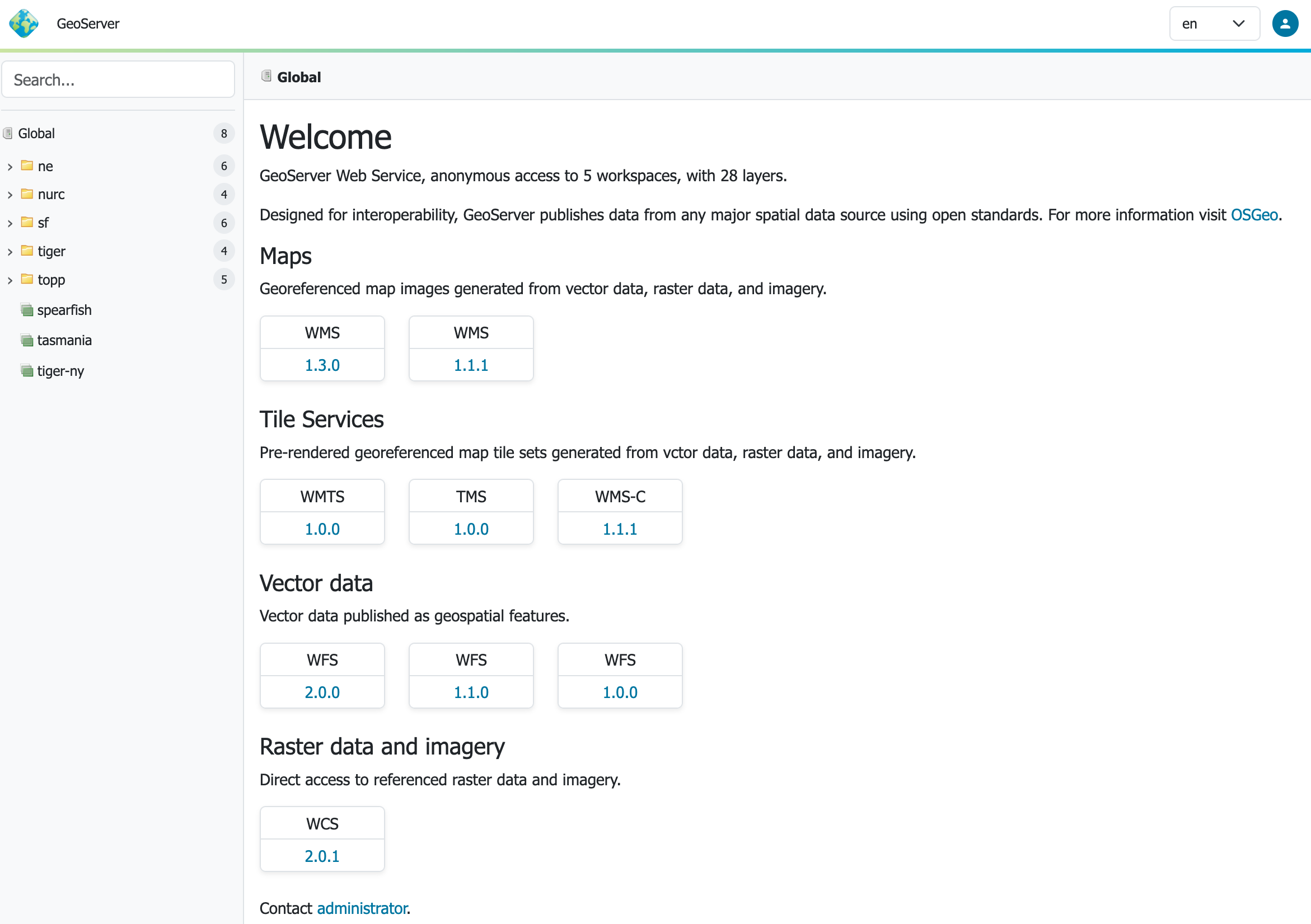
Users interacting with GeoServer 3 will immediately notice a transformed interface centered around a new context-driven user experience. Developed primarily through the contributions of Stefano Bovio of GeoSolutions and Jody Garnett of GeoCat, this overhaul aims to streamline administrative workflows and improve daily usability.

Complementing the context-driven layout is a newly implemented responsive-design theme, addressing a long-standing request from the global user base. This responsive framework ensures that map administrators and data managers can effectively navigate the interface across a wider variety of screen sizes and devices. Furthermore, GeoServer 3 introduces a modernized layer preview feature built on top of the latest OpenLayers library. Delivering a seamless, full-screen map preview capability, this addition enhances how administrators verify and interact with published spatial data layers directly within the web administration console.

Updated Environment and Modernized Web Stack
Under the hood, GeoServer 3 has undergone a massive modernization of its underlying web and application stack. The platform now officially requires Tomcat 11.0.x or Jetty 12.1 application servers. This requirement is the direct result of completing a comprehensive transition to the Spring Framework 7 and the Jakarta EE Servlet API 6.1.

Extensive testing has validated GeoServer 3 compatibility with Java 17 and Java 21, maintaining the same robust Java runtime baseline established in the 2.28.x series. While Java 25 undergoes automated testing within the development pipeline, the core team advises holding off on production adoption until the broader user community has thoroughly tested the environment and reported stability metrics.

For deployment planning, administrators must ensure their servlet containers align with the new Jakarta EE standards. GeoServer 3 requires Tomcat 11.0.x or Jetty 12.1 utilizing Servlet API 6.1. Older servlet containers relying on Java EE Servlet API versions 3.1, 4.0, or earlier Jakarta iterations like Servlet API 5.0 and 6.0—as well as Tomcat 10 or Jetty 11—are incompatible with this release. Maintaining compatibility with the older servlet containers remains exclusive to the GeoServer 2.28.x branch.

OAuth2 OpenID Connect Extension
Security integration has taken a major leap forward with the graduation of the OAuth2 OpenID Connect Security Integration plugin into an official, fully supported extension. The migration to Spring Security 7 required a complete overhaul of authentication modules, leading to the creation of this robust OIDC plugin. The new module officially supersedes and absorbs the responsibilities of previously separate Keycloak and OAuth2 plugins.

Following a successful release candidate phase that allowed developers to gather crucial real-world feedback, the module is now ready for production deployments. Administrators planning to upgrade from older authentication setups can consult the dedicated migration guide provided in the official documentation to ensure a smooth transition of their security policies.

New Documentation and Community Modules
Long-awaited improvements have also arrived for the project’s documentation infrastructure. The GeoServer user manual has completed its transition to Markdown, offering a streamlined, accessible reading and editing experience. The version switcher at the top of the documentation portal allows users to continue accessing legacy GeoServer 2.x guides as needed. This monumental documentation overhaul was spearheaded by Peter Smythe of AfriGIS and Jody Garnett of GeoCat. The project welcomes community contributions for fixing minor editorial issues or logging documentation improvements via the updated documentation guide.

Additionally, the updated documentation introduces a dedicated section for pending community modules. These experimental modules are actively seeking public usage, feedback, and support from the user community to help them graduate into fully supported official extensions. Available for download alongside each release, pending modules allow developers to test emerging features and provide the necessary validation for production readiness.

The 3.0.0 release encompasses a wide array of new features, performance improvements, bug fixes, and development tasks. A complete, itemized breakdown of code changes, resolved issues, and ongoing community module development is cataloged in the official release notes hosted on the project’s GitHub repository, providing full transparency for system administrators and developers deploying the new version into production environments.


