Skip to content
Breaking News
  • Unlocking Spatial Intelligence: How Thematic Maps Transform Complex Data into Actionable Insights
  • SmartQueryTools Launches Browser-Based Data Utility Suite Powered by WebAssembly to Enable Secure Local SQL Queries and File Conversions
  • Bridging the Gap: Why Trusted Data is the Missing Link in Enterprise AI Success
Monday, November 2, 2026
Edition: U.S. International Login

Hack The Map

Month: September 2026

Open Data and Civic Tech

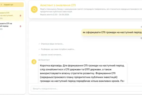
How Ukraine is Integrating Artificial Intelligence Into Its Massive Wartime Reconstruction Efforts

September 20, 2026 Azzam Bilal Chamdy
Over the past three years, Ukraine has been quietly implementing one of the most ambitious governance overhauls in its modern…
Environmental and Climate Mapping

Indonesia’s 2026 Wildfires Track Toward Historic Devastation as Intense El Niño Drives Extreme Dryness

September 20, 2026 Dwi Wanna
Wildfires currently tearing through large swathes of land in Indonesia are on a dangerous trajectory, putting the country on course…
Open Data and Civic Tech

How Italian Civic Coalitions Forged Olympic History with the First-Ever Transparency Portal for Milano Cortina 2026

September 20, 2026 Laily UPN
One month after the world-class athletes, television crews, and roaring fans departed, the reality of the Milano Cortina 2026 Olympic…
Environmental and Climate Mapping

UK Aviation on Track to Account for 80% of National CO2 Emissions by 2050, Climate Change Committee Warns

September 20, 2026 Layla Zulfa
Aviation is on track to be responsible for a staggering 80% of the United Kingdom’s entire carbon dioxide emissions by…
GIS and Spatial Technology

Mapping the Invisible: How Thematic Cartography Transforms Raw Data Into Spatial Stories

September 20, 2026 Pevita Pearce
In the rapidly evolving landscape of data visualization and geographic information science, maps have transcended their traditional role as mere…
Remote Sensing and Satellite Imagery

Sweltering Heat Dome Smashes Records Across the Central and Southern U.S. as Summer Winds Down

September 20, 2026 Iffa Jayyana
Even as the calendar turned toward the autumnal equinox and astronomical summer prepared to yield to cooler months, a vast…
Location Intelligence and Spatial Analytics

Precisely Named a Leader in 2026 IDC MarketScape for Data Intelligence Platform Software as AI Redefines Enterprise Data Strategy

September 20, 2026 Layla Zulfa
For the better part of the past decade, enterprise data catalogs and governance tools occupied the periphery of corporate IT…
Drone Mapping and Aerial Photography

City of Raleigh Uses Drones, AI Technology to Create Digital Twin

September 20, 2026 Nila Kartika Wati
The city of Raleigh, North Carolina, is deploying an advanced combination of drones and artificial-intelligence-enabled tools to build a comprehensive…
Geography and Earth Science

New Research Identifies Four Key Signs That Help Tropical Cyclones Stand Up Straight and Intensify

September 20, 2026 Nana Muazin
For decades, meteorologists tracking the unpredictable paths and ferocious power of tropical cyclones have understood a fundamental physical rule governing…
Urban Planning and Smart Cities

Congress Advances Water Resources Development Act of 2026 to Strengthen National Flood Protection and Infrastructure

September 20, 2026 Nila Kartika Wati
WASHINGTON — In a resounding display of bipartisan cooperation, the U.S. House of Representatives passed the Water Resources Development Act…

Posts navigation

Older posts
Newer posts

Recent Posts

  • Unlocking Spatial Intelligence: How Thematic Maps Transform Complex Data into Actionable Insights
  • SmartQueryTools Launches Browser-Based Data Utility Suite Powered by WebAssembly to Enable Secure Local SQL Queries and File Conversions
  • Bridging the Gap: Why Trusted Data is the Missing Link in Enterprise AI Success
  • Unauthorized Drone Activity Disrupts Jersey Airport for Two Consecutive Nights, Sparking Calls for Counter-Technology
  • NASA Satellite Images Reveal Antarctica’s "Icy Skull" on Vega Island and the Serious Climate Story Beneath

Recent Comments

No comments to show.

Archives

  • November 2026
  • October 2026
  • September 2026
  • August 2026

Categories

  • Data Visualization and Infographics
  • Disaster Response and Humanitarian Mapping
  • Drone Mapping and Aerial Photography
  • Environmental and Climate Mapping
  • Geography and Earth Science
  • Geolocation and Cybersecurity
  • Geopolitics and Map News
  • GIS and Spatial Technology
  • Location Intelligence and Spatial Analytics
  • Open Data and Civic Tech
  • Open Source Geospatial Software
  • OpenStreetMap and Community Mapping
  • Remote Sensing and Satellite Imagery
  • Transportation and Mobility Tech
  • Travel Hacking and Digital Nomad
  • Urban Planning and Smart Cities
  • Web Mapping and Cartography

© 2026 Hack The Map. All rights reserved.

Theme: The Original by Rifan Muazin.