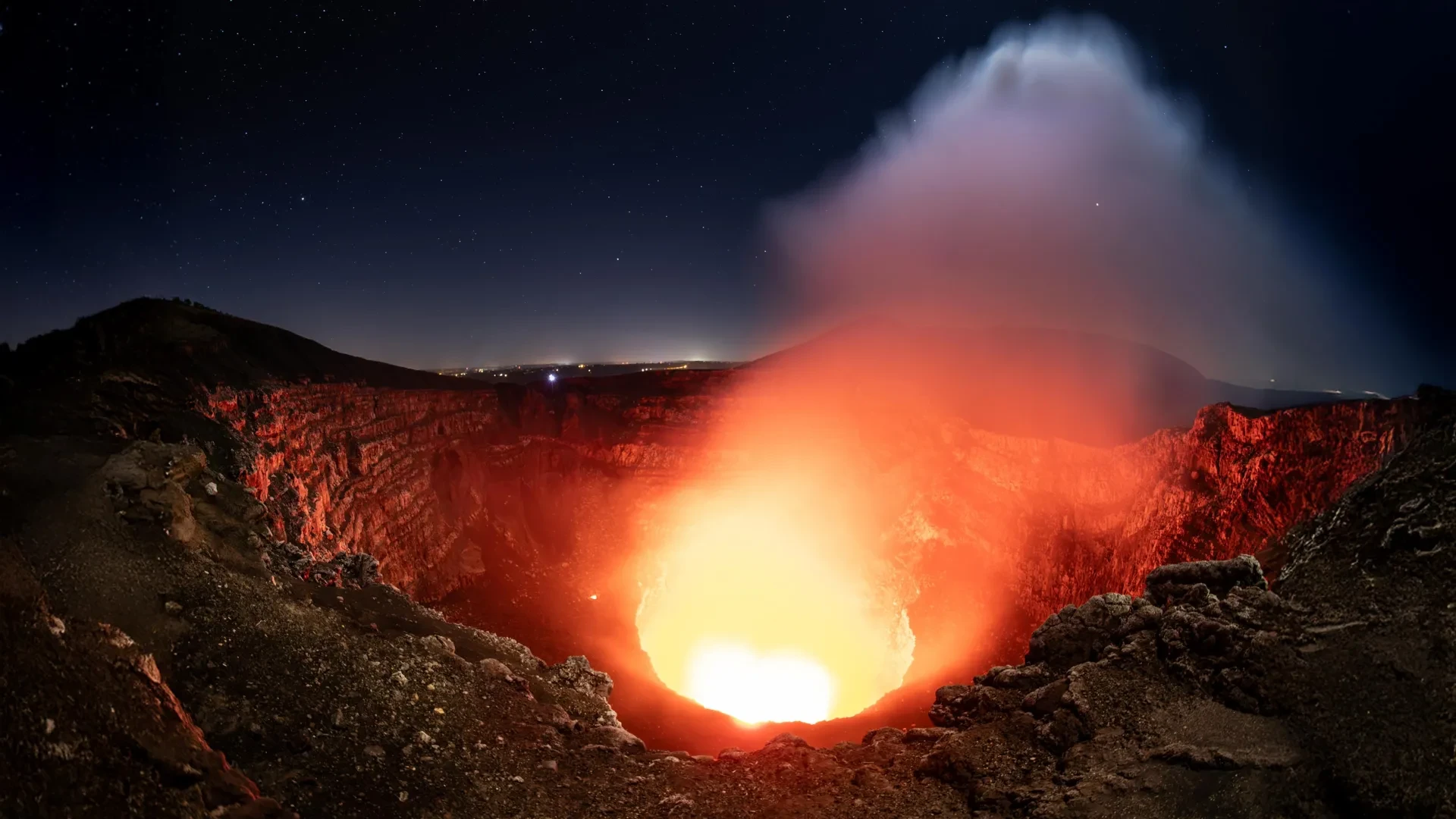
A volcano famous for its glowing lava lake is hiding a surprisingly complex system of magma deep underground. Scientists at Penn State have uncovered evidence of two previously unrecognized magma sources beneath Nicaragua’s active Masaya volcano, raising new questions about how molten rock moves beneath the surface and reshaping our understanding of how these hazardous systems operate.
The discovery is particularly important because approximately two million people live within 13 miles of the volcano, which is also a major national park and a popular tourist destination. Understanding its underground activity could help scientists recognize warning signs of future eruptions and better protect nearby communities from potential volcanic hazards.
Using six years of continuous satellite observations, researchers tracked subtle changes in the ground around Masaya. They discovered that one part of the volcano initially sank before beginning to rise, possibly indicating that fresh magma was entering a deep reservoir. Meanwhile, the ground around its active Santiago crater and lava lake continued to sink, suggesting that a separate, shallower magma reservoir was behaving independently and differently from the deeper system.
The findings, recently published in the scientific journal Geophysical Research Letters, reveal that the volcano’s underground magma system may be considerably more complicated than previously understood by geologists.
"These observations help scientists better understand how magma moves beneath Masaya and may improve monitoring and eruption forecasting in the future," said lead author Lizzie Johnson, who earned her bachelor’s degree in geosciences from Penn State.
Why Masaya Volcano Is Closely Monitored
Located near Managua, the capital city of Nicaragua, Masaya is a geologically complex volcano featuring multiple overlapping craters and calderas. Calderas are large, cauldron-like depressions that generally form when the ground collapses inward after massive amounts of magma are removed from an underground chamber during an eruption or magmatic shift.
Although scientists have studied Masaya for decades, the movement of magma through its intricate underground reservoirs and passageways remains poorly understood. These plumbing systems can change over time, making it difficult to determine exactly what is happening far beneath the surface of the earth.
"Having a thorough understanding of Masaya’s volcanic activity and its related hazards is critical as around two million people live near Masaya and the caldera is a national park and popular tourist destination," Johnson said. "Although Masaya last produced a major lava flow in 1772, its persistent degassing often produces dangerously high concentrations of sulfur dioxide volcanic gas."
Sulfur dioxide is a potentially harmful volcanic gas released continuously as magma approaches or remains near the surface. Even without a major explosive eruption, elevated concentrations of this gas can create dangerous and unhealthy conditions for tourists, park rangers, and surrounding communities.
Young Cheol Kim, who completed his doctorate in geosciences at Penn State, explained that monitoring the volcano continuously is essential for distinguishing normal, everyday activity from sudden changes that might signal increasing volcanic hazards.
"Doing continuous monitoring allows us to understand the baseline activity and identify see if things are changing," he said, explaining that certain shifts in volcanic behavior could indicate a period of heightened unrest or a possible future eruption. "And then if there is a need to warn people, we can do that in a timely manner."
Satellites Reveal Hidden Movements Beneath the Volcano
To investigate Masaya’s hidden underground activity, the research team analyzed extensive measurements collected by the European Space Agency’s Sentinel-1 satellite, which observes the volcano approximately once every 12 days as it passes overhead.
The team utilized an advanced remote sensing technique called interferometric synthetic aperture radar, commonly known as InSAR. This technology can detect extremely small, millimeter-scale changes in the elevation of Earth’s surface over large areas. By comparing satellite measurements taken at different points in time, scientists can precisely identify areas where the ground is rising through inflation or sinking through subsidence.
The technique combines two important capabilities. Synthetic aperture radar sends microwave signals down toward Earth’s surface, allowing satellites to collect accurate measurements even when thick clouds obscure the ground from optical view. Interferometry then compares the returning radar signals to detect microscopic changes in the distance between the satellite and the ground surface.
This capability is especially valuable in tropical regions like Central America, where frequent cloud cover can make conventional satellite imagery and aerial photography unreliable.
"Cloud penetration is important for volcanoes because many of them, like Masaya, are in tropical areas where there is often cloud cover," Kim explained. "And when we look at all the different satellite images across multiple years, we can see how the distance between the satellite and the ground changes, where it is uplifting or subsiding."
By examining these subtle movements over long periods, researchers can investigate complex geological processes happening far below the surface without needing to directly observe the molten magma itself.
Two Magma Reservoirs Behaving in Different Ways
The satellite measurements revealed an intriguing and unexpected pattern between 2018 and 2024. During the first part of the study period, the ground within Masaya’s broader caldera gradually subsided, meaning it moved downward. Later in the timeline, the exact same general area began to rise, or inflate.
Scientists believe this transition could reflect significant changes in the amount of magma stored deep underground. When magma drains away from a reservoir, the overlying ground loses support and can sink. Conversely, when additional magma enters and increases pressure within a reservoir, the surface above may rise.
The most surprising finding of the study was that the area immediately surrounding the active Santiago crater did not follow the same pattern as the rest of the caldera. Instead, it continued to steadily sink throughout the entire six-year study period, even as the broader caldera surrounding it began rising.
"When it’s subsiding, that means that there’s probably magma draining away from the volcano, but once the ground starts uplifting again, that can mean that there’s potentially new magma moving in," Johnson said. "At the same time, the area directly around the active Santiago crater deflated over the entire study period independently of the transition to inflation of the main reservoir. This indicates that the plumbing system is more complex and could be due to decreasing magma in a second, shallower reservoir."
Together, these observations strongly suggest that Masaya may have at least two distinct parts of its magma storage system undergoing completely different physical changes at the same time. A deeper source could be actively supplying additional magma to the main reservoir, while a separate, shallower reservoir near the Santiago crater may be losing magma or depressurizing.
This discovery helps explain why different sections of the same volcano moved in opposite directions during the observation window.
What the Discovery Means for Future Eruptions
Understanding these underground movements is crucial because shifts in the ground surface can provide vital clues about where magma is accumulating, where it is moving through the crust, and how it might eventually find a path to the surface.
The researchers emphasized that their observations did not reveal any immediate danger or imminent threat to the communities surrounding Masaya. However, identifying the volcano’s baseline behavior and understanding its complex magma supply system could make it much easier for authorities and scientists to recognize unusual changes in the future.
Continued satellite observations, combined with more detailed computer models of volcanic mechanics, could also help scientists better understand the intricate connections between deep underground magma reservoirs and persistent activity at the surface.
"Further long-term geodetic and modeling studies will provide a more thorough understanding and allow for effective hazard monitoring and mitigation at Masaya and other lava-lake hosting basaltic volcanoes," Johnson said.
The findings may therefore have important implications well beyond Nicaragua, particularly for other active volcanoes around the world that contain persistent lava lakes and similarly complex underground plumbing systems.
From Undergraduate Research to Volcano Science
Johnson first became involved in the demanding research project after attending an academic presentation by Christelle Wauthier, a Penn State professor of geosciences and computational sciences hub director at the university’s Institute for Computational and Data Sciences.
She completed the research as an undergraduate as part of her Schreyer Honors College thesis, working closely alongside graduate researchers, including Kim, to analyze massive sets of satellite measurements and develop her scientific skills.
"I appreciated learning how a research group works," said Johnson, who has since started a doctoral program in Earth sciences at the University of Hawaii at Manoa, where she will continue studying volcanoes by using seismic waves to image deep below the surface of Kilauea volcano. "I had never had any experience with research, so it was great to be able to join in the group meetings and get to hear about everybody’s work. And learning coding was also useful as I continue with my Ph.D."
The research received financial support from the U.S. National Science Foundation through specific awards, along with advanced computational resources provided by Penn State’s Institute for Computational and Data Sciences. The authors remain solely responsible for the scientific findings and conclusions, which do not necessarily represent the official views of the funding organizations.