
Whether referring to the uniquely punctuated municipality of Saint-Louis-du-Ha! Ha! in Quebec, the dozens of communities sharing the name Springfield across the United States, or the two-letter coastal enclave of Ea in the Basque Country, names are the fundamental anchors of human geography. They define where communities reside, signify cultural origins, and guide travelers toward their destinations. Across the globe, almost every physical feature that humans interact with carries a verbal identifier, and capturing this vast linguistic landscape has become one of the most intricate undertakings in modern cartography.
Within the collaborative digital ecosystem of OpenStreetMap, volunteer mappers have cataloged more than 115 million individual names. This immense repository of toponyms represents an unprecedented, ground-up inventory of the world’s streets, hamlets, retail shops, bodies of water, and natural landmarks. Behind this monumental total lies a sophisticated yet deliberately flexible tagging framework, a collection of core mapping principles, and an ongoing technical evolution designed to navigate the intricate realities of how human beings name the world around them.
Local Names of Features on OpenStreetMap
At the heart of OpenStreetMap’s vast geospatial database is a simple, standardized convention: the primary verbal identifier by which people refer to a feature is documented using the name= tag. In the project’s data architecture, this key represents the most common, recognizable designation applied to a feature in the local language spoken where the object physically exists.
This standard is directly tied to OpenStreetMap’s foundational "on the ground rule," which holds that maps should reflect physical and observable reality as experienced by people living and working in that specific area. For instance, a surveyor mapping a street in France would record the roadway with the tag name=Rue des Beaux-Arts. This ensures that anyone looking at the primary geographic data sees the street identified exactly as it appears on local street signs, storefronts, and in daily regional communication. The community of volunteer contributors actively monitors the database to verify that this standard is upheld across a dizzying spectrum of features, from small corner stores and suburban cul-de-sacs to continental mountain ranges and world oceans.
Visitors to the main project portal at openstreetmap.org encounter this principle immediately. The default cartographic presentation on the website relies on a rendering style known as "osm-carto." Under this baseline style, features are rendered using their local name= values rather than attempting to adapt labels dynamically to the geographic location or browser language of the visitor. An English-speaking user browsing a map of Tokyo or Athens on this primary layer will see names rendered in Japanese or Greek script, reflecting the local linguistic environment.
The reliance on local naming in the default map style is grounded in practical and technical considerations. Rendering dynamic, multi-lingual raster map tiles on a global scale demands immense computational power, and presenting the local name establishes a stable, culturally accurate baseline that accurately represents the ground truth of the mapped area. For the volunteer mapping community that builds and maintains the database, this default layer acts as an essential diagnostic tool, ensuring that the primary local identifier is present, accurate, and free of extraneous translations or formatting errors.
Additional Names and Linguistic Layers on the Map
While the primary name= tag serves as the standard local baseline, geography is rarely monolingual or static. Features across the world often possess multiple names simultaneously, reflecting layered histories, official decrees, minority languages, and global translations. To accommodate this reality, OpenStreetMap supports a comprehensive taxonomy of secondary name tags designed to categorize how different names are used in contrast to the primary local identifier.
The database can store alternative designations, official legal titles, colloquial variants, and historical names that have fallen out of common use. Beyond these functional categories, OpenStreetMap employs a standardized international system using language codes to record translations and transcriptions. When a contributor wishes to document how a feature is referred to in other languages, they append an ISO language code suffix to the tag. A feature in France, for example, can retain its French designation under the primary name= key while also carrying name:en= for its English equivalent, name:fr= for French, or any other supported language.
This coding framework is capable of handling deep linguistic nuance. It extends beyond broad national languages to account for distinct writing systems, regional variations, and dialects. Because English spoken and written in Great Britain incorporates different idioms and spellings than the English used in Australia, the tagging taxonomy accommodates specific regional variants. Through this multifaceted approach, a single geographic feature—such as a major capital city or an international waterway—can accumulate dozens of structured name tags, transforming OpenStreetMap into a rich multilingual lexicon.
On the front end of the openstreetmap.org website, handling this linguistic variety has historically presented a technical challenge. While the standard osm-carto layer continues to display only the primary local name=, the site offers a layer switcher that allows users to explore alternative visual presentations. Furthermore, development has been advancing on a new vector tile layer for the main platform. Unlike traditional pre-rendered raster image tiles, vector tiles deliver raw geometric data and label attributes directly to the user’s browser, paving the way for maps that can dynamically adjust label displays to match a user’s preferred local language. Elsewhere across the broader geospatial web, independent map creators have long leveraged this data to publish specialized styles that render cartography exclusively in single languages, such as German or English.
One Database, Unlimited Maps: The Power of Open Cartographic Data
The existence of millions of secondary and multi-lingual tags underlines a fundamental reality of the project: OpenStreetMap is not merely a website with a single, static world map. Instead, the website is primarily an editing and data-inspection platform designed to facilitate the work of volunteer contributors. The true core of the project is the underlying geospatial database itself.

OpenStreetMap’s data is released freely to the global public under the Open Database License (ODbL). Under this legal framework, any individual, organization, or enterprise is permitted to download, filter, modify, and redistribute the database for virtually any purpose, including commercial applications, provided proper attribution and license terms are maintained.
Because the entire data pipeline is open and unencumbered by restrictive commercial fees, it supports an extraordinarily broad range of applications. Humanitarian organizations rely on OpenStreetMap data to coordinate disaster relief operations in regions where proprietary commercial maps offer little detail. Grassroots community groups use it to document local cycling networks and public amenities. At the same time, major technology corporations, video game developers, scientific researchers, and government agencies incorporate OSM data into their services and operational platforms.
Because all 115 million names and their accompanying language tags are preserved within this shared database, developers and cartographers are free to build custom maps that extract only the exact information they require. An application designed for international maritime logistics can query only the international names of ports and shipping channels; a local transit authority can filter for regional transit identifiers; and an educational platform can render historical boundaries and antiquated toponyms. The single database provides the foundational infrastructure, leaving the visual output and linguistic focus entirely up to the creator.
What About Official Names?
In many instances, the common, colloquial name used by the people living near a geographic feature aligns seamlessly with its legal, government-sanctioned title. When this occurs, the primary name= tag serves double duty as both the everyday identifier and the formal designation. However, discrepancies frequently arise when governmental authorities introduce new titles, alter administrative terminology, or issue decrees that diverge from actual public usage.
To resolve these tensions, OpenStreetMap maintains a dedicated official_name= tag. This key allows mappers to record formal, legally enacted names without disrupting the primary name= tag, which remains reserved for the moniker genuinely used on the ground by the local populace. If an administrative body renames a public plaza or natural landmark, but residents, business owners, and local media continue using the traditional moniker, the established name remains intact under the primary tag, while the government-sanctioned title is cataloged under the official name key.
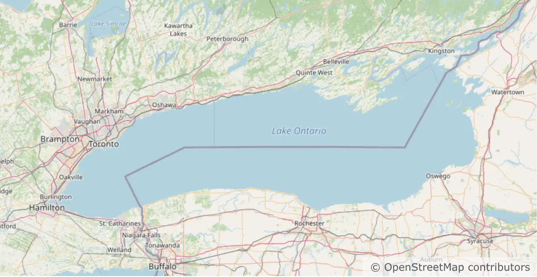
A prominent illustration of this dynamic emerged during community deliberations regarding Lake Ontario following a United States executive order touching on the water body’s designation. The political maneuver prompted an active discussion within the OpenStreetMap community regarding how to handle the proposed title of "Lake America."
Following established cartographic protocols, contributors reached a consensus that preserved empirical reality: because the overwhelming majority of people living on and around the international lake continue to call it Lake Ontario, the primary name= tag remained completely unchanged. To accurately record the legal development without overwriting physical vernacular, mappers introduced the tag official_name:en-US=Lake America.
This tagging decision highlighted the strength of OpenStreetMap’s non-destructive data model. Because the search engines and routing algorithms operating across openstreetmap.org and third-party applications ingest the entire suite of name tags, the database remains comprehensive and resilient. A user searching for "Lake America" is immediately directed to the correct body of water, while the map continues to faithfully present the lake under the time-honored name recognized by the global public.
The Name of the Game
Ultimately, the handling of place names reveals the core philosophy that distinguishes OpenStreetMap from conventional, centralized mapping providers. Rather than imposing a top-down, corporate, or politically motivated perspective on world geography, the platform relies on a decentralized, international community bound by non-commercial freedom and a dedication to mapping what exists in reality.
By adhering firmly to the "on the ground rule," the community ensures that names on the baseline map reflect the lived experiences of everyday residents rather than distant administrative decrees or algorithmic assumptions. At the same time, the project’s flexible, multi-layered data structure avoids the trap of cartographic oversimplification. By allowing mappers to pair primary local names with dialect-specific variants, secondary translations, and official administrative designations, OpenStreetMap accommodates the full complexity of global culture.
For cartographers, developers, and everyday users across the globe, this open repository offers the freedom to build maps tailored to any audience, language, or perspective. By treating toponymy as an open, collective, and living record, OpenStreetMap continues to demonstrate that when it comes to mapping the world by its true names, an open community remains an unmatched authority.


