
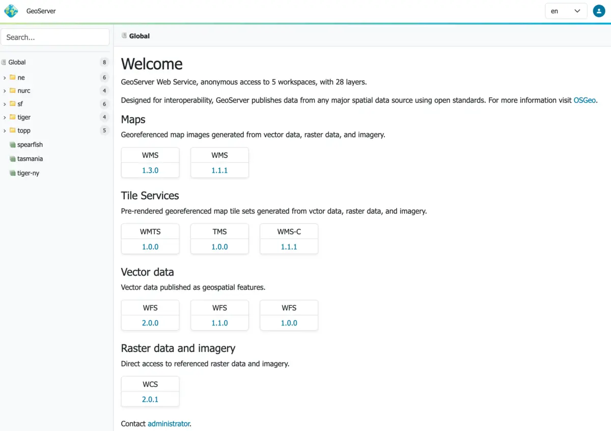
The open-source geospatial community has reached a major milestone with the official release of GeoServer 3.0.0. Available now for download across binary, Windows, and Web Archive (WAR) formats—alongside comprehensive documentation and a robust suite of extensions—this stable release represents the culmination of a full year of intensive planning, community support, and modern software development. Built in conjunction with GeoTools 35.0 and GeoWebCache 2.0.0, the new major version brings foundational architectural upgrades, a completely revamped user interface, and critical security enhancements tailored for modern production environments.
The launch of GeoServer 3.0.0 marks the end of a long development journey made possible by the dedicated contributions of key developers, including Andrea Aime of GeoSolutions, Jody Garnett of GeoCat, and Peter Smythe of AfriGIS. Crucially, the milestone was heavily backed by a successful crowdfunding campaign, uniting dozens of corporate sponsors and individual donors from across the globe to bring the vision of GeoServer 3 to life.

Security Considerations and Production Readiness
As a core component of enterprise spatial data infrastructures, security remains a top priority for the project. The 3.0.0 release addresses multiple underlying security vulnerabilities, making it an essential upgrade for any production system currently running older iterations. By utilizing the Common Vulnerabilities and Exposures (CVE) system, the GeoServer development team ensures that critical security advisories reach a much broader audience than traditional blog posts alone. Organizations managing geospatial web services are encouraged to review the project’s formal security policy on GitHub to understand how vulnerabilities are systematically tracked, managed, and mitigated.

A Straightforward Upgrade Path
Transitioning major software versions often introduces friction for system administrators, but the core team has taken special care to ensure a seamless upgrade path for users moving from the GeoServer 2.28.x series. Detailed instructions have been published in the official upgrade guide to facilitate smooth migrations of existing map layers, styles, and configurations.
The arrival of GeoServer 3 also introduces a modernized enterprise environment. The software now requires Tomcat 11.0.x and Jetty 12.1 application servers, a technical leap made possible by completing a comprehensive transition to the Spring Framework 7 and Jakarta EE Servlet API 6.1 stacks. Extensive testing has verified stability with Java 17 and Java 21, matching the baseline runtime expectations of previous versions. While automated testing has begun exploring compatibility with Java 25, the development team advises production environments to hold off on adopting the newer runtime until the wider community has thoroughly vetted its performance.

Context-Driven User Experience and Responsive Design
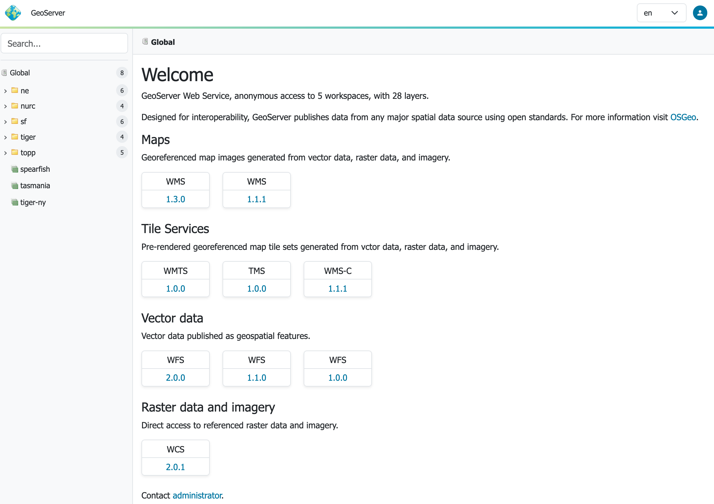
One of the most visible changes in GeoServer 3.0.0 is the introduction of a completely reimagined context-driven user experience. Spearheaded by Stefano Bovio of GeoSolutions, alongside contributions from Jody Garnett and other community members, the administrative interface has been modernized to streamline common geospatial workflows.

At the heart of this redesign is a new responsive design theme, which has been frequently requested by administrators who need to manage map services across various devices and screen sizes. Furthermore, the platform introduces a brand-new, full-screen layer preview powered by the latest OpenLayers library. This enhancement allows administrators and users to inspect vector and raster data layers with greater speed and visual fidelity directly within the browser interface.

Advanced Authentication with OAuth2 and OpenID Connect
Enterprise integration receives a significant boost in GeoServer 3 with the graduation of the OAuth2 OpenID Connect (OIDC) security integration into an official extension. This development follows a massive behind-the-scenes migration to Spring Security 7. The new OIDC module officially absorbs and streamlines the functionalities previously handled by separate Keycloak and OAuth2 plugins, offering a unified, modern standard for identity management and single sign-on capabilities. Detailed migration pathways have been documented to help administrators transition their security configurations smoothly from older plugins to the new OIDC extension.

Transition to Markdown Documentation
In addition to software and security updates, the project has completed a massive overhaul of its user manual. After years of relying on traditional documentation formats, the team has successfully transitioned the entire documentation ecosystem to Markdown. Led by Peter Smythe of AfriGIS and Jody Garnett of GeoCat, this monumental undertaking makes contributing to the documentation much easier for the wider community.

The updated user manual features a new structure, including a dedicated section for pending community modules. These modules represent experimental features that are actively seeking public feedback, testing, and institutional support so they can eventually graduate into fully supported official extensions. Users interested in collaborating on these experimental features are encouraged to reach out directly to the respective module developers.

Global Community and Sponsor Support
The realization of GeoServer 3.0.0 is a testament to open-source collaboration, driven forward by an extensive network of organizational sponsors and individual contributors. Financial and technical backing for the GeoServer 3 crowdfunding campaign came from a diverse array of public institutions, private enterprises, and regional OSGeo chapters from around the world.

Corporate supporters span multiple industries and public sectors, including AfriGIS, Camptocamp, the German Aerospace Center (DLR), Dorset Council, Deutsche Telekom, Frachtwerk GmbH, GeoCat BV, Geocrafter, the Municipality of Genoa, g.on, GeoSolutions, geosos, Geospatial Enabling Technologies (GET), Incloud Limited, HL Consulting, the French National Institute of Geographic and Forest Information (IGN), ITS Digital, JDev, Kreditanstalt für Wiederaufbau, Mammoth Geospatial, the US National Ocean Service, Plangis, the Office of Public Works, Open Geo Groep, OSGeo:Korea, OSGeo:UK, Quarticle Research, Sea Island Software, Tailormap, terrestris, Ubigu, Value AG, Region Västra Götaland, and WaldExpert.

Additionally, individual financial contributions from community members such as Abhijit Gujar, Hennessy Becerra, Ivana Ivanova, John Bryant, Jason Horning, Jose Macchi, Peter Smythe, Sajjadul Islam, Sebastiano Meier, and Stefan Overkamp played a vital role in sustaining the development effort.

With the release of version 3.0.0, the GeoServer project enters a robust new era of performance, security, and usability. Complete release notes detailing all new features, improvements, bug fixes, and community module developments are available on the project’s official GitHub repository.


