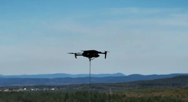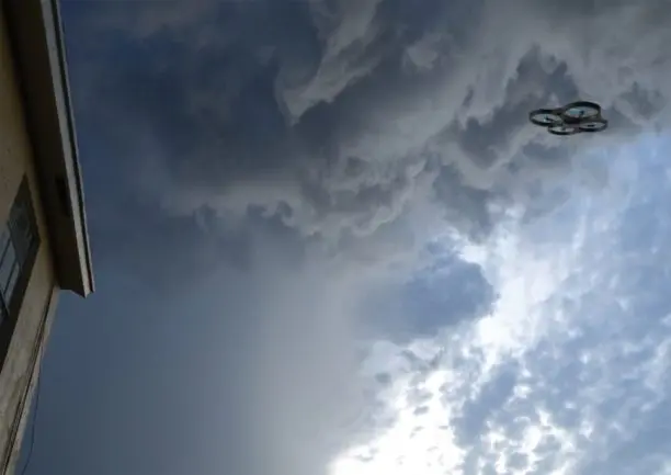
Commercial drones have long established their utility by observing the world below our feet. Across industries ranging from real estate and construction to agriculture and infrastructure inspection, unmanned aerial systems (UAS) have redefined how we map land, monitor crops, and film job sites. However, a new class of specialized commercial missions is pushing these aircraft upward, moving them away from passive observation of the earth’s surface and directly into the turbulent, highly dynamic environment of the atmosphere itself.
This paradigm shift is currently underway in the western United States, where state agencies are looking to modernize traditional water management strategies. Notably, the Utah Division of Water Resources is actively exploring drone-based cloud seeding as a high-tech successor to the crewed aircraft tests it conducted between 2022 and 2025. This evolutionary step places unmanned aviation at a fascinating intersection of modern aviation, complex meteorology, advanced software autonomy, and critical state water infrastructure.
To understand the broader implications of this trend, industry observers must look beyond the aircraft hardware alone. According to Andrew Verda, founder and CEO of Utah-based Alto Cirra, the true catalyst for this technological leap involves a delicate synthesis of atmospheric science, precision measurement, and regulatory milestones like Beyond Visual Line of Sight (BVLOS) progress. Verda argues that these foundational elements will ultimately determine whether drone-based cloud seeding transitions from an experimental concept into a dependable, everyday operational tool for water managers. Furthermore, he makes the compelling case that atmospheric UAS may soon warrant an entirely distinct category within the broader commercial drone industry.
The Evolution of Cloud Seeding
Cloud seeding is far from a novel technology. For decades, water conservation districts, state agencies, and private entities across the western United States have utilized ground-based generators and crewed airplanes to introduce ice-nucleating particles into suitable winter storms. The primary objective of these long-standing efforts has always been to bolster dwindling snowpacks, which serve as vital natural reservoirs for municipal water supplies, agricultural irrigation, and hydroelectric power generation across arid regions.
What is fundamentally changing today, however, is the delivery mechanism. By transitioning toward unmanned aircraft, atmospheric programs can potentially make cloud seeding operations significantly more targeted, remarkably more repeatable, and eventually much more scalable. This operational evolution creates an entirely new frontier where aviation hardware meets atmospheric physics.
Utah’s rich history with cloud seeding dates back to the 1950s, highlighting the state’s long-term commitment to augmenting its natural water supplies. The Utah Division of Water Resources notes that its recent exploration of expanded drone-based technology builds directly upon the foundational data gathered during crewed aircraft testing phases. One of the primary operational advantages cited by state officials is the ability of a UAS to fly directly into active cloud formations and release seeding materials precisely where temperature, moisture, and overall atmospheric conditions are most favorable.
For the wider commercial drone industry, the overarching narrative extends well beyond cloud seeding as a standalone application. Instead, it signals a monumental turning point: what happens when drones cease merely observing the weather and begin actively operating within it.
Why Use a Drone?
Traditional cloud-seeding methodologies generally fall into two distinct operational categories, each carrying inherent limitations. Ground-based generators release seeding agents from mountain ridges or valleys, relying entirely on unpredictable surface winds and complex atmospheric lifting to carry those particles upward into the targeted portion of a winter storm cloud. While economical, ground generators offer very little control over where the material ultimately travels.
On the other hand, crewed aircraft can place seeding material much closer to a specific target area within a storm. Yet, utilizing manned airplanes introduces substantial financial costs, strict crew scheduling requirements, logistical hurdles, and significant human risk when flying light aircraft through severe winter weather and icing conditions over rugged mountain terrain.
Unmanned aerial systems occupy a uniquely advantageous position between these two traditional approaches. A specialized drone can be launched relatively close to a designated target area, guided autonomously to a specific altitude or atmospheric region, complete its mission, recover safely, and potentially launch again during the exact same storm cycle. Furthermore, sophisticated sensors mounted aboard the aircraft can continuously stream vital telemetry data concerning temperature, relative humidity, precise GPS location, and surrounding atmospheric conditions throughout the duration of the flight.
Most importantly, an unmanned aircraft has the capacity to actively go where the meteorological opportunity exists, rather than relying passively on the atmosphere to transport seeding materials to the desired location.
The Utah Division of Water Resources emphasizes that drone operations facilitate far greater precision when targeting specific zones inside clouds. State officials are careful to clarify that cloud seeding occurs exclusively during qualifying winter precipitation events. Crucially, cloud seeding cannot create storms or manufacture precipitation from clear blue skies.
That distinction remains vital for public understanding and scientific integrity. Cloud seeding is not about manufacturing weather out of nothing; rather, it is an effort to influence the microphysical processes already occurring naturally inside an existing cloud when all necessary atmospheric ingredients are already present.
During winter operations, this process typically involves introducing silver iodide particles into regions containing supercooled liquid water—water that remains liquid even though temperatures have dropped below freezing. Because silver iodide possesses a crystalline molecular structure remarkably similar to ice, it acts as an effective nucleus around which ice crystals can rapidly form. Once these ice crystals grow sufficiently heavy, they fall from the cloud as natural snow.
Even so, the aircraft itself represents only a single component of a much larger, highly complex system. The far more challenging problem lies in determining precisely when and where to deploy that aircraft.
The Drone Is Only as Useful as the Meteorology Behind It
As unmanned aerial platforms become increasingly sophisticated and robust, atmospheric operations will likely evolve into a tightly integrated, closed-loop system.
The operational workflow begins when advanced meteorological data identifies a potential weather opportunity. Sophisticated predictive models then determine where the most favorable atmospheric conditions are likely to develop. Once airborne, onboard environmental sensors verify those micro-conditions in real time, allowing the aircraft to deploy seeding material at the exact optimal location. Finally, a combination of weather radar, flight telemetry, continuous atmospheric measurements, and ground observations are analyzed to evaluate the outcome of the mission.
This comprehensive model mirrors the vision driving Alto Cirra. The Utah-based enterprise focuses on deploying fixed-wing vertical take-off and landing (VTOL) aircraft, advanced meteorological modeling, onboard environmental sensing, and precision payload deployment systems to explore how UAS can substantially enhance winter cloud-seeding programs.
Yet, building a successful operational framework involves far more than simply strapping a chemical flare onto a flying wing. If drone-based cloud seeding is to mature into a reliable, widespread operational tool, the commercial drone industry must solve complex challenges surrounding atmospheric sensing, sophisticated mission planning, multi-aircraft fleet coordination, rigorous verification methods, safe airspace integration, and—perhaps most critically—measurement.
Measuring What Happened Is the Hard Part
Cloud seeding introduces an unusual and persistent measurement problem that distinguishes it from almost any other commercial drone application. When heavy snow falls following a seeding mission, researchers face a difficult question: how much of that accumulated snowfall would have naturally occurred without human intervention?
Atmospheric systems are inherently chaotic and variable. Two separate winter storms that appear nearly identical on radar can produce drastically different precipitation outcomes. This inherent variability makes attribution considerably more difficult than measuring the performance metrics of a standard aerial inspection or agricultural mapping drone mission.

Consequently, the industry must resist the natural temptation to treat every successful snowfall event following a flight as definitive proof of operational effectiveness.
The state of Utah openly acknowledges that evaluating the true effectiveness of cloud seeding remains one of the field’s most stubborn scientific challenges. To address this hurdle, the state launched expanded research initiatives incorporating high-resolution atmospheric measurements, advanced hydrological modeling, and detailed trace-chemistry analysis. These efforts are designed to provide a clearer, more scientifically rigorous understanding of both operational effectiveness and potential environmental impacts.
This meticulous measurement work is becoming increasingly critical as modern drones make it entirely feasible to collect vastly more granular mission data than ever before. A modern UAS can log precise flight trajectories, exact timestamps, pinpoint deployment locations, continuous onboard sensor readings, and dynamic operating conditions.
When researchers combine these rich UAS datasets with ground-based weather radar, high-altitude snow gauges, sophisticated atmospheric models, and targeted ground sampling, they gain access to an unprecedented volume of information. This multi-layered approach far surpasses simply knowing that an automated ground generator was switched on somewhere upwind of a mountain range.
From an operational perspective, this robust data layer may ultimately prove to be just as valuable as the physical aircraft itself.
The Regulatory Challenge Is Significant
Flying a commercial drone through harsh winter mountain weather demands a vastly different operational standard than operating a standard quadcopter over a suburban construction site. These specialized missions routinely involve high altitudes, complex terrain, severely restricted visibility, dangerous icing conditions, rapidly shifting wind patterns, and long-range flights that benefit immensely from Beyond Visual Line of Sight (BVLOS) capabilities.
Under current Federal Aviation Administration (FAA) regulations, standard Part 107 operators generally must maintain visual line of sight with their aircraft at all times unless they secure the appropriate regulatory waivers. To obtain such waivers, operators must rigorously demonstrate to regulators how they will maintain an equivalent level of safety through alternative operational procedures, redundant technologies, or advanced ground-based surveillance.
Consequently, the long-term future of atmospheric UAS operations is inextricably linked to the broader drone industry’s ongoing progress toward routine BVLOS flight. Advanced detect-and-avoid (DAA) avionics, highly reliable command-and-control communication links, robust remote operations frameworks, redundant safety systems, enhanced airspace awareness, and proven aircraft reliability are not abstract regulatory exercises in this domain. They are immediate, practical requirements that directly dictate how effectively a drone can operate inside an active winter storm.
State-level regulations introduce yet another layer of compliance complexity. In Utah, commercial cloud-seeding operators must secure formal permits and submit comprehensive operational plans detailing target-area boundaries, comprehensive insurance documentation, specific seeding methodologies and materials, and strict meteorological criteria for temporarily suspending operations under adverse conditions.
The resulting regulatory environment sits squarely at the intersection of two heavily regulated domains: civil aviation and atmospheric resource management. While this profound complexity will likely temper the speed of initial deployment, it will simultaneously force the development of safer, more resilient, and more accountable systems.
A New Category of Drone Infrastructure
Within the commercial drone sector, a persistent tendency exists to categorize the entire market strictly by immediate aircraft use case: infrastructure inspection drones, package delivery drones, agricultural crop-monitoring drones, and defense surveillance drones.
However, atmospheric UAS may ultimately merit an entirely separate category of their own. While cloud seeding serves as a prominent initial application, many of the core underlying technologies possess much broader relevance across environmental and scientific sectors.
Aircraft engineered to operate reliably and safely in severe atmospheric conditions open up new possibilities for collecting high-resolution weather observations in remote or hazardous locations where conventional meteorological sensing infrastructure is sparse or entirely absent. Distributed fleets of weather-hardened drones could soon assist meteorologists in sampling the lower atmosphere at unprecedented spatial and temporal resolutions.
This identical technological stack—ruggedized airframes, reliable autonomous navigation, sophisticated atmospheric sensing suites, remote operations capabilities, and real-time predictive modeling—could eventually support advanced scientific research, rapid wildfire smoke monitoring, severe-weather observation, comprehensive environmental measurement, and numerous other specialized missions.
Instead of merely carrying an optical camera or thermal sensor, these specialized aircraft function essentially as mobile, autonomous atmospheric sensor platforms. In select applications, they also evolve into active tools capable of interacting directly with the very environmental systems they are measuring.
The Opportunity and the Responsibility
Unmanned aerial systems have already revolutionized what is economically and logistically practical across industries ranging from aerial surveying to cinematic production. Atmospheric operations represent the next logical step in that ongoing technological evolution.
Nevertheless, this immense opportunity carries an accompanying responsibility to strictly separate genuine technological capability from rigorous scientific evidence. Advanced aircraft hardware does not eliminate the fundamental need for sound meteorology. More precise chemical deployment does not automatically guarantee improved precipitation outcomes. And advanced software autonomy does not remove the absolute necessity for robust aviation safety systems.
The most exciting takeaway is that modern UAS make all three foundational challenges—targeted deployment, precise measurement, and operational repeatability—far more approachable than they have ever been in the past.
Cloud seeding offers a fascinating glimpse into what that future might resemble. Rather than commercial drones merely documenting the physical world from a safe distance, the industry is witnessing the emergence of aircraft capable of actively navigating dynamic atmospheric environments, gathering critical scientific data from within them, making increasingly sophisticated operational decisions, and performing useful, measurable work inside severe weather systems.
That capability may ultimately represent a much larger developmental milestone for the unmanned systems industry than cloud seeding alone.