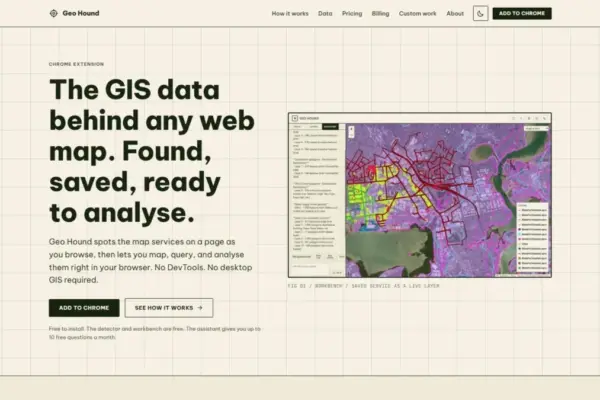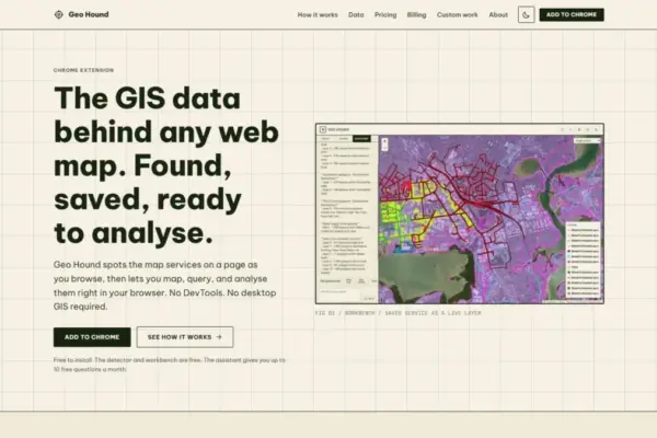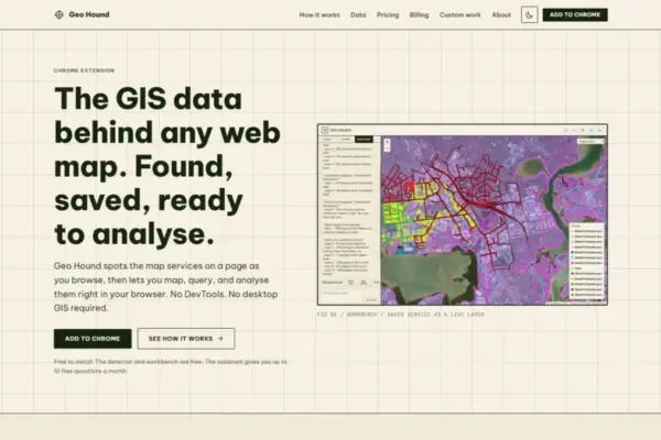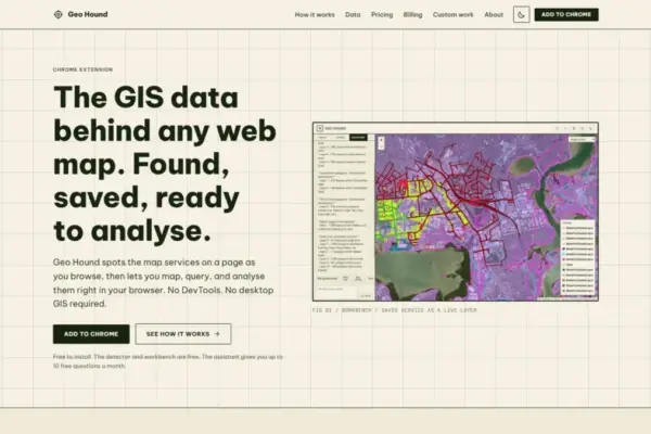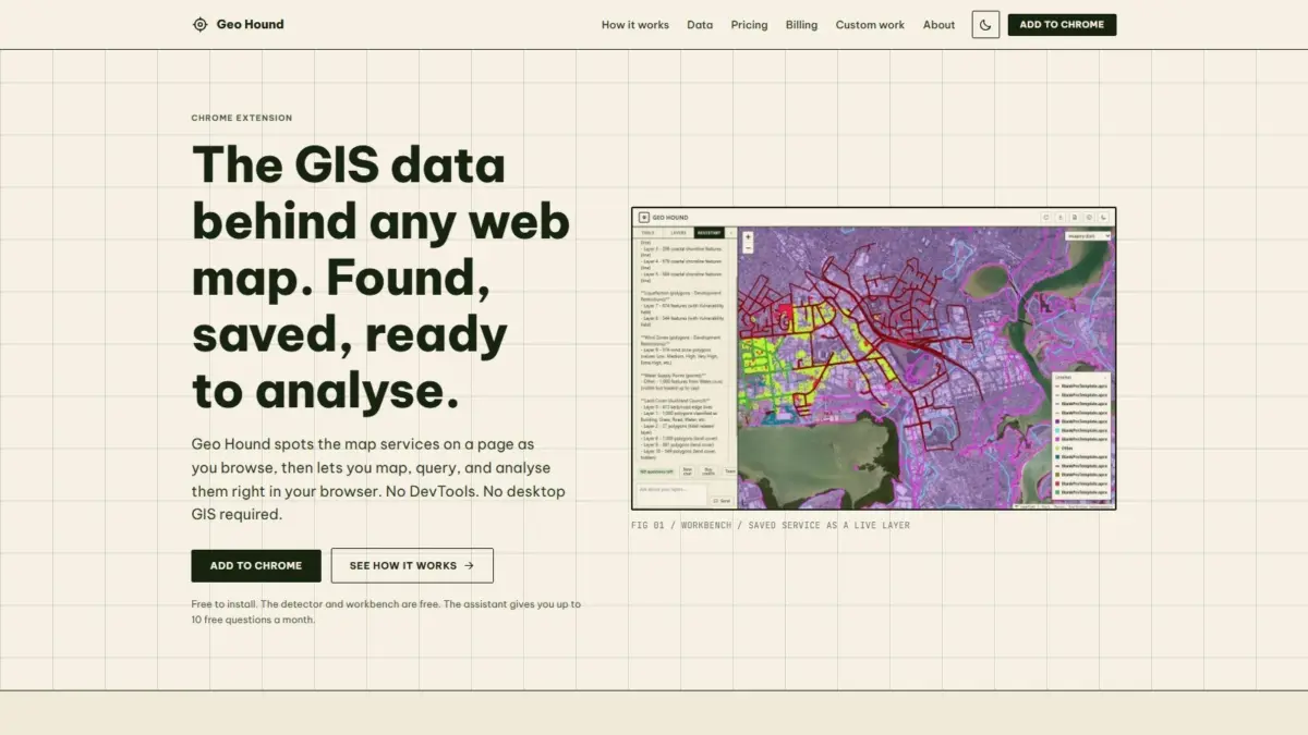
A new Google Chrome browser extension named GeoHound has been launched to transform how geospatial professionals, researchers, and everyday web users interact with digital maps across the internet. Created by geospatial specialist and podcast producer Daniel O’Donohue, the tool automatically inspects web pages as users browse, identifying the underlying spatial services and data feeds powering interactive web maps. By eliminating the manual technical hurdles traditionally required to discover and extract spatial data from web applications, GeoHound streamlines geographic data access and brings core spatial processing capabilities directly into the browser.
Across the modern web, thousands of public and private organizations—ranging from municipal planning departments and environmental monitoring agencies to transportation authorities and commercial mapping firms—publish interactive web maps to communicate geographic information. While these web applications present clear visual layers for end users, the underlying spatial data endpoints powering them are frequently buried beneath user interface elements. Accessing the raw spatial feeds behind these maps has historically required users to inspect browser network traffic manually, identify protocol-specific request endpoints, and copy complex URLs into desktop mapping software. GeoHound automates this discovery process by monitoring network traffic in real time as a user navigates any web page, automatically detecting active geographic data endpoints as they load.
The extension supports a broad spectrum of spatial web formats, capable of identifying 29 distinct service types operating behind web maps. Among these supported protocols are open industry standards developed by the Open Geospatial Consortium (OGC), including Web Map Services (WMS), Web Feature Services (WFS), and modern OGC API standards. In addition to open standards, GeoHound detects widely used proprietary and enterprise service architectures, such as Esri ArcGIS REST Feature Services and Map Services, various vector and raster tile service configurations, and standalone GeoJSON data feeds. As it discovers these endpoints, GeoHound captures and records the associated metadata, giving users instant visibility into service parameters, spatial references, bounding boxes, and layer attributes.
Historically, identifying the exact uniform resource locators (URLs) powering a web map required what geospatial analysts commonly refer to as "DevTools spelunking." This manual inspection process involves opening a web browser’s developer tools, searching through hundreds of asynchronous HTTP network requests in the network tab, filtering fetch calls for spatial query keywords, and reconstructing query parameters to isolate raw data endpoints. For analysts, journalists, and planners needing to verify data provenance, inspect feature attributes, or extract spatial layers for further study, this process represented a tedious and time-consuming barrier. By automatically recognizing map service signatures directly within the browser context, GeoHound replaces manual network inspection with a seamless background detection workflow.
Beyond automated endpoint detection and metadata collection, GeoHound features an integrated browser workbench designed for direct spatial data interaction. Rather than forcing users to immediately export detected endpoints into standalone desktop Geographic Information System (GIS) software such as QGIS or ArcGIS Pro, the tool provides built-in spatial processing capabilities directly inside Google Chrome. This in-browser environment allows users to inspect, manipulate, and refine captured spatial datasets without leaving their active web browser tab or launching external desktop applications.
Within the native workbench environment, users can perform several core vector processing and data manipulation tasks, including attribute filtering, spatial buffering, data joining, and multi-format exporting. Attribute filtering enables users to query captured datasets and isolate specific features based on property values or operational thresholds, refining large web feeds into focused datasets. The buffering tool allows users to generate parametric distance boundaries around point, line, or polygon features, enabling rapid spatial proximity assessments. The join functionality allows users to combine tabular or spatial attributes from separate layers based on shared keys, merging disparate information directly within the browser. Once analysis or data cleaning is complete, the workbench enables immediate export of the processed spatial features into standard file formats for downstream use.
To simplify complex spatial manipulation further, GeoHound incorporates an artificial intelligence assistant capable of executing GIS tasks using natural language inputs. Instead of requiring users to manually navigate multi-step software menus, construct complex database query statements, or execute desktop processing tools, the AI assistant interprets plain English instructions to perform spatial operations on saved layers. Users can state what spatial task or feature manipulation they wish to accomplish, and the assistant executes the corresponding processing workflow directly on the active data layers within the browser workbench.
The tool’s functional design emphasizes accessibility across different skill levels within the mapping community. Both the automated service detector and the interactive browser workbench are available for free, providing high-capability data discovery and manipulation tools without subscription requirements. The addition of the plain-English AI assistant offers an accessible entry point for researchers, journalists, and domain generalists who may lack formal training in desktop GIS software or spatial query languages, while simultaneously providing experienced GIS specialists with a rapid prototyping tool for on-the-fly web data extraction.
The creation of GeoHound reflects the industry background and community focus of its developer, Daniel O’Donohue. As a geospatial specialist and the creator and host of The MapScaping Podcast—a widely followed audio publication within the global geospatial sector—O’Donohue has spent years exploring spatial technology developments, industry workflows, and data accessibility challenges. His work across podcasting and spatial consultancy routinely focuses on breaking down technological silos, advancing spatial literacy, and improving how geographic data is accessed, shared, and applied to complex real-world problems.
The introduction of GeoHound addresses a broader shift within the technology landscape toward lightweight, browser-native geospatial tools. Traditionally, performing meaningful spatial data extraction and vector processing required resource-intensive desktop GIS software installations, complex software licensing, and specialized technical expertise. By bringing automated endpoint detection, layer metadata capture, client-side vector analysis, and conversational artificial intelligence directly into the web browser, the extension demonstrates how modern web capabilities are decentralizing spatial workflows and reducing friction in geographic data acquisition.
By converting passive web map browsing into an active data discovery and extraction opportunity, GeoHound alters how users interact with spatial web content. Rather than viewing web maps as static visual displays or isolated web applications, analysts can treat every web page as a potential gateway to underlying spatial data. Whether evaluating public infrastructure layers, reviewing municipal planning overlays, analyzing environmental boundaries, or conducting open-source intelligence research, users can capture, filter, transform, and export geospatial data layers as part of their routine web browsing workflow.
The extension’s combination of automated endpoint detection, integrated workbench tools, and natural language AI processing offers practical advantages for data journalists, urban planners, GIS analysts, and environmental researchers. In fast-paced research environments where rapid access to raw geographic features is critical, removing the need to manually parse browser network logs or toggle continuously between web browsers and desktop GIS packages significantly streamlines information gathering. As web mapping frameworks continue to expand across the internet, tools that automate background service discovery and simplify browser-based data processing play an increasingly important role in making spatial data open, accessible, and actionable.