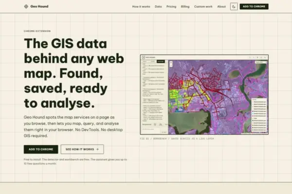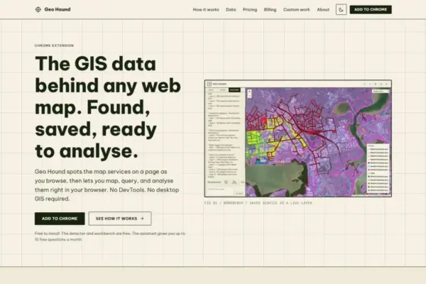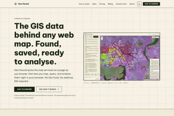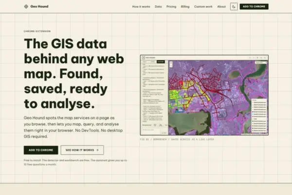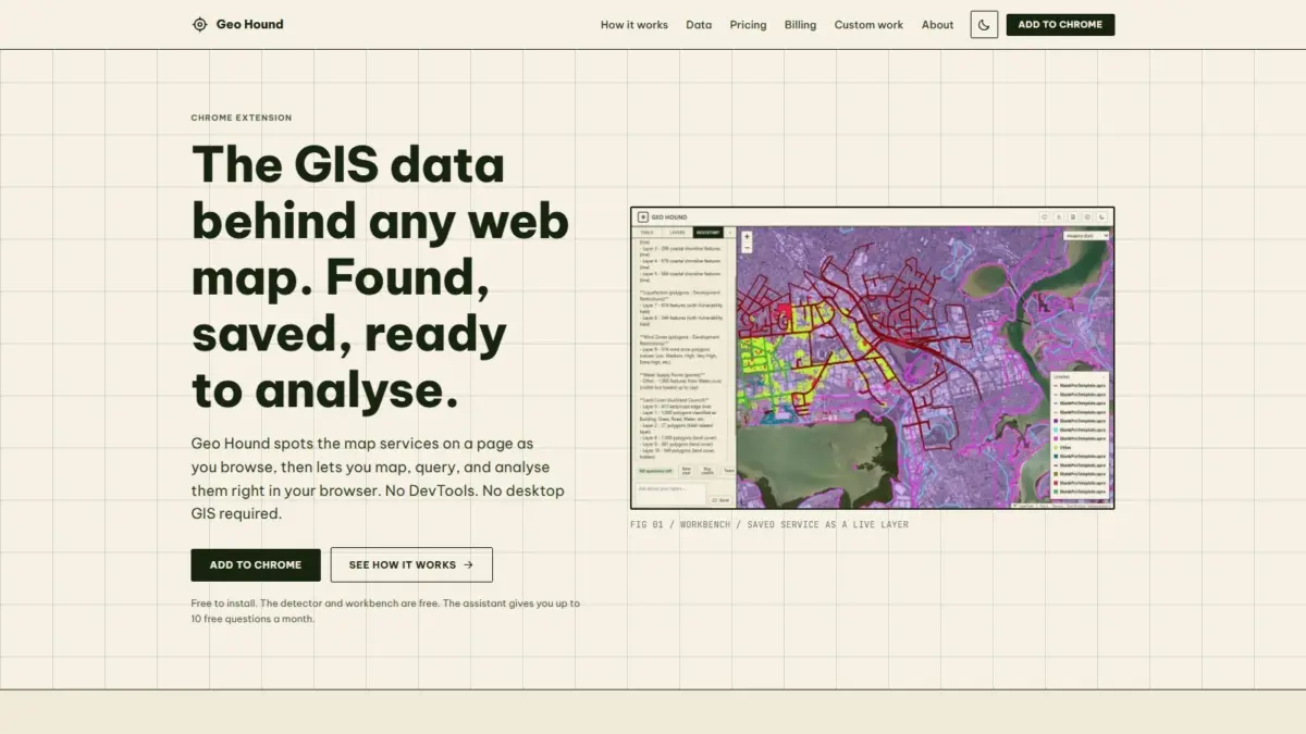
A new Google Chrome extension named GeoHound aims to streamline how spatial professionals, researchers, and mapping enthusiasts discover and analyze geographic data embedded across the web. Developed in connection with Daniel O’Donohue, a geospatial specialist and creator of the widely followed MapScaping Podcast, the browser extension automatically identifies the underlying geographic information system endpoints powering interactive web maps, allowing users to capture, analyze, and export spatial data layers directly within their web browser.
Interactive web maps have become ubiquitous across modern digital platforms, powering everything from municipal urban planning portals and environmental tracking dashboards to data journalism graphics and commercial location-based services. However, behind these polished visual interfaces lie vast network structures of spatial data endpoints that are often difficult to extract or inspect. Traditionally, identifying the exact server connections, data layers, and API calls driving an online map required technical knowledge of browser developer tools, manual inspection of network network traffic, and laborious extraction of API parameters—a process frequently described among spatial professionals as developer tools spelunking.
GeoHound addresses this technical friction by running quietly in the background as users navigate the web. Whenever a user visits a webpage containing an interactive map, the extension automatically inspects incoming network traffic to identify active geographic data services. Rather than forcing users to sift through hundreds of raw web requests in search of map tile URLs or vector endpoints, GeoHound automatically isolates these services, identifies their structural specifications, and saves them alongside their accompanying metadata for immediate or future use.
The extension boasts comprehensive coverage of the modern web mapping ecosystem, supporting 29 distinct spatial data service types and protocols. Among the supported formats are traditional geospatial standards established by the Open Geospatial Consortium, including Web Map Service feeds for raster imagery and styled map renders, Web Feature Service streams for raw vector geometries and attributes, and modern OGC API standards designed for lightweight RESTful web integration. Additionally, GeoHound detects proprietary and enterprise server formats, such as Esri ArcGIS REST services, which power millions of public agency and corporate mapping portals worldwide. The tool also recognizes standard web vector formats like GeoJSON alongside various tile service architectures, including XYZ raster tile templates and modern vector tile specifications.
By capturing these 29 distinct service types automatically, GeoHound removes the necessity of launching heavy desktop Geographic Information System applications, such as QGIS or Esri ArcGIS Pro, simply to inspect a web map’s underlying datasource. In traditional workflows, capturing web map layers meant isolating an endpoint URL from a browser network tab, configuring authentication or coordinate parameters, opening a desktop GIS application, setting up a new service connection, and verifying layer compatibility. GeoHound condenses this multi-step, multi-software workflow into a single browser-based detection mechanism.
Beyond automated endpoint detection, GeoHound incorporates a fully functional geospatial workbench directly into the browser interface. Once data layers are captured and saved, users can open the built-in workbench to perform core GIS tasks without leaving their web browser or transferring datasets into external software packages. The workbench provides essential spatial capabilities, allowing users to filter attributes, construct proximity buffers, execute dataset joins, and export processed spatial data into standardized external file formats.
The inclusion of client-side filtering capabilities allows users to query saved layers based on specific attribute values or spatial criteria, isolating relevant features directly within the browser’s memory. The buffering tool enables spatial proximity analysis, generating defined distance boundaries around point, line, or polygon geometries to evaluate spatial relationships or catchment areas. Through attribute and spatial joining features, users can combine separate captured layers or attach external tabular attributes to geometric features, facilitating on-the-fly spatial enrichment. Once processing is complete, the workbench enables seamless data exporting, making it straightforward to transfer parsed spatial datasets into downstream spatial analytical pipelines or cartographic workflows.
To further lower the technical barrier for web-based spatial analysis, GeoHound introduces an integrated artificial intelligence assistant capable of executing spatial operations through natural language. Operating directly on the layers captured within the workbench, the AI assistant allows users to run complex GIS tasks by issuing instructions in plain English. Rather than navigating manual software menus, building spatial SQL expressions, or executing multi-step analytical tool sequences, users can instruct the assistant to perform processing steps, filter spatial records, or summarize layer metadata using everyday conversational language.
This integration of artificial intelligence reflects a broader movement within the geospatial technology industry toward natural language interfaces and automated data workflows. By allowing users to interact with spatial data layers using plain text commands, the assistant makes spatial analytical capabilities accessible to professionals who may lack extensive training in traditional desktop GIS platforms, while accelerating routine data handling tasks for experienced GIS specialists.
The creation of GeoHound reflects the ongoing efforts of its developer, Daniel O’Donohue, to expand access to spatial technology across the broader geospatial community. As the voice and producer behind The MapScaping Podcast, O’Donohue has spent years highlighting innovations, trends, and methodologies shaping spatial data engineering, earth observation, cartography, and location intelligence. Drawing from a professional background as a geospatial specialist, his work frequently focuses on demystifying complex spatial concepts and highlighting software tools that solve daily operational bottlenecks faced by spatial practitioners.
The modern web mapping environment is notoriously fragmented, with data hosted across open-source GeoServer instances, commercial ArcGIS Enterprise servers, cloud-native vector tile repositories, and custom spatial APIs. For researchers, data journalists, urban planners, and environmental analysts, attempting to source baseline geographic datasets from published web maps often leads to lost time spent diagnosing web requests and reformatting incompatible spatial protocols. By unifying detection across 29 layer types and uniting endpoint capture with browser-native analytical tools, GeoHound seeks to eliminate these operational speedbumps.
The core core detection engine and the browser-based GIS workbench are offered free of charge, ensuring that basic data discovery, endpoint detection, and spatial processing remain accessible to individual researchers, students, and open-source mappers. The added artificial intelligence assistant provides an additional layer of automation, bringing intelligent command execution to the captured datasets.
As web applications continue to play a central role in how spatial data is distributed and visualized globally, tools that bridge the gap between web presentation layers and underlying spatial data structures are becoming increasingly essential. GeoHound represents a significant step forward in browser-based spatial utility, converting passive web map browsing into an active, frictionless data capture and analysis environment. By eliminating the double burden of manual network inspection and desktop GIS reliance, the Chrome extension offers spatial professionals an efficient, accessible path from web map discovery to actionable spatial intelligence.