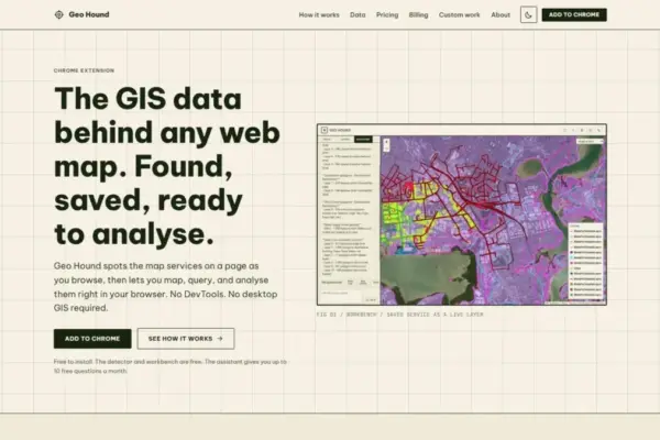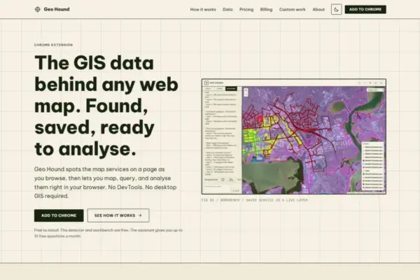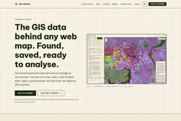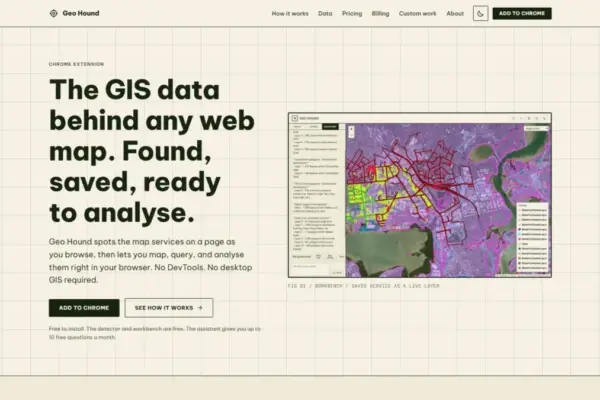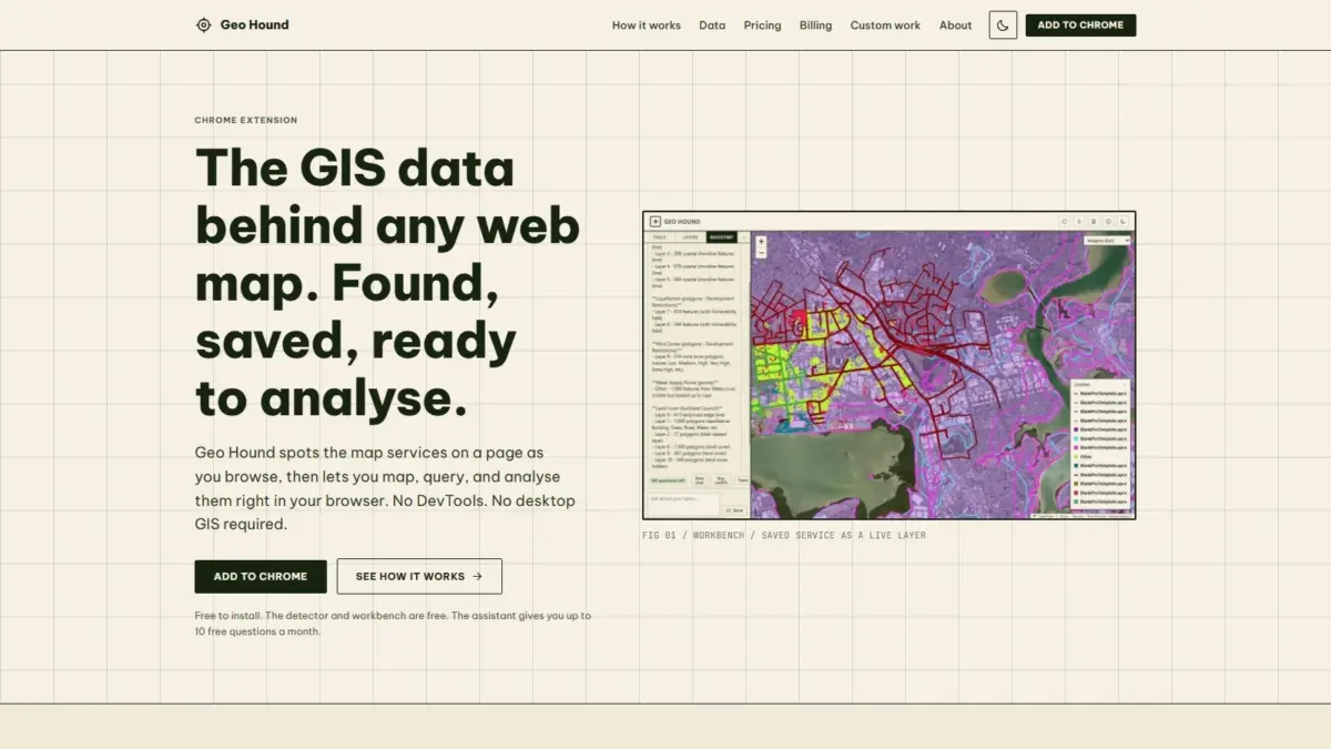
Modern web browsers serve as the primary interface through which millions of users, researchers, and spatial professionals interact with geographic information every day. From municipal open data portals and interactive environmental dashboards to real estate tools and logistics platforms, web maps permeate the digital landscape. However, the geographic datasets powering these visual interfaces often remain concealed behind complex network requests and nested web services. A new Google Chrome browser extension named GeoHound, developed by geospatial specialist and podcast creator Daniel O’Donohue, aims to eliminate this barrier by automatically detecting, capturing, and analyzing spatial web services directly within the browser environment.
The release of GeoHound addresses a long-standing point of friction in spatial data discovery. For years, geographic information systems (GIS) professionals, spatial analysts, data journalists, and researchers seeking to inspect or extract the raw geographic layers rendered on a web page had to rely on cumbersome manual inspection techniques. Finding the origin of a specific vector feature or raster layer typically required opening browser developer tools, filtering through hundreds of active network requests, identifying service endpoints, and painstakingly reconstructing query parameters. GeoHound streamlines this process by passively monitoring network activity while a user navigates any web map, automatically identifying underlying spatial data services, and preserving them along with their associated metadata.
The tool’s detection engine is equipped to recognize 29 distinct types of spatial services and web data protocols. This broad coverage spans foundational standards established by the Open Geospatial Consortium (OGC), including Web Map Services (WMS) and Web Feature Services (WFS), as well as modern OGC APIs designed for contemporary web architectures. Additionally, the extension seamlessly identifies proprietary but ubiquitous formats across the geospatial industry, such as Esri ArcGIS REST services, various raster and vector tile services, and standalone GeoJSON feeds. By capturing these endpoints in real time as the browser renders them, GeoHound effectively turns standard web browsing into a continuous, automated spatial data discovery process.
Beyond basic detection, the tool places a strong emphasis on preserving the structural context of detected datasets. When GeoHound identifies a service, it captures not only the raw network endpoint but also the detailed metadata associated with the layer. Metadata in geospatial operations serves a fundamental role, providing essential information regarding coordinate reference systems, spatial extent, attribute table schemas, field types, and service capabilities or operational limits. Having immediate access to this background information allows analysts to evaluate the accuracy, coverage, and suitability of a dataset for a given project before attempting to integrate it into broader workflows.
To complement its detection engine, GeoHound incorporates a built-in analytical workbench operating entirely within the web browser. Historically, once a GIS analyst successfully identified a spatial service URL from a website, processing or analyzing that data required launching heavy desktop GIS application suites such as QGIS or ArcGIS Pro, configuring server connections, and downloading layers to local disk storage. The extension’s integrated workbench redefines this workflow by bringing basic and intermediate spatial processing directly into the browser tab.
Within the workbench environment, users can inspect detected layers and perform fundamental vector operations without leaving the web page. The software enables users to filter spatial data based on specific attribute values or criteria, narrowing large municipal or regional datasets down to localized areas of interest. It also supports spatial analytical functions such as creating geometric buffers around points, lines, or polygons, as well as executing spatial joins to combine properties from overlapping geographic layers. Once the desired processing or filtering is complete, users can export the resulting spatial layers into standard formats for downstream applications, presentation, or archival purposes.
This browser-native approach to spatial processing represents a significant operational efficiency for analysts performing rapid preliminary evaluations, site assessments, or data validation tasks. By removing the technical overhead of opening browser DevTools or transferring data back and forth between web applications and desktop GIS software, the tool reduces time-to-insight for routine geographic inquiry. Tasks that previously required multi-step manual extraction and desktop software setup can now be completed within the immediate context of the web page where the data was originally discovered.
The architecture of GeoHound is structured around an accessible model that provides both core spatial functionality at no cost and advanced artificial intelligence capabilities. The primary service detection system and the interactive in-browser workbench are made available for free, ensuring that students, independent researchers, open data advocates, and professional spatial analysts can access core data discovery and processing tools without financial barriers.
For users seeking to streamline complex spatial queries, GeoHound integrates an optional AI assistant capable of running GIS tasks using plain English instructions. Rather than manually configuring complex spatial parameters, attribute query syntax, or multi-step processing operations within the workbench menu, users can interact with their saved spatial layers through natural language prompts. The AI assistant translates these conversational requests into spatial operations, executing filters, buffers, joins, or geometric transformations on the saved data layers automatically.
The inclusion of natural language processing within a spatial workbench highlights an emerging shift in how users interact with geographic information tools. By translating conversational prompts into precise spatial commands, the system lowers the barrier to entry for individuals who possess domain knowledge but may lack deep familiarity with formal GIS query syntax or spatial database functions. At the same time, for experienced GIS professionals, the ability to issue plain English commands provides a rapid method to iterate through exploratory spatial analysis tasks.
The development of GeoHound reflects the practical insights of its creator, Daniel O’Donohue, a seasoned geospatial specialist who is widely known within the international spatial community as the voice and creator of The MapScaping Podcast. Through years of producing conversations with leading practitioners, software developers, researchers, and innovators across the geospatial industry, O’Donohue has maintained a consistent focus on the evolving methodologies used to capture, analyze, and communicate location intelligence.
O’Donohue’s professional background as a geospatial specialist has consistently centered on leveraging location data to unravel real-world complexities across environmental, urban, and commercial sectors. His work with The MapScaping Podcast has established a major community platform dedicated to discussing vector and raster technologies, open-source GIS software, remote sensing advancements, web mapping framework evolutions, and the broader future of spatial computing. The creation of GeoHound grows directly out of this deep engagement with community pain points, addressing the universal challenge of accessing and working with spatial data distributed across the modern web.
The landscape of web mapping has grown increasingly decentralized and complex over the past decade. As government agencies, research institutions, non-profit organizations, and commercial enterprises deploy proprietary web applications to share geospatial information, data frequently becomes isolated within customized web interfaces. While these interfaces offer tailored user experiences for general public viewing, they often obscure the underlying open data standards and web service endpoints that enable true data interoperability and independent analysis.
Tools that shed light on underlying web services serve a dual purpose in the modern data ecosystem. On a technical level, they simplify developer and analyst workflows by consolidating service identification into a single automated interface. On a broader institutional level, they support data transparency and open data initiatives by making public spatial services easily identifiable and reusable across different software platforms. When public sector organizations publish spatial web services to power interactive maps, ensuring that those underlying services are easily discoverable empowers researchers, urban planners, and citizens to conduct independent verification and secondary analysis.
Furthermore, the capability to handle 29 different service protocols reflects the diverse technical landscape of spatial web publishing. In contemporary web mapping, it is common for a single interactive mapping application to consume base tiles from one provider, draw vector feature services from an Esri server, stream real-time sensor observations via an OGC API, and load client-side GeoJSON files for localized boundaries. By providing a unified detection mechanism capable of capturing this entire spectrum of service standards simultaneously, GeoHound offers a cohesive view of multi-source web map architectures.
The integration of client-side spatial operations directly into web browser extensions also highlights the expanding performance capabilities of modern web browsers. Historically, spatial analysis required substantial local computational hardware or dedicated server-side spatial database processing due to the complexity of polygon intersections, spatial indexing, and coordinate transformations. Advances in web technologies now allow browsers to execute spatial calculations client-side with remarkable speed, enabling lightweight tools to perform tasks that once strictly belonged within dedicated desktop application suites.
As spatial data continues to play an essential role in decision-making processes across urban planning, climate adaptation, emergency response, logistics, and infrastructure development, tools that accelerate data discovery and streamline analytical workflows remain increasingly vital. By bridging the gap between web map visualization and raw spatial service extraction, GeoHound provides a practical solution to a ubiquitous challenge in the geospatial sector, enabling users to discover, process, and understand the geographic data layers that shape our digital view of the physical world.