The open-source geospatial community is celebrating a major milestone as GeoServer 3.0 becomes generally available. Rather than focusing solely on a traditional list of flashy new user-facing features, this release represents something much rarer in the open-source software ecosystem: the successful execution and fulfillment of a major, community-funded promise to completely overhaul the platform’s underlying technical architecture. The extensive modernization work, which was heavily backed by a coalition of corporate sponsors, institutional partners, and individual donors, is now finished and fully integrated into the official software release.

The primary objective of the GeoServer 3 initiative was to bring the entire platform back onto a modern, fully supported technical foundation. As software ecosystems evolve, maintaining legacy codebases becomes increasingly difficult and risky, particularly when core dependencies approach the end of their security lifecycle. For GeoServer, the driving force behind this massive transition was the approaching expiration of security support for Spring 5. Staying secure and sustainable meant the platform had to make the critical leap to JDK 17.

However, upgrading the Java Development Kit could not happen in isolation. It triggered a complex, cascading series of necessary updates across the entire technology stack. Moving forward required transitioning to Spring 7, adopting Jakarta EE specifications, integrating modern servlet containers, and overhauling numerous supporting libraries throughout the architecture. Furthermore, the project’s ageing image-processing components had to be completely replaced to ensure long-term viability. While none of these foundational, behind-the-scenes engineering efforts are the kind of glamorous updates that typically win feature votes, they are entirely essential for keeping GeoServer current, secure, and dependable for the thousands of enterprises, governments, and organizations that rely on it every day. The community recognized that letting these technical requirements accumulate further would pose a severe risk to the project’s future, prompting a coordinated, ecosystem-wide rescue effort.

Financing such a massive, foundational overhaul required an extraordinary level of trust, collaboration, and financial commitment from the global geospatial community. The overall financial target for the crowdfunding campaign was set at €550,000. Three core industry partners—Camptocamp, GeoCat, and GeoSolutions—stepped forward early with substantial commitments of €50,000 each. Together, this consortium provided vital project coordination, delivery capacity, and critical co-funding to kickstart the initiative.

That left a community funding goal of €400,000, which was successfully pledged by a diverse array of sponsors, institutional community members, and individual donors during a dedicated commitment phase. To protect all participants, funds were only formally collected once the target had been fully reached, ensuring that the ambitious modernization work could begin with a fully secured budget rather than facing the constant threat of stalling midway through development. In May 2025, the crowdfunding campaign officially surpassed its financial goal, greenlighting the intensive development cycle that has now culminated in the release of GeoServer 3.0.

What the Funding Delivered
GeoServer 3 was designed from its inception to modernize the platform from the foundation up, and the newly released software delivers precisely on that promise. The engineering effort was executed as a comprehensive, synchronized program rather than a series of isolated patches. A handful of major architectural upgrades set off a chain reaction of necessary modifications across the codebase, resulting in a cleaner, more maintainable, and highly secure platform.

The transition to a modern Java foundation stands as the central achievement that unlocked all subsequent improvements. By moving the GeoServer ecosystem to JDK 17 and Spring 7, the project successfully aligned itself with contemporary enterprise standards and secured long-term vendor support. This core upgrade cascaded smoothly into Jakarta EE, modern servlet containers, and a vast array of supporting libraries that all had to be updated and tested concurrently. Developers meticulously worked through the entire dependency tree from end to end, ensuring that the resulting platform sits on a clean, robust, and easily maintainable base.

In addition to the core framework updates, the release addresses long-standing limitations in raster data handling. The legacy image-processing engine has been completely replaced by ImageN, establishing a modern, high-performance foundation for raster processing that will be significantly easier for developers to maintain and extend in the future. Security and vulnerability management have also been reinforced extensively throughout the software stack, placing GeoServer on a much stronger footing to meet the increasingly stringent compliance, auditing, and assurance requirements demanded by modern IT departments and government agencies.

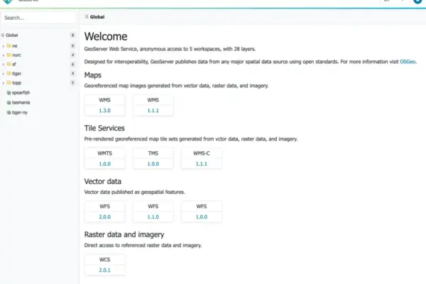
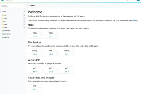
Users will also notice a significantly refreshed administration experience alongside completely updated documentation. The administrative user interface has been rebuilt from the ground up utilizing a modern, context-driven design philosophy, making server management more intuitive. Comprehensive documentation has been simultaneously revised and expanded to guide administrators through the updated interface and new system behaviors.

Crucially, the scope of this modernization initiative extended far beyond GeoServer core. The funded work was designed to benefit the wider geospatial ecosystem, meaning that GeoServer 3.0 ships in close coordination with updated releases of GeoTools and GeoWebCache. Furthermore, integration work for GeoServer Cloud has closely followed, positioning GeoServer exceptionally well for modern cloud-native, microservices-based, and containerized deployment environments.

For the vast majority of existing production deployments, the upgrade path from version 2.28.x has been designed to be remarkably straightforward, requiring no modifications to the existing data directory. Comprehensive migration guides have been provided to assist administrators with any remaining edge cases. An extensive release candidate phase allowed organizations worldwide to test these upgrades rigorously within their own staging environments, and the valuable feedback gathered during that period directly shaped the final, polished release.

Thank you
GeoServer serves as vital infrastructure for countless public and private sector organizations across the globe. Keeping a mission-critical platform of this scale healthy and secure requires funding the unglamorous, foundational engineering work that rarely captures mainstream attention on its own. The fact that a global open-source community rallied together to back this complex initiative, actively participating through every phase until its successful delivery, serves as a powerful testament to how open-source software can successfully sustain itself when its users choose to invest collectively in its future.

That substantial investment was made possible by a vast network of dedicated organizations and individuals. Sincere gratitude is extended to every corporate sponsor that pledged financial support, every individual who contributed personal donations, and every community member who dedicated their time to testing, reporting bugs, reviewing code, and contributing development hours. This landmark release exists fundamentally because the community decided that it needed to happen. Special recognition is also due to the consortium teams at Camptocamp, GeoCat, and GeoSolutions, whose tireless dedication carried the initiative from an ambitious funding target across the finish line into a fully realized software release.

GeoServer 3 represents the solid foundation upon which all future innovations for the project will be built, proving once again what can be achieved when a passionate community builds the future together.

The successful realization of GeoServer 3 was made possible through the financial backing and institutional support of AfriGIS, Camptocamp, DLR, Dorset Council, Deutsche Telekom, Frachtwerk GmbH, GeoCat BV, Geocrafter – Geospatial Studio, Comune di Genova, g.on, GeoSolutions SRL, geosos, Geospatial Enabling Technologies (GET), Incloud Limited, HL Consulting, Institut national de l’information géographique et forestière (IGN), ITS Digital, JDev, Kreditanstalt für Wiederaufbau, Mammoth Geospatial, NOAA National Ocean Service, Plangis, Office of Public Works, Open Geo Groep, OSGeo:Korea, OSGeo:UK, Quarticle Research Srl, Sea Island Software, Tailormap, Terrestris, Ubigu, Value AG, Region Västra Götaland, and WaldExpert.

Valuable contributions were also made possible through individual donations provided by Abhijit Gujar, Hennessy Becerra, Ivana Ivanova, John Bryant, Jason Horning, Jose Macchi, Peter Smythe, Sajjadul Islam, Sebastiano Meier, and Stefan Overkamp.