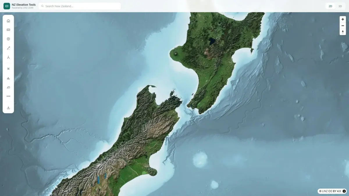
Understanding exact terrain heights across New Zealand’s varied and often rugged landscapes has long posed a distinct challenge for land professionals, planning specialists, and outdoor recreationists. Traditional topographic maps and general-purpose digital mapping interfaces frequently rely on generalized contour lines or broad-scale satellite estimates. While these tools offer a broad overview of geography, they often lack the detailed precision required to accurately analyze sharp ridge lines, agricultural catchments, civil engineering corridors, or remote mountain passes.
To address this gap between raw spatial data and end-user accessibility, a new web-based mapping application called NZ Elevation Tools has been launched. The platform provides direct, browser-based access to New Zealand’s Land Information New Zealand (LINZ) Light Detection and Ranging (LiDAR) data—the most comprehensive, detailed, and high-resolution elevation dataset ever collected across the nation. By rendering this extensive data accessible within an intuitive web interface, the application allows users to query exact ground heights, plot cross-sectional terrain profiles, and switch between interactive two-dimensional and three-dimensional map perspectives across the entire country.
At the core of the NZ Elevation Tools platform is a focus on high performance, precision, and ease of use. Operating entirely within standard web browsers, the tool eliminates the requirement for specialized GIS software, local computational installations, or heavy data downloads. When users open the map viewer, they are presented with a streamlined interface displaying New Zealand’s terrain. Users can click on any point on the map to instantly retrieve an exact elevation measurement derived directly from underlying LINZ LiDAR datasets. This point-query functionality provides immediate vertical accuracy, replacing rough approximations with authoritative elevation metrics.
In addition to single-point queries, the application includes a dynamic line-drawing tool designed for cross-sectional terrain analysis. By drawing a line across any selected segment of the map, users can generate an immediate, interactive terrain profile. This tool dynamically plots ground elevation changes across the selected transect, illustrating terrain gradients, slope changes, and cumulative elevation gains or losses. Furthermore, the map viewer features full two-dimensional and three-dimensional toggles, enabling users to view flat cartographic layouts or manipulate fully navigable 3D terrain models to examine physical landscapes from multiple angles.
The spatial foundation of the application relies on the national LiDAR collection program coordinated by Land Information New Zealand, the government department responsible for national geographic authoritative records and mapping services. LiDAR technology captures physical terrain by emitting thousands of high-frequency laser pulses per second from specialized equipment mounted on aircraft. By measuring the precise time required for laser signals to reflect off the ground surface and return to the aircraft’s sensor, the technology generates dense point clouds representing the physical earth below.
When processed into digital elevation models, LINZ LiDAR data provides bare-earth terrain measurements that penetrate vegetation cover, capturing sub-meter variations in ground height. This dataset represents a major step forward in regional topographic mapping across New Zealand, offering unmatched fidelity compared to traditional satellite radar or coarse elevation models. However, despite being publicly accessible through open data repositories, raw LiDAR datasets present logistical barriers for standard users. Due to the vast size of high-resolution point clouds and grid files—often measuring in gigabytes or terabytes—working with raw LiDAR historically demanded powerful desktop workstation hardware, specialized spatial analysis tools, and technical domain knowledge.
NZ Elevation Tools resolves these technical hurdles by serving processed LiDAR data through modern web mapping formats and client-side graphics rendering technology. By translating complex geospatial files into lightweight, responsive tiles rendered directly in the user’s browser, the application provides instantaneous querying and profile generation capabilities without requiring high-end graphics processing hardware or technical expertise.
The creation of an accessible, accurate elevation viewing application offers direct practical value to a wide range of professional sectors and recreational communities across New Zealand who depend on true elevation measurements rather than estimated figures.
For land surveyors and civil engineers, accurate early-stage site evaluations are vital for project planning, cost estimation, and risk mitigation. NZ Elevation Tools enables engineering professionals and survey teams to conduct desk-based site inspections, evaluate terrain gradients across proposed infrastructure corridors, and analyze ground slopes prior to committing field personnel to on-ground site visits. The ability to instantly generate elevation profiles along road lines, utility pathways, or building sites simplifies preliminary feasibility studies and environmental impact assessments.
In the agricultural sector, rural land managers, farmers, and agricultural consultants face complex land management challenges where micro-topography plays a crucial role. Ground elevation dictates natural water flow patterns, soil erosion risks, pasture productivity, and drainage management. By utilizing the web viewer to inspect ground heights and analyze contours, agricultural operators can better plan surface drainage networks, evaluate catchment behavior, optimize irrigation infrastructure, and map practical fence lines across complex hill country properties.
Beyond commercial applications, the platform offers significant benefits for outdoor recreationists navigating New Zealand’s backcountry, including trampers, mountaineers, and hunters. New Zealand’s alpine regions and bush tracks are known for their steep, demanding terrain and variable weather conditions, where accurate route planning is essential for outdoor safety. Trampers planning off-track traverses or alpine routes can draw line profiles along prospective tracks to evaluate exact steepness, identify difficult ascents, and assess vertical terrain challenges before setting out. Similarly, hunters operating in remote river valleys and steep ranges can analyze ridge lines, valley floors, and elevation zones to navigate safely and effectively in unmapped terrain.
The development of NZ Elevation Tools reflects a deliberate initiative to bridge the gap between complex geospatial data infrastructure and non-specialist end users. The application was built by Daniel O’Donohue, an experienced geospatial specialist who is best known as the creator and voice behind The MapScaping Podcast, a platform dedicated to spatial technology, location data innovation, and industry developments within the global geospatial community.
With a background as a professional geospatial specialist, O’Donohue has spent years working with geographic information systems and investigating how spatial data can be harnessed to solve practical problems across various industries. His experience in spatial communications and technology development highlighted a persistent challenge in the field: while public agencies invest heavily in high-value spatial data like LiDAR, the benefits often remain restricted to specialized technical organizations equipped to process complex file formats.
By designing a fast browser-based interface, O’Donohue sought to democratize access to LINZ LiDAR data, ensuring that anyone requiring reliable terrain heights—whether for professional land management or recreational planning—can access authoritative information effortlessly. The tool emphasizes simplicity and performance, streamlining user interaction into key functional capabilities like point-and-click height queries, cross-sectional line profiling, and rapid 2D/3D visualization toggles.
The release of NZ Elevation Tools highlights broader shifts within the spatial software industry, where traditional, heavy desktop GIS tools are increasingly complemented by fast, purpose-built web utilities. As modern web browsers gain advanced graphics rendering capabilities, complex geographical data can be viewed and analyzed in real time on standard consumer devices, including personal computers, laptops, and mobile devices.
This shift toward accessible spatial utilities ensures that open government data programs deliver maximum practical value to the public. By translating massive national datasets into user-focused web applications, tools like NZ Elevation Tools ensure that high-precision geographic information is accessible to surveyors, engineers, farmers, trampers, and hunters across New Zealand.