Organizers of State of the Map 2026 have officially launched the Call for Posters, inviting cartographers, academic researchers, community organizers, and geospatial enthusiasts from around the world to present their work at the flagship global gathering. The announcement provides a timely and welcome pathway for contributors who missed earlier deadlines for the general conference program and the specialized OpenStreetMap Science presentations, ensuring that impactful projects, unique cartographic experiments, and regional mapping efforts still have a prominent platform at the upcoming international event.
State of the Map serves as the premier annual conference celebrating OpenStreetMap, bringing together the international community that builds, maintains, and utilizes the world’s most extensive collaborative geographic database. Through the poster exhibition, the State of the Map Working Group aims to spotlight the breadth of work taking place across the ecosystem, offering attendees an opportunity to examine visual, analytical, and community-centered achievements in detail.
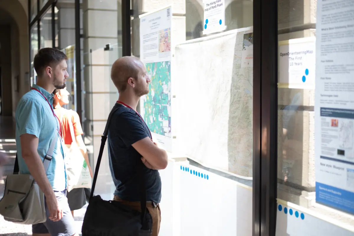
The initiative highlights how visual media can capture the complexity and diversity of OpenStreetMap. Posters have historically served as a critical medium at the conference, allowing participants to convey complex spatial analyses, share grassroots organizing stories, and present novel cartographic styles in an accessible and engaging format.
A Broad Canvas for Community Mapping, Cartography, and Academic Research
The scope of eligible submissions reflects the wide variety of activities within the OpenStreetMap community. The organizers emphasize that the primary unifying criterion is a direct and meaningful connection to OpenStreetMap. Beyond that fundamental requirement, participants are encouraged to explore diverse angles, ranging from local grassroots mapping milestones to advanced data science and spatial statistics.
Contributors are invited to present visual narratives demonstrating how thoroughly their local areas or specific communities are mapped. These entries often illustrate mapping progress over time, highlighting how local groups have mobilized to map previously underrepresented neighborhoods, transport networks, natural features, or rural settlements. Such posters not only celebrate local mapping milestones but also provide practical blueprints for other regional communities seeking to launch similar data-collection campaigns.
Aesthetic and functional innovation in map design forms another central pillar of the poster call. The organizers encourage submissions that introduce fresh, compelling cartographic styles or present comprehensive custom maps tailored for specialized uses. By leveraging OpenStreetMap’s open data layers, cartographers have the freedom to experiment with non-standard rendering rules, distinctive color palettes, and unconventional thematic visual designs, pushing the boundaries of modern digital and print cartography.
Community initiatives and organizational methodologies are equally welcomed. Posters in this category may focus on mapping group governance, local outreach activities, youth engagement, or collaborative partnerships between local chapters and civil society organizations. Closely aligned with this are promotional and educational posters designed to demystify OpenStreetMap for newcomers, explain how open geospatial data works, and invite everyday citizens to contribute their local geographic knowledge.
Statistical evaluations and data analytics represent another key thematic focus. With billions of spatial nodes and ways cataloged across the globe, OpenStreetMap offers an immense dataset for quantitative analysis. Posters can focus on metrics regarding contributor activity, tagging conventions, completeness assessments, or comparative analyses between OpenStreetMap and other geographic databases.
In addition to community and design projects, the Call for Posters places significant emphasis on academic contributions. The organizing team actively welcomes research posters investigating OpenStreetMap data from scholarly viewpoints. These submissions may encompass academic inquiries into geospatial data quality, spatial data science methodologies, routing optimization, machine learning applications applied to validation, humanitarian response analytics, or urban planning studies supported by OpenStreetMap infrastructure.
To help prospective participants conceptualize their submissions, the organizers have pointed contributors toward previous visual galleries, including the poster collection from State of the Map 2025, which remains accessible online through the conference website as a source of creative and structural inspiration.
Submission Requirements
To ensure that the exhibition maintains high editorial and visual standards, the State of the Map Working Group requires that all proposed posters align strictly with the foundational themes of the OpenStreetMap project. Every submission must place OpenStreetMap data, community initiatives, technical tools, or scientific inquiry at the core of its subject matter.
Submissions must adhere to clear visual presentation guidelines designed to maintain legibility and graphic clarity, whether viewed in digital collections or examined during in-person conference exhibitions. Contributors are expected to prepare their work in suitable formats that support high-resolution rendering, ensuring that fine geographic details, labels, legends, charts, and textual explanations remain distinct and accessible.
Academic and research submissions are expected to uphold appropriate scholarly standards, clearly presenting research questions, methodologies, findings, and conclusions alongside data citations that accurately credit OpenStreetMap contributors.
Furthermore, all submitted and shortlisted posters must be compatible with the community’s commitment to open licensing. Selected works will be published and distributed under the Creative Commons Attribution-ShareAlike 4.0 International license (CC-BY-SA 4.0), ensuring that the knowledge, designs, and analytical techniques shared through the conference can be studied, distributed, and adapted by the wider global public with appropriate attribution.
How to Participate
The participation process is structured to accommodate contributors from diverse geographic backgrounds, institutional affiliations, and skill levels. Whether prospective presenters are seasoned researchers, independent cartographers, or local community mappers, the poster track offers an egalitarian channel to contribute to the international discourse.
Interested participants are instructed to follow the official submission process established by the conference organizers. This includes preparing an overview of their poster project, outlining the objectives, thematic focus, and relevance to OpenStreetMap, along with submitting the visual layout of the poster in accordance with technical specifications outlined by the organizing team.
The evaluation process will focus on relevance to the OpenStreetMap movement, originality, clarity of presentation, aesthetic and cartographic quality, and the broader utility of the insights presented. From the pool of entries, the State of the Map team plans to shortlist up to 15 standout posters. These chosen works will be formally showcased across official conference channels and published on the State of the Map website under the designated open license, granting creators international visibility throughout the global mapping community.
Timeline
The poster submission process operates along a dedicated schedule designed to allow ample time for drafting, design refinement, review, and final production. Prospective participants are urged to plan their entries carefully to ensure their visual materials and accompanying documentation are submitted before the close of the review window.
Following the initial submission period, the review panel will evaluate the pool of candidates to finalize the shortlist of up to 15 posters. Successful submitters will receive confirmation and feedback to finalize their designs for digital hosting and conference presentation, after which the official gallery will be published ahead of the main event.
The State of the Map Working Group and Foundation Governance
The Call for Posters is coordinated by the State of the Map Working Group, one of the dedicated volunteer bodies operating under the aegis of the OpenStreetMap Foundation (OSMF). The OpenStreetMap Foundation is a non-profit organization formed specifically to support and sustain the OpenStreetMap project.
At its core, the Foundation is dedicated to encouraging the steady growth, ongoing development, and unhindered distribution of free geospatial data for anyone to use, analyze, and share. Rather than directing mapping projects in a centralized, top-down manner, the Foundation operates primarily as a custodian of the project’s institutional integrity, technical stability, and legal structure. It owns and maintains the servers, storage systems, and technical infrastructure that allow millions of global edits to be processed and served daily.
The Foundation is supported financially through individual membership fees and organizational donations, maintaining a lean operating structure powered by volunteer-driven Working Groups and a modest core staff. This volunteer-centered framework ensures that community members remain directly involved in shaping the project’s governance and major international initiatives, including the State of the Map conference series.
Membership in the OpenStreetMap Foundation is open to anyone worldwide who shares its commitment to open geospatial data. Standard individual membership is available for £15 per year, while active contributors to the OpenStreetMap database can qualify for fee waivers, ensuring that financial barriers do not prevent dedicated community members from taking part in Foundation governance and voting on strategic decisions.
Reflecting the global diversity of the movement, the State of the Map Working Group also emphasizes linguistic inclusion, calling on volunteers from the community to assist in translating announcements, blog posts, and official communications into various regional languages. Community members interested in supporting translation efforts are invited to connect directly with the Foundation’s communications team at [email protected] with the subject line specifying their language of interest.
Two Decades of Open Mapping
The launch of the State of the Map 2026 poster track arrives against the backdrop of more than two decades of sustained growth for the OpenStreetMap initiative. Founded in 2004 as an open alternative to proprietary, closed-source mapping providers, OpenStreetMap has grown into an indispensable global spatial database.
The project relies on hundreds of thousands of registered volunteers across the planet who actively collect, curate, and verify data detailing roads, railways, footpaths, waterways, buildings, forests, protected natural reserves, public transport networks, and municipal amenities. By gathering information through ground surveys, aerial imagery interpretation, and open local government data integrations, the community constructs a dynamic, living map of the earth.
A defining characteristic of OpenStreetMap is its open licensing model. The entire geographic database can be downloaded free of charge by individuals, academic researchers, non-governmental bodies, public authorities, and commercial enterprises. Unlike proprietary mapping platforms that place heavy restrictions or subscription fees on commercial use and data extraction, OpenStreetMap permits users to generate custom maps, perform routing and network analyses, and build specialized commercial applications without prohibitive licensing hurdles.
This open approach has made OpenStreetMap a critical resource across modern technology, logistics, environmental research, and humanitarian disaster response. In rapidly changing regions where traditional proprietary mapping cycles lag behind real-world developments, OpenStreetMap’s decentralized contributor model allows local features, infrastructure updates, and crisis information to be incorporated into the database with unmatched speed and flexibility.
As the State of the Map 2026 poster exhibition approaches, the organizers anticipate that the curated collection of up to 15 posters will reflect this ongoing evolution, demonstrating how grassroots collaboration and open data continue to reshape the world’s understanding of geography.