The tilt in Earth’s axis of rotation makes the apparent position of continents shift with the seasons in imagery from a NASA camera stationed deep in space. This cosmic perspective offers a unique look at our home planet, capturing the dynamic visual changes that occur as our world journeys around the Sun.
Most children learn in elementary school that the seasons are caused by Earth rotating on a tilted axis during its yearly orbit around the Sun. This substantial tilt, measuring about 23.5 degrees, is widely believed by scientists to be the result of an ancient planetary body known as Theia. Roughly 4.5 billion years ago, Theia smashed into the early Earth in the same cataclysmic collision that ultimately formed the Moon.
To visualize why Earth experiences distinct seasons, it helps to imagine the planet as a spinning top tilted to one side. Around the June solstice, the Northern Hemisphere leans toward the Sun, bringing more direct sunlight and longer days to the upper half of the globe. Around the December solstice, the Southern Hemisphere does the same. That fundamental geometry is why June ushers in summer and warm weather in the Northern Hemisphere, while December brings those same conditions to the Southern Hemisphere.

The March and September equinoxes serve as the astronomical midpoints between these two seasonal extremes. On those specific days, the terminator—the moving boundary that divides the sunlit and dark sides of Earth—runs directly through both the North and South poles. As a result, the Northern and Southern Hemispheres receive almost the exact same amount of sunlight, making day and night nearly equal in length across the planet.
Capturing this planetary rhythm from a million miles away is the job of NASA’s Earth Polychromatic Imaging Camera, known as EPIC. Aboard the National Oceanic and Atmospheric Administration’s Deep Space Climate Observatory, or DSCOVR mission, EPIC maintains an orbit that positions the spacecraft directly between the Sun and Earth, roughly 1.6 million kilometers (1 million miles) away. This strategic vantage point provides the camera with a nearly continuous, unobstructed view of the sunlit hemisphere. As Earth rotates on its axis during the course of a day, EPIC captures a full-disk image of the planet’s sunlit face every few hours.
A series of four images taken by the camera at roughly the same time of day vividly demonstrates how EPIC’s view of the Western Hemisphere changes over the course of a year. The sequence moves from the December solstice to the March equinox, the June solstice, and finally the September equinox. The most striking difference across these frames is apparent between the two solstices. In the December image, South America lies near the center of the planetary disk and much of Antarctica is fully visible, while North America is partially rotated out of view. By June, Earth’s axial tilt means the situation is completely reversed: the Northern Hemisphere and North America are more prominently centered, Arctic sea ice comes into view, South America is offset toward the edge, and Antarctica is entirely out of sight.
Beyond these seasonal shifts, closer inspection reveals other notable differences among the four images. Earth actually appears slightly smaller during the March and September equinoxes than it does during the solstices. This variation occurs because DSCOVR does not sit in a static spot; instead, it follows a looping, three-dimensional path called a Lissajous orbit. This specialized orbital trajectory keeps the spacecraft near Lagrange point 1, a gravitational sweet spot where the combined pull of the Sun and Earth and the centrifugal pull of the satellite roughly balance out. This balance makes it far easier for mission engineers to maintain the spacecraft’s position without consuming excessive amounts of fuel.
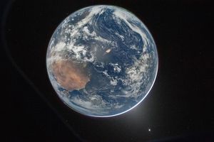
Because of this complex path, DSCOVR’s distance from Earth swings between its maximum and minimum roughly every three months, with the exact timing drifting throughout the year due to lunar influences and necessary orbital maneuvers. In 2024, for instance, the orbital geometry happened to place the spacecraft slightly farther away from Earth during both equinoxes, though that is not always the case. On December 21, 2023, DSCOVR was 1,447,327 kilometers (899,327 miles) away from Earth, compared with 1,561,901 kilometers (970,520 miles) on September 22, 2024.
There is yet another subtle nuance visible in the imagery. Because of DSCOVR’s Lissajous orbit, the angle between the Sun, Earth, and the satellite varies continuously between 2 and 12 degrees, as explained by Alexander Marshak, the deputy project scientist for the DSCOVR mission. When the angle is smaller, Earth appears as a fully illuminated, round disk. At larger angles, the planet looks less rounded—almost as if a bite has been taken out of its side, bearing a striking resemblance to the gibbous phase of the Moon.
For the specific set of seasonal comparison images, the September 22 frame featured a slightly lower angle of 8.1 degrees compared to the December 21 image at 10.3 degrees, rendering the September planet view slightly rounder and fuller. The Sun-Earth-satellite angles for the remaining two images fell safely between 9 and 10 degrees.
"You can see the subtle influence of the changing orbital geometry in these images," Marshak noted. "But the most obvious changes—the apparent location of the continents—are due to Earth’s tilt."

While EPIC’s unique vantage point provides an intuitive perspective that makes it easy for scientists and the public alike to visualize why Earth experiences seasons, the mission’s contributions extend far beyond striking photography. After more than a decade operating in deep space, the DSCOVR mission has opened up entirely new approaches for observing and understanding how daily and seasonal cycles play out on a global scale. Over the years, the camera has amassed a decade-long archive of diurnal and seasonal data tracking crucial environmental features across Earth, including vegetation health, cloud dynamics, ice and snow cover, ultraviolet radiation levels, ocean color, and atmospheric aerosols.