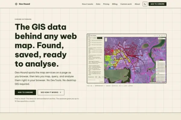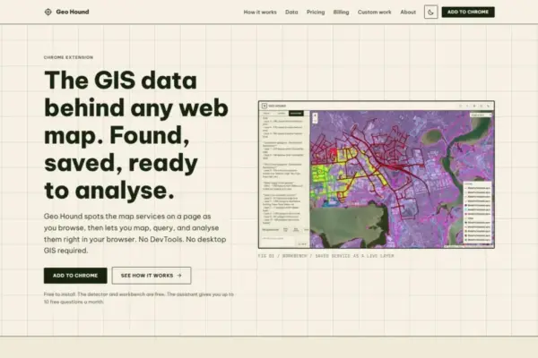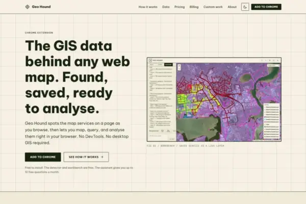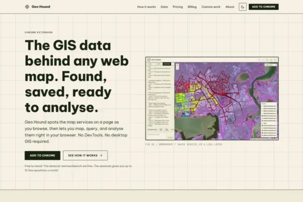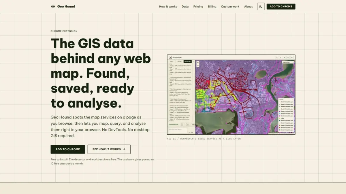
A new tool designed to simplify how geographic information is discovered, extracted, and analyzed directly within web browsers has been introduced to the geospatial community. GeoHound, a Google Chrome extension, enables users to identify, inspect, and interact with the underlying data services that power web maps across the internet. By operating passively as users navigate digital mapping applications, the tool automatically detects underlying spatial feeds and saves them alongside their associated metadata, addressing a long-standing friction point in geospatial data workflows.
Modern web maps rely on a diverse range of backend web services to render vector features, imagery, and interactive data layers. However, identifying the specific server endpoints or underlying geographic layers driving a given map visual has traditionally required technical maneuvers. Users often had to open browser developer tools, inspect complex network logs, or search through web page code to pinpoint the raw data feeds. GeoHound eliminates the need for this technical overhead by continuously monitoring network traffic for spatial data streams in real time.
The extension is capable of recognizing 29 distinct types of geospatial web services and data standards. Among the supported formats are established spatial web protocols such as Web Map Service (WMS) and Web Feature Service (WFS), emerging Open Geospatial Consortium (OGC) APIs, ArcGIS REST services, various raster and vector tile services, and standalone file feeds like GeoJSON. As users interact with web maps online, GeoHound automatically captures these service streams, organizing them in a structured manner and recording critical metadata that describes the origin, spatial parameters, and attributes of the data layers.
Beyond simple detection and data capture, GeoHound includes an integrated workbench that allows users to work with saved spatial layers directly inside the web browser. The workbench provides core GIS functionality, enabling users to perform vector operations and data manipulation without having to download files or launch traditional desktop GIS software suites. Within this browser environment, users can filter layer attributes, construct geographic buffer zones around spatial features, execute data joins between tables or geographic datasets, and export processed data into standard usable formats.
By bringing these core analytical functions into the browser context, the tool bypasses the conventional requirement for desktop geographic information systems when performing lightweight spatial tasks. For many geospatial analysts, urban planners, data journalists, and researchers, extracting web map data historically involved multiple steps: inspecting browser network traffic to locate hidden endpoint URLs, importing raw streams into software like QGIS or ArcGIS Pro, and configuring spatial processing toolboxes to perform basic filtering or buffering. The integrated workbench streamlines this sequence into a single browser-based process.
In addition to its detection capabilities and manual analysis workbench, GeoHound incorporates an artificial intelligence assistant designed to execute GIS tasks using natural language processing. The AI assistant allows users to run geographic operations on their saved layers by entering plain English commands. Rather than manually configuring tool parameters, setting up spatial queries, or managing command-line scripts, users can describe the desired spatial operations in conversational terms, allowing the assistant to carry out the corresponding GIS procedures on the captured layers.
The core service detector and built-in workbench are available to users at no cost, establishing an accessible gateway for web-based data extraction and browser GIS. The availability of free data discovery and processing tools reflects a growing movement within the spatial technology sector toward lowering barriers to entry for spatial data acquisition and rapid analysis.
The tool was created by Daniel O’Donohue, a professional geospatial specialist and the creator and host of The MapScaping Podcast, an established publication and audio platform focused on the geospatial industry. Drawing on years of experience navigating complex spatial technology stacks and discussing industry trends with mapping professionals, O’Donohue developed GeoHound to target everyday operational bottlenecks experienced by practitioners working with web mapping platforms.
The challenge of data discovery in modern web mapping stems from the decentralized nature of spatial data distribution on the internet. Government agencies, private entities, researchers, and non-profit organizations publish geographic data across thousands of disparate web portals, custom spatial dashboards, and interactive mapping applications. While these frontend web applications present visual maps to end-users, the underlying vector features, raster tiles, and attribute tables often remain locked behind service endpoints that are not readily visible or straightforward to harvest for external analysis.
By offering passive detection of 29 service types, GeoHound changes how professionals and enthusiasts discover open spatial data. Rather than searching through portal directories or relying solely on pre-packaged data download buttons, users can browse interactive web maps across the web while the extension captures active endpoints in the background. Whether a web map is built on proprietary enterprise GIS servers, open-source cartographic engines, or modern OGC-compliant APIs, the extension unifies the identification of these services under a single browser interface.
The addition of natural language AI processing highlights an evolving trend in geospatial software development, where natural language interfaces are increasingly used to complement technical menu systems and scripting environments. By enabling users to express analytical requests—such as filtering specific geographic categories, measuring spatial proximities through buffering, or joining datasets—in plain English, the system makes spatial operations more approachable while reducing the setup time required for common data manipulation tasks.
Furthermore, conducting data manipulation directly in the browser reflects ongoing advancements in web technology. As browser engines become increasingly powerful, performant spatial operations that once mandated local installation of heavy desktop software can now be executed seamlessly within standard web sessions. This browser-native approach minimizes software dependency, allows for immediate data validation, and speeds up the transition from spatial data discovery to actionable geographic insight.
GeoHound provides a streamlined mechanism for interacting with the broad ecosystem of web services powering modern digital cartography. By combining automated service detection, metadata preservation, a browser-native GIS workbench, and natural language AI capabilities, the extension offers a unified workflow for discovering, processing, and exporting spatial data directly from the web browser.