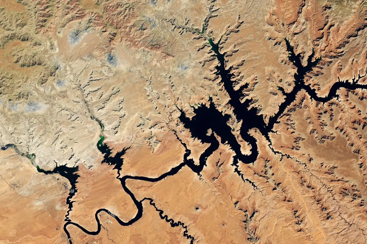
The compounding effects of an unprecedented snow drought and persistently high temperatures across the Colorado Basin have driven down reservoir water storage in the American West to critical levels. By late summer 2026, the consequences of a meager mountain snowpack in the Upper Colorado Basin had manifested downstream at Lake Powell, leaving the second-largest reservoir in the United States sitting at record-low elevations.
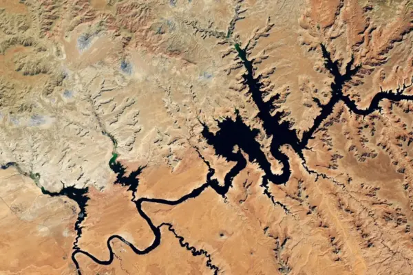
Satellite observations captured by the Operational Land Imager (OLI) on the NASA-USGS Landsat 8 satellite illustrate the dramatic contraction of the reservoir over the past decade. Comparing imagery from September 1, 2017—which represented one of the highest water levels of the preceding decade—with an image from September 10, 2026, reveals stark reductions in surface water near the Glen Canyon Dam. In the September 2026 image, the water level stood at 3,517.24 feet. Approximately a month prior, the lake dipped below its previous record-low level of 3,519.92 feet, which had been set on April 13, 2023, and the water surface continued to decline through early September.
The Colorado River system serves as a crucial lifeline for the American Southwest. The river feeds Lake Powell before flowing downstream into Lake Mead, which also dropped to record-low levels in August 2026. Managed cooperatively by the U.S. Bureau of Reclamation (USBR) and various state and federal agencies, the river provides essential water and hydroelectric power generation to more than 40 million people across major urban centers, including Las Vegas, Phoenix, Los Angeles, and San Diego. Furthermore, the system supplies irrigation water to approximately 5 million acres of vital agricultural land throughout the Southwest.
Because a significant portion of the Colorado Basin is characterized by arid or semi-arid conditions, the river’s annual flow depends heavily on the accumulation and subsequent melt of mountain snowpack at higher elevations. During the winter of 2025-2026, the Upper Colorado Basin experienced unusually low snow accumulation, echoing broader snow drought conditions observed in mountainous regions across the western United States. Extended stretches of unseasonably warm weather further exacerbated the depletion of the already scarce snowpack. Consequently, the anticipated spring snowmelt failed to provide the substantial replenishment that these lake levels typically receive at the conclusion of winter.
To mitigate the crisis and prevent catastrophic drops in water elevation, the USBR implemented targeted operational adjustments in April 2026. These interventions were designed to stabilize Lake Powell and avert a scenario in which the water level would fall below the minimum threshold required for hydropower production—an outcome that agency modeling indicated was entirely possible by August 2026 without intervention.
As part of these emergency measures, the USBR began releasing stored water from the Flaming Gorge Reservoir in northern Utah and southern Wyoming into Lake Powell. Simultaneously, the agency reduced releases from Lake Powell into Lake Mead. To conserve crucial storage volumes, officials also canceled a planned "controlled flood" in April that was originally intended to build sandbars and support native fish habitats, and skipped a "cool mix" water release in August aimed at protecting native aquatic species.
These operational strains unfold against the backdrop of a broader, long-term climate pattern. Drought conditions across the U.S. Southwest have persisted since approximately the turn of the 21st century, a prolonged dry spell that hydrologists and climate scientists have classified as a megadrought. This ongoing climatic pressure continues to strain municipal, agricultural, and ecological water resources across the region.
To aid decision-makers in navigating these challenging conditions, various projects and tools funded by NASA and supported by NASA Earth observations are being utilized throughout the Colorado Basin to monitor drought development and evaluate its impacts in real time. Near the headwaters of the Colorado River, a specialized dashboard utilizing the Western Land Data Assimilation System (WLDAS) provides critical visualizations of soil moisture, snow water equivalent, and evapotranspiration. These metrics directly inform Colorado’s drought task force and contribute data to the weekly U.S. Drought Monitor maps.
Closer to Lake Powell, regional leaders rely on the Drought Severity Evaluation Tool, which was co-developed alongside the Navajo Nation. This platform assists tribal leaders in monitoring localized drought indices, precipitation trends, and vegetation health across indigenous lands. Supported by funding from NOAA’s National Integrated Drought Information System, the application of this tool expanded in 2025 to serve Oklahoma’s Chickasaw and Choctaw Nations as well.
Additionally, researchers at Arizona State University, in partnership with the Central Arizona Project, developed the Colorado River Integrated Assessment tool. This comprehensive platform consolidates improved modeling systems and information validated by NASA satellites—covering snowpack dynamics, surface water and groundwater storage, and soil moisture—into a single, interactive interface for the entire basin.