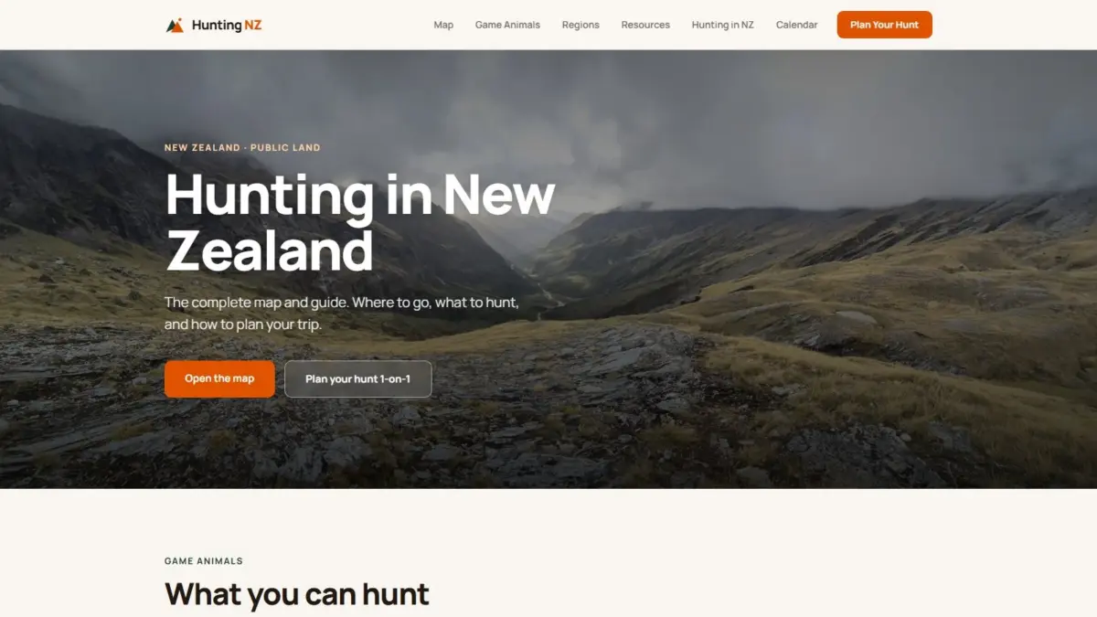
For outdoor recreationists navigating New Zealand’s rugged terrain, identifying clear legal boundaries and understanding environmental conditions has historically required cross-referencing multiple disparate resources. The "Hunting NZ" platform resolves this fragmentation by consolidating official spatial data from Land Information New Zealand, the Department of Conservation, and the Walking Access Commission onto an interactive mapping engine. Through this centralized portal, users can evaluate precise legal boundaries, identify designated hunting areas, assess physical terrain, and review active management operations within a unified spatial environment.
A core objective of the platform is answering the fundamental question of where legal hunting is permitted across the country. New Zealand’s public land estate includes an extensive network of conservation areas, national parks, reserves, and designated hunting blocks, each governed by specific access rules and management mandates. By integrating boundary data directly from the Department of Conservation alongside land record data from Land Information New Zealand, the map provides visual clarity regarding public conservation land boundaries. Users can pinpoint specific hunting blocks and verify the exact spatial extent of areas where hunting is authorized, mitigating the risk of accidental trespass onto restricted lands or private property.
In addition to defining legal boundaries, the platform directly addresses what recreationists can expect to encounter in the field by mapping species distributions across the landscape. New Zealand is home to diverse introduced game populations, each established in distinct geographic niches across the North and South Islands. The interactive map incorporates spatial distribution overlays for major game species, including red deer, Himalayan tahr, chamois, sika deer, and wapiti, as well as additional local game species. By layering biological presence data over geographic boundaries, the tool enables users to analyze species prevalence across specific regional catchments, mountain ranges, and public conservation blocks.
To support detailed spatial analysis, "Hunting NZ" offers multiple visualization layers that cater to varied mapping needs and planning requirements. Users can toggle between traditional topographic maps, high-resolution aerial imagery, hillshade visual models, and fully rendered three-dimensional terrain views. The inclusion of topographic basemaps provides classic cartographic detail, showing contour lines, river systems, and spot heights essential for navigational orientation. Aerial imagery offers clear visual context regarding vegetation cover, bush lines, clearings, and river flats, allowing for detailed inspection of local environments.
The platform’s hillshade and 3D terrain modeling capabilities enhance spatial visualization by providing physical context to New Zealand’s steep and complex topography. The hillshade view uses digital elevation models to simulate light and shadow across mountain ranges, emphasizing slope aspects, ridgelines, gullies, and valley floors. The
3D terrain rendering feature enables users to view landscape features in three dimensions, offering an immersive look at elevation changes, mountain passes, and steep gradients. This elevated visual detail assists in evaluating physical access routes, terrain difficulty, and visibility across remote backcountry areas.
Beyond boundary and terrain mapping, the platform incorporates essential operational and recreational infrastructure data. The map features comprehensive overlays of established walking tracks and backcountry trails, along with the locations of public huts and shelters managed across the conservation estate. Integrating track networks and hut locations into the spatial interface allows users to plan travel routes, estimate distances, and identify potential shelter options relative to legal hunting block boundaries and terrain features.
The platform also tracks active pest-control operations across public conservation land. Pest-management activities, including control operations managed by state agencies and local authorities, represent critical operational data for backcountry visitors. Mapping these operations alongside hunting zones provides situational awareness, helping users identify where active control programs are taking place and adjust their plans accordingly to maintain safety and compliance with local operational advisories.
Supporting the interactive mapping interface is an extensive repository of educational resources, regional analyses, and compliance information. The platform incorporates dedicated guides for each primary game species found in New Zealand, detailing the biological characteristics, preferred habitats, and distribution patterns of red deer, Himalayan tahr, chamois, sika deer, wapiti, and other game animals. These guides connect biological habits with spatial data, helping users understand how terrain, elevation, and vegetation influence animal movement and habitat selection across different seasons.
To accommodate regional variations in landscape, regulation, and species composition, "Hunting NZ" features region-by-region breakdowns across the country. New Zealand’s diverse geography—ranging from the dense native forests and volcanic plateaus of the North Island to the alpine chains, glacial valleys, and tussock lands of the South Island—presents distinct conditions for backcountry navigation. The regional summaries organize spatial, regulatory, and biological information into localized contexts, giving users targeted insights into specific geographic districts.
Regulatory compliance is further integrated through a specialized hunting calendar and licensing information suite. Obtaining proper authorizations, understanding seasonal game conditions, and adhering to regional rules are essential components of responsible public land use. The platform synthesizes relevant permit requirements, licensing procedures, and seasonal frameworks, aligning regulatory obligations directly with the spatial zones mapped on the interface. This integration ensures that users have direct access to the administrative rules governing public conservation land alongside physical and spatial geographic data.
The development of "Hunting NZ" was led by Daniel O’Donohue, a professional geospatial specialist and the creator and voice behind The MapScaping Podcast, a widely recognized audio platform serving the global geospatial community. With years of professional experience in spatial science and geographic information systems, O’Donohue built the platform to demonstrate the practical utility of spatial data synthesis in resolving real-world informational challenges. Through his work in the geospatial sector, O’Donohue has focused on harnessing spatial analysis to simplify complex spatial environments, breaking down multi-layered data into clear, accessible visual formats.
The creation of "Hunting NZ" highlights the growing role of open government data and geospatial engineering in improving public access to geographic information. By aggregating spatial data from Land Information New Zealand, the Department of Conservation, and the Walking Access Commission into a unified, interactive digital map, the project bridges the gap between raw spatial datasets and practical user applications. The platform translates complex vector boundaries, elevation models, and biological survey records into an accessible resource for understanding New Zealand’s public lands, wild game distributions, and legal recreational spaces.