Skip to content
Breaking News
  • GeoHound Tool Launches as Chrome Extension to Instantly Detect, Analyze, and Process Web Map Data
  • From ERP Systems to AI Strategy: Inside Aakansha Bhalotia’s 13-Year Tech Journey at Precisely
  • Elistair Unveils Tethered Air Module for the Parrot ANAFI UKR to Enable Extended ISR Missions
Thursday, October 22, 2026
Edition: U.S. International Login

Hack The Map

Author: Sagoh

Geopolitics and Map News

How Moscow’s Evolving Strategic Mindset is Redrawing the Security Map of Europe

October 21, 2026 Sagoh
Nearly five years after Russia launched its full-scale invasion of Ukraine—and amid the evolving landscape of the second Trump administration—the…

Environmental and Climate Mapping

COP17: Which countries have released new pledges to tackle nature loss?

October 20, 2026 Sagoh
The findings indicate that roughly 58% of countries have met a United Nations call to submit new pledges targeting nature…
Drone Mapping and Aerial Photography

Senator Cites Classified Security Findings in Defense of DJI and Autel Restrictions

October 17, 2026 Sagoh
Federal Communications Commission (FCC) filings have brought to light new dimensions in the ongoing regulatory battle over foreign-manufactured unmanned aircraft…
Travel Hacking and Digital Nomad

Navigating Credit Card Rewards and Editorial Disclosures in Modern Financial Journalism

October 16, 2026 Sagoh
October 16, 2026 The modern landscape of financial journalism and consumer credit advisory services continues to evolve rapidly, blending independent…
Geography and Earth Science

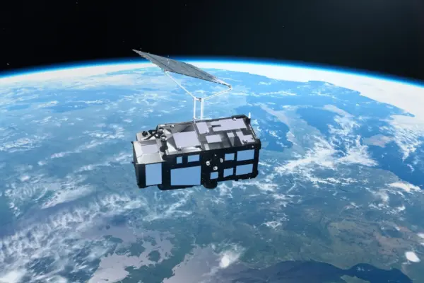
Europe’s New Sentinel-3C Satellite Delivers Stunning First Earth Images and Critical Climate Data

October 14, 2026 Sagoh
Just two weeks after successfully reaching orbit, Europe’s newest Earth-observing spacecraft, the Copernicus Sentinel-3C satellite, has delivered its first breathtaking…
Open Source Geospatial Software

GeoServer Issues Urgent Security Update After August Zero-Day Disclosure and Outlines New AI Vulnerability Policies

October 14, 2026 Sagoh
As the open-source community reflects on the security landscape over the summer of 2026, the GeoServer project has issued a…
OpenStreetMap and Community Mapping

OpenStreetMap Working Group Launches 2026 Community Microgrants Program to Back Grassroots Mapping Initiatives

October 13, 2026 Sagoh
The Local Chapters and Communities Working Group of OpenStreetMap has officially announced the launch of its 2026 Community Microgrants program,…
Travel Hacking and Digital Nomad

Holafly Launches Ongoing Global eSIM Subscription Plan for International Travelers and Digital Nomads

October 13, 2026 Sagoh
Travel technology company Holafly has rolled out a new product category designed to streamline mobile connectivity for frequent international travelers.…
Urban Planning and Smart Cities

Bipartisan Congressional Caucus Unveils "Build More Agenda" to Tackle U.S. Housing Crisis and Streamline Development

October 12, 2026 Sagoh
WASHINGTON — Building on their legislative momentum following the passage of the 21st Century ROAD to Housing law, the bipartisan…
Data Visualization and Infographics

The Rise of AI Software Clones: How REA and ArtCraft Are Going Viral

October 12, 2026 Sagoh
Something remarkable is happening in the global AI development community, signaling what many industry observers believe is the beginning of…

Posts navigation

Older posts

Recent Posts

  • GeoHound Tool Launches as Chrome Extension to Instantly Detect, Analyze, and Process Web Map Data
  • From ERP Systems to AI Strategy: Inside Aakansha Bhalotia’s 13-Year Tech Journey at Precisely
  • Elistair Unveils Tethered Air Module for the Parrot ANAFI UKR to Enable Extended ISR Missions
  • A 178-Year-Old Train Delay Solves a Major Mystery in the History of Space Weather and Solar Storms
  • Urban Parking Costs and Curb Management Drive Traffic and Transportation Planning Challenges, New Report Shows

Recent Comments

No comments to show.

Archives

  • October 2026
  • September 2026
  • August 2026

Categories

  • Data Visualization and Infographics
  • Disaster Response and Humanitarian Mapping
  • Drone Mapping and Aerial Photography
  • Environmental and Climate Mapping
  • Geography and Earth Science
  • Geolocation and Cybersecurity
  • Geopolitics and Map News
  • GIS and Spatial Technology
  • Location Intelligence and Spatial Analytics
  • Open Data and Civic Tech
  • Open Source Geospatial Software
  • OpenStreetMap and Community Mapping
  • Remote Sensing and Satellite Imagery
  • Transportation and Mobility Tech
  • Travel Hacking and Digital Nomad
  • Urban Planning and Smart Cities
  • Web Mapping and Cartography

© 2026 Hack The Map. All rights reserved.

Theme: The Original by Rifan Muazin.