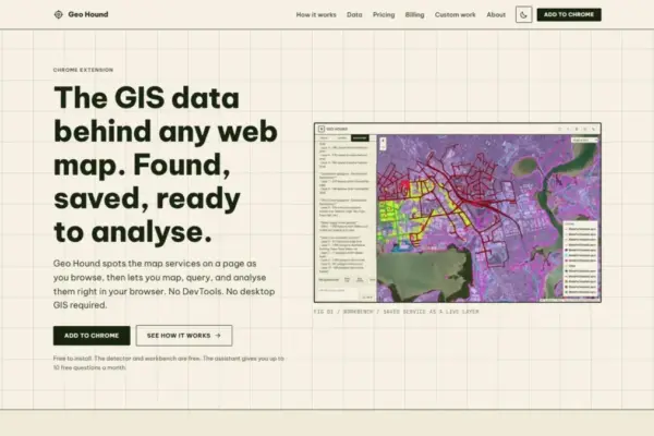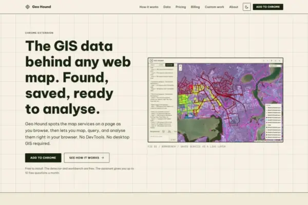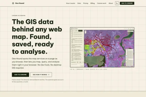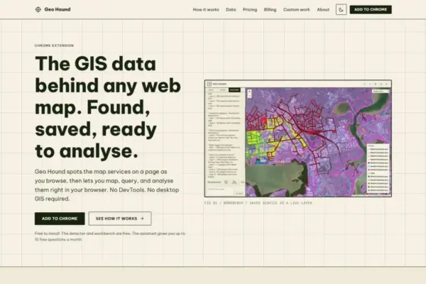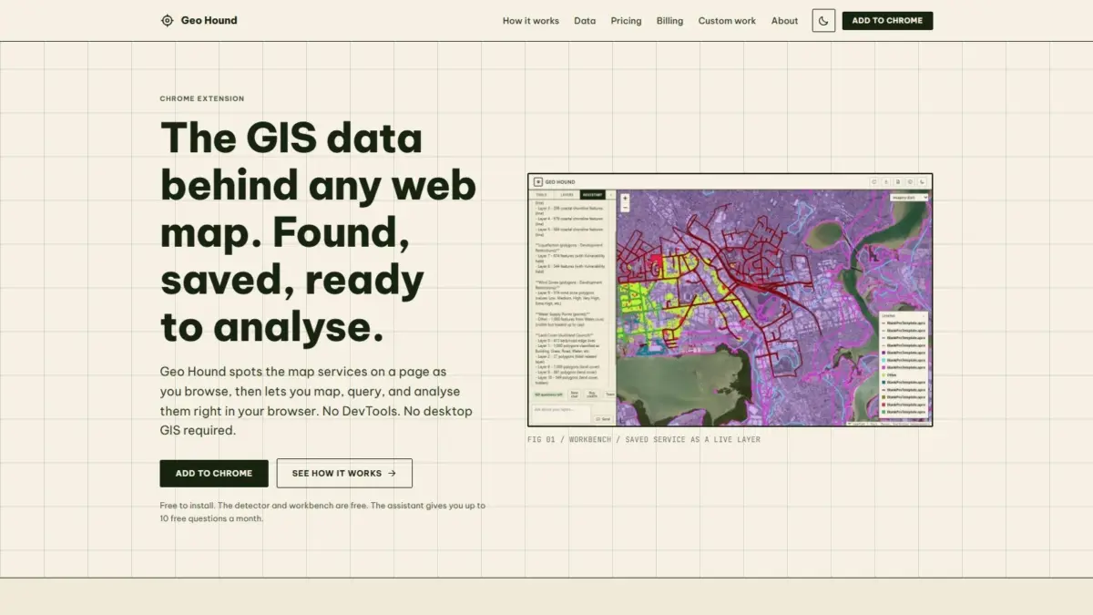
A new web browser extension named GeoHound aims to simplify how spatial analysts, researchers, and cartographers uncover and manipulate the underlying geographic data powering interactive web maps. Developed by geospatial specialist Daniel O’Donohue, creator and host of The MapScaping Podcast, the Google Chrome extension automatically identifies remote mapping services and data feeds as users browse the web, capturing operational endpoints alongside their essential metadata without requiring manual inspection through browser developer tools or desktop Geographic Information System software.
Modern web mapping relies heavily on distributed client-server architectures, where interactive web applications request spatial datasets dynamically from remote servers. When users interact with a map embedded on a website, the underlying platform continuously streams geographic data in the form of pre-rendered image tiles, vector geometry tiles, or structured vector feature feeds. Historically, identifying the exact server location, format specifications, and endpoint parameters of these underlying web services required a tedious technical process. Spatial professionals and open-source intelligence analysts were forced to open browser Developer Tools, open network inspection tabs, monitor incoming web requests, and filter through hundreds of individual HTTP network payloads to extract active spatial service links. Once located, analyzing or repurposing that data typically required copying complex service URLs into desktop software suites such as QGIS or Esri ArcGIS Pro just to evaluate simple attributes or render spatial layers.
GeoHound eliminates this friction by automating data discovery directly within the browser background. As a user navigates any web page containing a map, GeoHound continuously scans network interactions to detect active mapping services. The extension natively recognizes 29 distinct web service and geospatial format types, offering broad coverage across open standards, proprietary enterprise platforms, and light web data formats.
Among the 29 supported service types are core Open Geospatial Consortium (OGC) specifications, including Web Map Services (WMS), which serve georeferenced map images, and Web Feature Services (WFS), which deliver raw spatial vector geometries and attribute tables directly to the client. The extension also detects modern OGC APIs designed for web-native RESTful interaction, alongside Esri’s widely deployed ArcGIS REST services, which power public sector GIS portals and enterprise spatial infrastructure globally. Beyond standardized web service protocols, GeoHound identifies both raster and vector tile services—which split geographic layers into manageable grids for high-performance browser rendering—as well as standalone web geometries such as GeoJSON files. When a spatial service is detected, GeoHound captures and preserves its associated metadata, giving users instant visibility into layer definitions, coordinate reference systems, service capabilities, and attribute schemas.
Capturing spatial service endpoints is only the first step in web map exploration; evaluating and manipulating that data often presents additional operational hurdles. To address this, GeoHound includes a built-in browser workbench that enables users to perform fundamental GIS tasks on captured datasets without leaving the browser interface or launching external desktop software.
Within the GeoHound workbench, users can perform essential vector and raster analytical operations on saved layers. The tool supports spatial and attribute filtering, allowing users to isolate specific spatial features or query attribute values directly inside the browser environment. Analysts can apply buffering operations to generate proximity zones around spatial features, such as points, lines, or polygons, facilitating immediate distance-based analysis. The workbench also supports dataset joining, enabling users to combine complementary tables or merge spatial layers based on tabular keys and geographic relationships. Once spatial datasets have been parsed, filtered, or combined, users can export the refined layers into standard formats for external use, distribution, or archival storage.
By unifying endpoint detection, layer management, spatial processing, and data export into a single browser interface, the extension streamlines context-switching between web browsers and traditional desktop software environments. Both the core detection engine and the integrated workbench environment are provided free of charge to users.
To further simplify spatial workflows, GeoHound incorporates an artificial intelligence assistant capable of executing GIS operations on saved layers using plain English commands. Rather than requiring users to manually select tool parameters, configure complex dialog boxes, or write spatial SQL queries, the AI assistant interprets natural language instructions and applies the corresponding operations directly to layers loaded in the workbench. This conversational interface enables users to request filtering, buffering, and analytical steps using straightforward written directives. For non-specialists or professionals seeking rapid exploratory analysis, the natural language engine reduces technical barriers to spatial processing, while offering experienced spatial analysts a direct, keyboard-driven method for managing geographic layers.
The creation of GeoHound stems directly from Daniel O’Donohue’s extensive background in the geospatial sector. As the host and producer of The MapScaping Podcast, an established audio platform catering to the global geospatial community, O’Donohue has spent years exploring the technical challenges, evolving standards, and practical
applications of location data alongside leading industry professionals. His background as a geospatial specialist informs the design of the extension, targeting longstanding inefficiencies in how spatial data is discovered, inspected, and reused across the modern web ecosystem.
The launch of GeoHound reflects broader technological trends within the location intelligence industry, where spatial workflows are increasingly shifting toward browser-native applications and light web interfaces. Historically, geographic analysis was largely constrained to heavy, desktop-bound GIS software requiring specialized training and local computational resources. While cloud-based mapping platforms and web GIS portals have expanded access to spatial data over the past decade, discovering the true source endpoints of web layers has remained fragmented. Automated service detection tools combined with lightweight, in-browser processing environments represent an important step toward democratizing access to web-hosted geographic information.
By pairing automated layer detection across 29 data formats with a functional in-browser workbench and plain-English AI processing, GeoHound offers a comprehensive, modern solution for working with web maps. The extension provides spatial professionals, researchers, developers, and data journalists with a streamlined toolset for discovering hidden spatial endpoints, evaluating service metadata, conducting rapid spatial operations, and exporting spatial datasets directly from their web browser.