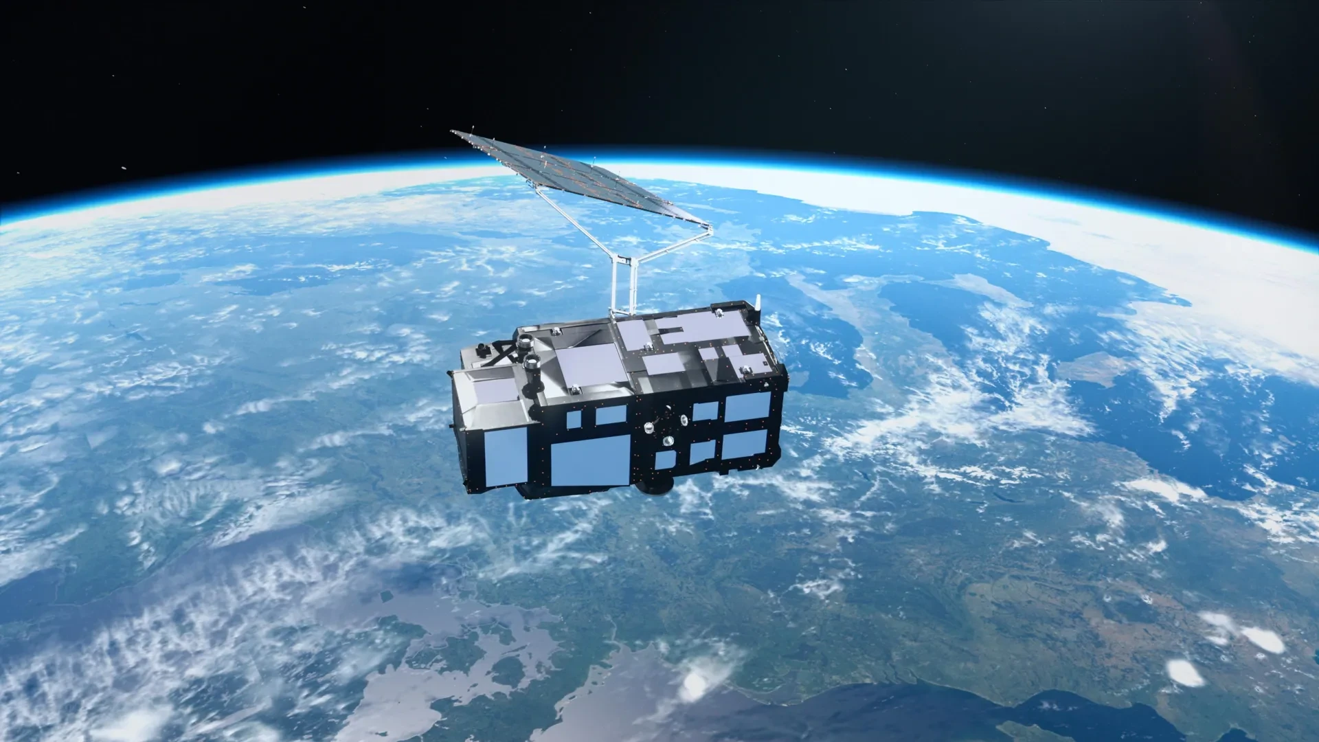
Yet, beneath the striking aesthetic appeal of these initial photographs lies a powerful suite of advanced scientific instruments already hard at work. Beyond merely capturing pictures, Sentinel-3C’s onboard technology has commenced the critical task of measuring global ocean heights and tracking the surface elevation of Greenland’s massive ice sheet. These early successes mark an encouraging and pivotal demonstration of cutting-edge hardware specifically engineered to monitor our planet’s rapidly changing climate in real time.
The first batch of imagery and telemetry data originates from two of Sentinel-3C’s primary payloads, both of which are reportedly performing exceptionally well during their initial checkout phases in orbit. This strong start brings the spacecraft one step closer to assuming its full operational responsibility: tracking complex environmental and ecological shifts across the globe with unprecedented precision.
A Powerful New Satellite to Monitor Earth’s Changing Climate
Sentinel-3C represents the third orbital spacecraft in the established Sentinel-3 series, which forms a cornerstone of the broader Copernicus Earth observation initiative. These satellites are meticulously outfitted with identical sets of complementary instruments designed to continuously ingest and analyze data concerning the world’s oceans, landmasses, atmosphere, and cryosphere—the collective term for Earth’s frozen domains.
Over the planet’s vast marine environments, the Sentinel-3 mission measures sea surface temperature, ocean color, dynamic sea surface height, and the thickness of floating sea ice. Such comprehensive observations are vital for scientists investigating marine pollution incidents, monitoring destructive marine heatwaves, and decoding the intricate shifts taking place within global ocean conditions.
Across terrestrial landscapes, the mission yields critical insights regarding agricultural droughts, creeping wildfires, vegetation health and vigor, and changing patterns of land utilization. Furthermore, the satellite meticulously tracks fluctuating water levels in inland rivers and lakes while simultaneously monitoring topographical alterations in polar ice sheets.
The wealth of data gathered by the spacecraft directly bolsters routine weather forecasting by supplying timely, highly accurate observations of current environmental conditions. Simultaneously, this continuous stream of information equips researchers with the long-term empirical evidence needed to identify and analyze systemic trends linked directly to ongoing climate change.
The European Space Agency (ESA) is currently guiding Sentinel-3C through a rigorous, multi-month testing and commissioning phase designed to fully prepare the platform for routine operations, a process expected to take roughly five months. Nevertheless, the remarkably successful yields of its initial fortnight in orbit have provided mission teams with profound encouragement.
Stunning Satellite Images Reveal Italy’s Diverse Landscape
Among the very first visual products delivered by the mission is a sweeping natural-color view of Italy and its surrounding marginal seas, captured on September 30 by the spacecraft’s dedicated ocean and land color instrument. The frame spans a vast geographic canvas, reaching from southern Germany down the entirety of the Italian peninsula to Sicily and across the southern Mediterranean basin.
The resulting photograph exposes an extraordinary variety of topography, transitioning seamlessly from towering, rugged mountain chains and fertile agricultural lowlands to the deep, uniform blue of the surrounding sea. Near the upper center of the composition, the Po Valley emerges clearly as a broad expanse of rich green and brown tones, marking the historic heartland of Italian agricultural productivity.
Immediately to the north of these lowlands, the snow-covered Alps rise dramatically, their brilliant white summits creating a sharp, striking contrast against the darker terrain below. Across the broader Italian landscape, subtle gradients of green and brown reflect ongoing variations in regional vegetation, active farming cycles, and diverse land cover types.
To the east, the Adriatic Sea forms a clear physical barrier separating Italy from the partially visible Balkan Peninsula. Along the eastern coast of Italy, distinct bands of lighter blue water trace the coastline against the much deeper blue of the offshore basin. Scientists attribute these localized color variations to heavy sediment loads swept into the sea by mainland rivers and subsequently redistributed by complex coastal currents.
On the opposite side of the peninsula, the dark, profound waters of the Tyrrhenian Sea enclose the major islands of Sardinia and Sicily. The island of Corsica also falls within the frame, though its surface is largely obscured by a blanket of passing clouds. Together, these vivid contrasts paint an extraordinary portrait of southern Europe from the unique vantage point of space.
A Dramatic View of the Arctic’s Vulnerable Ice
Shifting perspective from the Mediterranean to the high latitudes, a second image captured on September 30 trains its lens on the Canadian Arctic Archipelago, situated immediately west of Greenland. The resulting landscape offers a stark and chilling contrast to the sun-drenched agricultural valleys of southern Europe.
In this frozen theater, pristine snow and ancient ice blanket numerous islands, while exposed rock, jagged coastlines, and deep, carved fjords weave intricate patterns across the polar geography. The observation was intentionally timed to coincide with the period of the year when Arctic sea ice typically plunges to its annual minimum extent. Consequently, much of the surrounding water appears dark and open, though scattered fragments of residual floating sea ice remain visible drifting across the dark waves.
These observations carry profound scientific significance, largely because the Arctic is currently warming at a rate drastically faster than the global planetary average. As regional atmospheric and oceanic temperatures climb persistently, glaciers and ice sheets shed mass at alarming rates, while seasonal sea ice continues its steady decline. The disappearance of this bright, reflective ice unmasks darker ocean waters beneath, which subsequently absorb significantly more solar radiation and accelerate regional warming feedback loops.
Sentinel-3’s diverse array of instruments observes these frozen realms in complementary ways, granting researchers an increasingly holistic understanding of the rapid transformations unfolding across vulnerable polar ecosystems.
Brilliant Caribbean Waters Seen From Space
Demonstrating the mission’s incredible geographic versatility, a third featured image captured on September 29 reveals an entirely different facet of Earth’s complex environment. Focusing on the tropical Atlantic, the scene captures portions of the Caribbean, positioning Cuba near the lower edge of the frame and the sprawling Bahamian archipelago toward the top.
Surrounding these island chains, shallow marine waters glow in brilliant, luminous shades of turquoise, creating a sharp and vivid contrast against the deep, midnight blue of the surrounding ocean depths. These dramatic shifts in chromatic value help scientists visually decode variations in local water depth, seafloor topography, and the unique ecological characteristics of shallow-water marine habitats.
Beyond their visual splendor, views of the Caribbean serve as a sober reminder of the escalating threats confronting low-lying island nations and coastal settlements as global sea levels continue their upward march. To address these challenges directly, Sentinel-3C carries one of its most vital scientific payloads: a synthetic aperture radar altimeter explicitly engineered to measure the precise height of the ocean surface with extreme accuracy. By continuously tracking how these surface heights fluctuate over decades, researchers can sharpen their models of sea-level rise and better equip coastal communities to prepare for its future consequences.
New Measurements Show the Satellite Is Performing Well
Aside from delivering arresting photographs, Sentinel-3C has rapidly proven its capacity to gather rigorous, highly precise scientific measurements. Its sensitive radar altimeter has already successfully collected sea surface height profiles extending across the Atlantic Ocean and the Mediterranean Sea.
Mission researchers cross-referenced these fresh observations against the Copernicus Marine Service’s established multimission sea-level anomaly datasets, which synthesize height measurements pooled from multiple orbiting satellites. The early comparative results display remarkable alignment with existing observations, signaling that the new altimeter is functioning cleanly and precisely as intended.
Once the ongoing commissioning phase officially concludes, Sentinel-3C will step into service alongside veteran orbital platforms like Copernicus Sentinel-6 and the Jason series to maintain continuous global sea-level monitoring. Such long-running observational continuity remains absolutely vital for determining precisely how fast the world’s oceans are swelling.
Empowered by decades of precise satellite altimetry, scientists have established that global sea levels have risen by an average of 3.64 millimeters per year since 1999. Furthermore, empirical data confirms that the overall rate of sea-level rise is actively accelerating, rendering uninterrupted satellite surveillance more critical than ever.
The utility of Sentinel-3C’s altimeter extends far beyond open ocean measurements. The instrument is also tasked with capturing fluctuations in the surface heights of inland rivers, lakes, sea ice, and land ice, neatly complementing forthcoming observations from the specialized Copernicus CRISTAL mission.
Tracking Greenland’s Massive Ice Sheet From Orbit
Some of the most encouraging early telemetry returned by Sentinel-3C originates from the high plateaus of Greenland. Between September 30 and October 4, the satellite executed targeted passes to measure the surface elevation of the colossal Greenland Ice Sheet. An accompanying mission animation illustrates the precise orbital tracks of these observations as they sweep across the vast, frozen landscape.
When scientists matched these fresh orbital readings against an established reference digital elevation model—a high-resolution representation of the ice sheet’s topographical surface—the satellite’s data exhibited a tight, reassuring conformity with existing baselines. This close alignment provides definitive additional proof that the radar altimeter is operating at peak performance levels.
Accurately tracking changes in ice sheet elevation carries immense urgency as the global climate continues to warm. Both Greenland and Antarctica store staggering quantities of frozen freshwater, and even minor net losses from these massive ice sheets carry profound implications for worldwide sea-level rise.
Because ice discharge from these polar sectors represents a principal driver of modern sea-level rise, repeated spaceborne elevation measurements allow scientists to monitor mass balance trends over time and refine future sea-level projections with greater confidence.
What’s Next for Europe’s New Earth-Watching Satellite?
Though Sentinel-3C remains firmly entrenched in its early validation and testing phase, its initial bounty of observations marks a decisive stride toward full, routine scientific operations. The platform’s ocean and land color instrument has already proven its ability to render complex coastal and terrestrial landscapes in high detail, while its radar altimeter has successfully verified its aptitude for charting ocean and ice elevations.
Another major operational milestone looms on the horizon. The mission team is actively preparing to release the first analytical observations generated by the sea and land surface temperature radiometer, an advanced sensor specifically built to gauge the thermal conditions of both land surfaces and ocean waters across the globe.
Sentinel-3C operates as a core component of Copernicus, the expansive Earth observation component overseen by the European Union’s Space Program. The European Space Agency retains primary responsibility for developing, deploying, and commissioning the Sentinel-3 satellite constellation.
Upon the formal conclusion of the commissioning phase, joint management responsibilities shift to ESA and the European Organisation for the Exploitation of Meteorological Satellites (Eumetsat). Under this collaborative framework, Eumetsat manages routine satellite operations and delivers critical marine and atmospheric data streams, while ESA oversees land, cryospheric, inland water, and post-processed atmospheric product portfolios.
Together, these two major European institutions ensure that the continuous stream of Sentinel-3 data remains freely accessible to operational Copernicus services and research communities worldwide. Backed by such robust institutional support and validated by highly promising early telemetry, Sentinel-3C is well on its way to cementing its status as an indispensable instrument for keeping watch over our rapidly changing world.