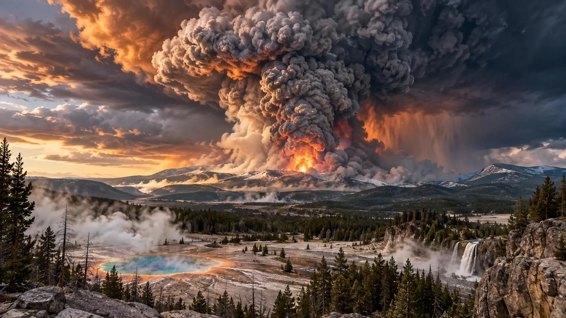
Roughly 631,000 years ago—a mere geological blink of an eye—a catastrophic event unfolded in what is now north-western Wyoming. During a series of immense volcanic eruptions, life within hundreds of kilometers of the blast zone was utterly devastated. Volcanic ash dispersed across much of the North American continent, and the atmospheric consequences were felt on a global scale. This was a super-eruption of the massive volcanic system residing beneath what is now Yellowstone National Park.
Despite the staggering scale of the disaster, no known human witnessed the cataclysm. As far as archaeological evidence indicates, early humans had not yet reached the North American continent. Across distant oceans, early human populations may have only wondered at hazier skies and unusually vivid sunsets. Volcanic particles circulating through the upper atmosphere cooled the global climate and likely altered regional weather patterns, directly affecting human survival. Whether ancient populations noted these environmental shifts or connected them to a distant subterranean event remains entirely unknowable.
In the modern era, however, humanity would notice immediately. Scientists already understand that a super-eruption of this magnitude would pose an existential threat to civilization as we know it. To explore this further, disaster and volcano experts have constructed a detailed thought experiment examining what society might experience if Yellowstone were to erupt today. This hypothesis is grounded in current volcanological research and observations of how modern nations manage severe, large-scale disasters.
T-2 Months: The First Tremors
Shortly after six in the morning, an analyst at the University of Utah Seismograph Stations notices a series of sharp spikes interrupting the typically quiet, wavy lines recorded by Yellowstone’s earthquake monitors. These measurements represent a cluster of seismic activity detected beneath the park overnight. The scientist pauses, recognizing immediately that these observations do not fit Yellowstone’s usual baseline behavior.
The public often imagines Yellowstone as a dormant "supervolcano." While it may sleep in terms of explosive output, its geological processes never truly halt. A vast array of instruments continuously monitors its activity. A dense network of seismometers tracks regional earthquakes, while data feeds stream in around the clock from GPS stations, strainmeters designed to measure the deformation of the Earth’s crust, and specialized sensors positioned throughout active geyser basins. Satellite observations, gas sampling programs, and field surveys supply an additional wealth of continuous data.
Volcanologists examine earthquake counts alongside their locations, depths, and magnitudes. Seismic "swarms" require particular attention, especially when they migrate horizontally through the crust or become progressively shallower. Such patterns frequently indicate that magma or pressurized, mineral-rich hydrothermal fluids are forcing their way upward.
The duty scientist is initially relieved to discover that most of the unusual tremors are extremely small—too weak to be felt at the surface. However, combined, they form an uncharacteristically concentrated swarm. Cross-referencing the signals with neighboring seismometers, the analyst contacts colleagues at partner organizations within the Yellowstone Volcano Observatory (YVO) to initiate standard protocols outlined in the YVO response plan.
The team deduces that instruments have recorded a tightening cluster of earthquakes beneath Yellowstone’s vast caldera, which spans roughly 55 to 70 kilometers across. Yellowstone experiences thousands of earthquakes every year, and seismic swarms are not uncommon. Yet this particular activity appears to be migrating slightly upward. By itself, an earthquake swarm does not signify an imminent eruption, nor do isolated instances of ground deformation, fluctuating temperatures, or shifting gas emissions. Scientists become genuinely alarmed only when multiple indicators converge simultaneously. For now, the scientific team decides to monitor the situation closely.
T-1 Month: Escalating Unrest
Four weeks later, the seismic swarm has continued its upward migration, and new tremors are appearing along a narrow zone directly beneath the caldera. The analyst, now writing increasingly urgent reports, notes that GPS stations positioned above the swarm have begun moving apart. Strain measurements have escalated, and satellite radar reveals the underlying cause: a broad, accelerating uplift of the ground surface.
Together, these observations strongly indicate that fresh magma is intruding into the Earth’s crust—a phenomenon documented at active volcanic systems like Kilauea in Hawai’i prior to eruptions. Reassuringly for YVO staff, Yellowstone has produced similar combinations of warning signals in the past without culminating in an eruption. Between 2013 and 2014, parts of the caldera rose at rates exceeding 15 centimeters per year alongside increased seismic activity, culminating in a magnitude 4.8 earthquake—the largest recorded at Yellowstone since 1975. Shortly afterward, the ground uplift transitioned into subsidence, and researchers concluded that the episode was driven by shifting hydrothermal fluids rather than ascending magma.
Mindful of the need to maintain public trust without triggering panic, the YVO responds cautiously. A duty scientist is assigned to continuous data assessment, while temporary seismometers and GPS units are deployed to gather higher-resolution measurements. Water and gas samples are collected with greater frequency.
The YVO also ramps up coordination with the National Park Service and federal emergency management authorities, reviewing evacuation plans, road closures, and public communication strategies. As a precaution, the Yellowstone Volcano Alert Level is raised from "normal" to "advisory," indicating that geological unrest has exceeded established background thresholds.
These developments prompt experts to privately model the potential impacts of a major eruption. While the media takes a keen interest, volcanologists are acutely aware of how quickly scientific uncertainties can devolve into public disputes. Officials agree on coordinated, transparent updates via media briefings and social media. As activity intensifies, high-level decision-makers are alerted that the situation carries a genuine risk of catastrophe, with the probability of an eruption within three months estimated to have risen from an initial 6-9 percent up to 21-27 percent.
Given the remaining uncertainties, politicians make no immediate evacuation declarations. Nevertheless, the U.S. Federal Emergency Management Agency (FEMA) begins drafting large-scale evacuation frameworks, projecting confidence publicly while privately grappling with the sobering reality that saving every resident in a worst-case scenario might prove impossible.
Over the next fortnight, the unrest accelerates dramatically. Earthquakes grow more frequent and shallower. Long-period seismicity—gentler seismic waves typically generated by fluid movement rather than fault ruptures—and sustained volcanic tremors indicate that magma and pressurized gases are actively fracturing the crust. Ground uplift accelerates, with GPS stations shifting by centimeters over mere days. Geyser activity becomes erratic; even Old Faithful departs from its famous regularity. Simultaneously, gas measurements and changes in spring water chemistry point to an escalating influx of carbon dioxide and sulfurous gases into the hydrothermal network.
T-2 Weeks: Preparing for Cataclysm
With shallow earthquakes, rapid uplift, and anomalous gas emissions pointing toward rising magma, the YVO convenes a press conference to announce an 85 to 92 percent probability of a cataclysmic eruption within three weeks. The YVO elevates Yellowstone’s alert level to "watch," and the U.S. Geological Survey raises the Aviation Color Code to orange, rerouting commercial flights away from the region.
Authorities announce an official evacuation zone extending 100 kilometers beyond Yellowstone National Park, affecting roughly 200,000 residents and thousands of regional visitors. The unfolding crisis dominates global media channels. Predictably, public reactions fracture: some detractors claim nothing will happen, while conspiracy theorists spread disinformation alleging that scientific agencies are fabricating the crisis for geopolitical motives.

As a super-eruption becomes increasingly certain, world leaders face a critical choice regarding international cooperation versus isolationism. True collaboration would involve synchronized evacuations across international borders, supported by shared housing, food, water, and infrastructure. While the United States possesses the economic resources and logistical capacity to manage massive domestic displacement, achieving seamless international cooperation remains a formidable challenge.
In a more probable scenario, many nations prove hesitant to accept large numbers of "volcano refugees," citing financial and spatial constraints. Meanwhile, affluent individuals with multiple passports or international networks self-evacuate independently. Charities step in to assist others via crowded buses and chartered flights, but the poorest and most marginalized populations are often left with few options. Some residents choose to stay behind, convinced the warnings are false or relying on misguided faith in underground bunkers.
T=0: The Eruption Begins
Seismic instruments are suddenly overwhelmed by an intense burst of shallow earthquakes. Expanding clouds of steam erupt from newly formed ground fissures, forcing the YVO and USGS to elevate warning levels and Aviation Color Codes to red.
The eruption does not begin with an instantaneous collapse of the entire caldera. Instead, ascending magma invades Yellowstone’s shallow hydrothermal system, instantly vaporizing immense volumes of water. Because water expands roughly 1,700 times in volume when converted to steam at atmospheric pressure, this trapped thermal energy triggers violent phreatomagmatic explosions. Superheated steam, mud, and shattered rock are hurled kilometers into the atmosphere.
Because of established exclusion zones, human casualties are initially zero within the immediate blast radius, though wildlife, livestock, and vegetation are instantly devastated. Within a four-to-six-kilometer radius of the initial vents, the landscape is battered by falling rock and thick mud. Observers beyond the safety perimeter watch an impressive two-kilometer-high plume rise into the sky, but the plume expands rapidly, extinguishing any sense of relief.
Hours later, gas-rich magma heated to between 650 and 800 degrees Celsius breaches the fractured surface. As confining pressure drops, dissolved gases expand violently, fragmenting the molten rock into pumice and ash while tearing away large fragments of the surrounding vent walls. This material is driven upward into an eruption column reaching 30 to 50 kilometers into the stratosphere—far above commercial cruising altitudes. On a clear morning, the column’s upper reaches are visible from Denver, 800 kilometers away.
As expelled volumes mount, scientists confirm the event has escalated into a VEI 8 super-eruption—the maximum rating on the Volcanic Explosivity Index. Humanity has not witnessed an eruption of this scale since the cataclysmic Toba event in Indonesia approximately 74,000 years ago.
The immense umbrella cloud does not merely drift with the wind; its initial momentum spreads ash hundreds of kilometers in every direction before high-altitude jet streams carry fine particles thousands of kilometers downwind within a single day. Continuous eruption pulses cause portions of the column to collapse, generating scorching pyroclastic density currents. These extremely hot, fast-moving avalanches of gas, ash, and rock surge for tens of kilometers, flattening forests and burying landscapes beneath superheated deposits.
Within the direct path of the pyroclastic flows, conditions are unsurvivable. Beyond this zone, immediate fatalities mount from vehicle accidents caused by zero-visibility ash-outs, respiratory distress, heart attacks triggered by stress, and secondary wildfires. As magma evacuation continues, unsupported sections of the caldera collapse, opening new vents and generating further explosive pulses.
Hundreds of kilometers away, heavy ashfall darkens the skies over Denver and the Canadian border. Accumulated ash collapses roofs, disables power grids, contaminates water supplies, and halts transportation across at least eight U.S. states. Subsequent days bring recurring explosive pulses, further infrastructure collapse, and the injection of massive quantities of sulfur dioxide into the stratosphere, setting the stage for long-term climatic disruption across the Northern Hemisphere.
T+3 Days to T+4 Months: The Crisis Unfolds
Three days into the cataclysm, much of North America remains shadowed by Yellowstone’s ash plumes. Billings, Montana, faces accumulations exceeding a meter of ash, while Salt Lake City and Boise receive tens of centimeters. Across the U.S., southern Canada, and northern Mexico, daytime resembles twilight, and outdoor movement requires specialized respiratory protection.
Electrical grids fail as damp, conductive ash short-circuits transformers and clogs generator intakes. With the loss of electrical power, municipal water pumps, sewage treatment facilities, fuel stations, and telecommunication networks shut down. Panic buying empties supermarket shelves nationwide as supply chains fracture.
Over the ensuing weeks, the crisis transitions into a grueling fight for survival. Repeated ashfall overwhelms drainage systems and damages structural integrity. Rain transforms dry ash into a heavy, cement-like slurry, complicating cleanup efforts. Airports remain closed across North America, and agricultural sectors suffer catastrophic losses as crops and livestock are buried under toxic debris.
By the fourth month, volcanic activity has diminished to intermittent explosions, but the environmental threat persists. Winds continuously remobilize dry ash, causing widespread eye and respiratory irritation, particularly among vulnerable populations with pre-existing conditions like asthma. Agricultural losses in North America drive global food prices sharply upward, triggering banking and insurance crises that culminate in a worldwide economic recession. Simultaneously, stratospheric sulfate aerosols reflect a significant fraction of incoming solar radiation, initiating a multi-year volcanic cooling episode that depresses global average temperatures and alters regional weather patterns.
T+10 Years and Beyond: Long-Term Recovery
A decade after the cataclysm, global society continues a slow, difficult rebuilding process. Populations adapt to a more localized, agrarian lifestyle, converting recreational spaces and urban areas into small-scale greenhouses and vertical farms. Traditional livestock production contracts due to feed shortages, leading to increased reliance on root crops, legumes, and alternative protein sources such as insect farming and intensified coastal fishing.
Water security remains precarious. While large-scale treatment technologies exist, supply chains for necessary chemicals are frequently disrupted. Waterborne diseases such as cholera, malaria, and dengue fever see localized revivals in areas with compromised infrastructure. Furthermore, long-term health studies reveal a statistical rise in chronic respiratory ailments, including silicosis and lung cancer, stemming from long-term inhalation of crystalline silica present in the volcanic ash.
Excess mortality analyses eventually estimate that the eruption and its cascading socioeconomic and health impacts resulted in between 700 million and 1.3 billion premature deaths globally, with billions more experiencing temporary or permanent health disruptions. Yet, despite the immense loss of life and civilizational disruption, human civilization endures.
Over subsequent decades, vegetation slowly reclaims the grey landscapes surrounding the caldera as natural succession transforms barren ash deposits back into functional soils and forests. As atmospheric dust eventually settles, full sunlight returns to warm the surface, allowing global ecosystems and agriculture to enter a new epoch of recovery—leaving behind a profound geological scar as a testament to the untamable power of the Earth.